March trip (13 days) and nice (though, cold at
night)
weather. Perfect
time of the year to beat soon to be rising temperatures.
The trip started by heading to Bakersfield and
refueling. Then across Tehachapi pass and towards Barstow. A few miles
before Barstow is a (very) small
town called Hinkley and you then take Hinkley Rd north and it turns to
dirt. After a few miles it leads you to the Black Mountain
Wilderness area where you can find Inscription Canyon, a place with
considerable Petroglyphs to view. There are many dirt roads/tracks that
cover the area around and through the Black Mountain wilderness and
this was also
my first campsite for the trip.
The topo maps showed a 'guzzler' and in my trip
preps I found that it describes a man made water catchment for local
fauna. So, figured I needed to at least visit one of them to see what
they looked like in person. It is basically a cement/concrete catchment
that directs water to an underground basement. This one was essentially
dry, the winter so far (as of Mar 2022) was very very dry.
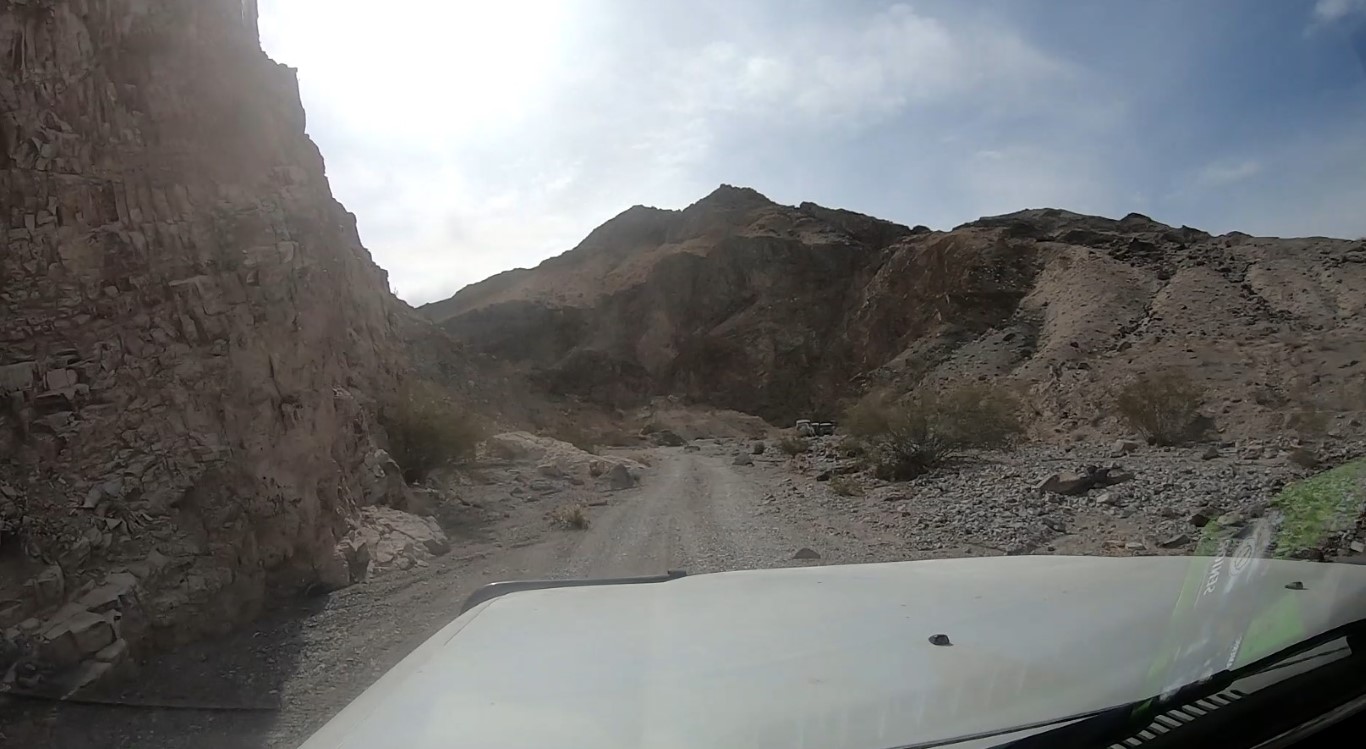
I then returned to the main road (Black Canyon)
that goes up the west side of the Black Mountain area (you can see
Black Mountain in the background of the above photo. As can be seen
from the shadows above, sunset wasn't far off and I needed to find a
spot to camp for the night. It was also fairly breezy and temperatures
were dropping, so somewhere sheltered was high on the wanted list.
For most of this trip, lady luck was on my side
and I saw something called Scouts Cove on the topo so I figured to
explore it to find a camp spot. In my driving around a found a man made
'cave'. On closer examination it was quite clean and even had a table
inside. I decided quickly (you can see the sun has already set in the
photo below) that this was going to be my camp spot for the night.
Inside the 'cave' there was no wind and it would be a perfect spot to
cook up dinner and be comfortable.
Spent a little bit of time getting things prepped
and set up lights before it got dark. Picture below shows cooking stuff
all set up and
camp lights strung. Stove is fired up and water is on the boil. For
this trip I constructed a sleeping platform on the passenger side
and removed the passenger 2nd row seat. This gave me 6' of bed space
and I made room under the platform where I could store 3 plastic totes
and other camp stuff. Bed was always made and ready, thermarest
mattress
and sleeping bag with a few layers of synthetic blankets for the colder
nights. The rest of the gear was then in two larger/taller totes behind
where you see the 7gallon water container on ther driver's side. I took
a further 5 gallons
in a bladder. That 13 gallons of drinking water was all I needed for
the 2 weeks I was out. I did get water at a few springs for showers and
as general washing up water.
And this is me in 'bed' getting ready for my
first night's sleep. Very comfortable and quick to get in bed or break
camp the next day. For one person, it certainly saves all the time
dealing with a tent. Also, totally waterproof in case of rain! No
amount of wind (other than a tornado or cyclone) to flap things around.
The next morning after breakfast and breaking
down camp, it was time to make for Inscription Canyon to check out the
petroglyphs that it is famous for. 20-30 minutes later I reached the
canyon entrance, parked the vehicle and went for a walk and took some
photos. The canyon is pretty short and less than 1/2 mile in
length. But it makes up for the shortness by have numerous petroglyphs
to examine. The following 3 photos are but a small sampling.
This is a picture of the entrance (fenced off).
There are a few damaged petroglyphs where some mental degenerates have
added their own doodles, but rather than the awe that the original
petroglyphs bring to you, the doodles just reinforce that there are
some incredibly stupid people around.
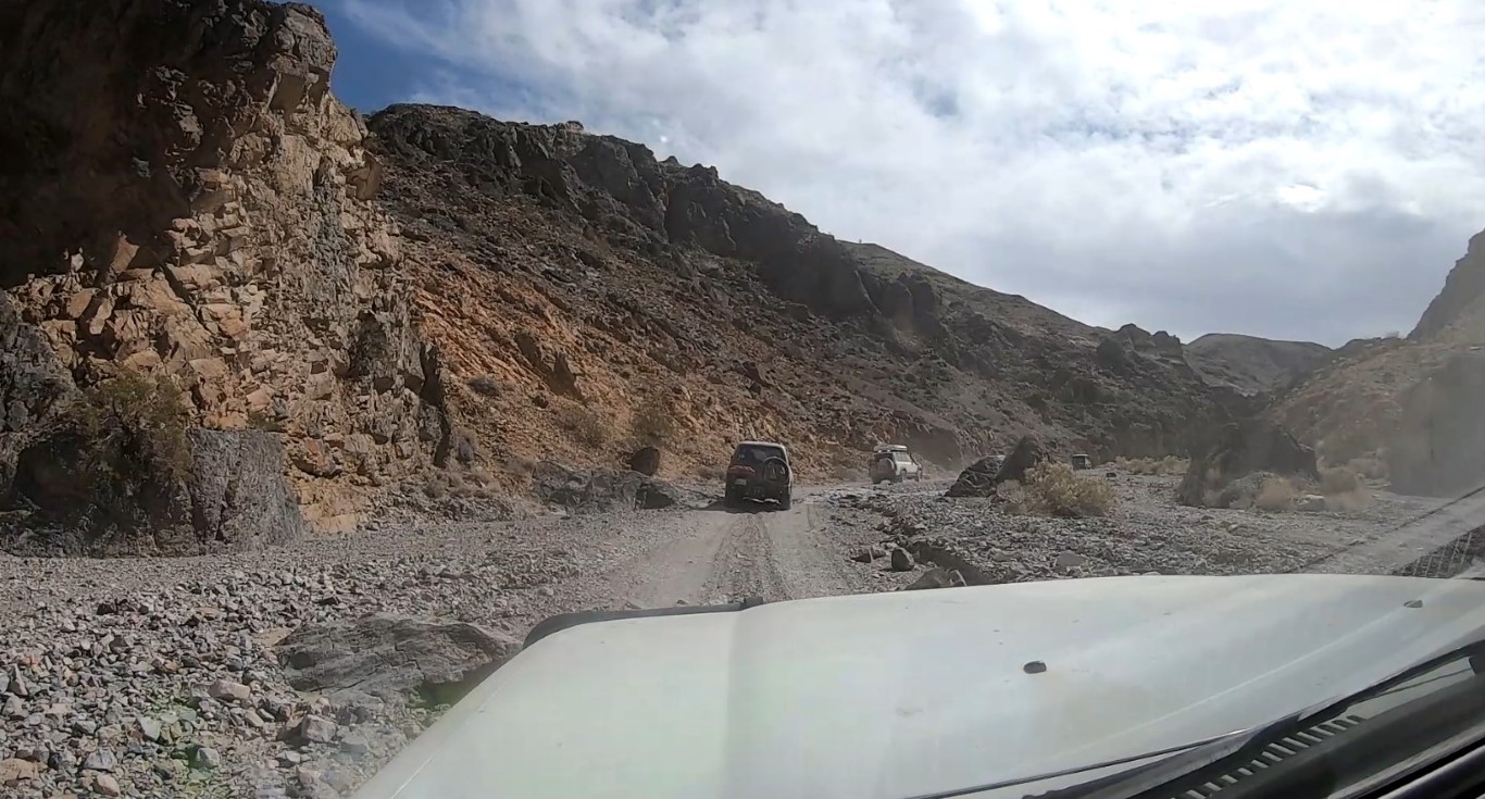
Then a bit more exploring as I headed out of
this area (so much to see) and then headed to Barstow to fuel up and
get some lunch before heading east on the 15 to Afton Road. This was my
exit from pavement and onto dirt for the next few days.
Near Afton Canyon campground I aired down to 18psi to take some of the
'edge' off the corrugated roads I'd encounter and also to make it
easier to drive through the sandy bits. Soon after I came to the first
puddle to cross. It's just a few inches deep.
A little further and you cross the Mojave River
alongside the train trestle. It's somewhat long and a little deeper,
but as of the past few months it has been filled with gravel etc., so
relatively shallow for a 4wd. These first videos are before I managed
to borrow the gopro back from my son. So, just handheld cell phone
video.
There's a few miles of driving packed dirt and
weaving in/out/across small puddles (the mighty Mojave River...).
There's really no signs telling you where to go, but at least this area
is a canyon and it would be pretty hard to get lost... It's a scenic
drive, so take your time and enjoy the views and eroded canyon walls.
Then I reached Spooky Canyon and that was a good
spot to stop and do a little exploring of the slot canyon. You go under
the railroad where the culvert is and the entrance is waiting for you.
Walking in the slot
canyon, it later narrows and becomes more of a cave. Bring a torch with
you if you want to explore since it gets dark. I guess when you get to
the dark part it becomes spooky :)
Near the eastern end of the Afton
Canyon there's some old mine relics and I found this mailbox. Not sure
how often the postman delivers or picks up at this location.
It took a
bit of searching to locate the actual Mojave Road since there's so many
tracks leading all over the place. While looking for a likely path to
follow I noticed an old guy on a quad next to the train track, so
headed over to see where he was heading and to just chat a bit. Turns
out he was trying to find his way to Rasor on the 15. There's a fuel
station there and he was trying to find out how to get there. He
clearly had no idea where he was, he said he had followed some sand
dunes and had been going cross country (heading west from where he was
camped). He admitted falling off the quad at one point with some bloody
scrapes as proof. I asked if he needed water but he declined. No
evidence he had any water or food with him. He didn't even realize he
was at the entrance of Afton Canyon and where it led, in my opinion he
was disoriented and lost.
So, after looking over the maps (he had none with him...) I found Rasor
and told him it was nearly 20 miles away. Looking at him, I
realized that the right thing to do was to head to Rasor road and have
him follow me. This way he wouldn't get lost and if he needed water I'd
be there to provide it to him. He agreed to the plan and we headed off.
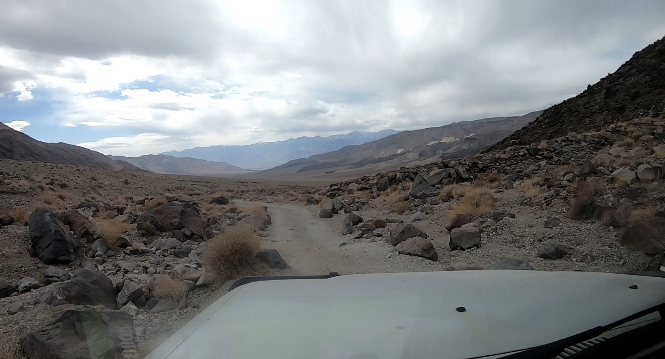
This section of the Mojave Road is just a mess of dirt tracks leading
all over the place. Folk have taken alternate paths and it's just a
criss cross of tracks and quite a sandy area to make it even
more confusing. Anyhow, I kept an eye behind me to keep him in sight
and make sure he was following and I just picked tracks that looked
smoother for him and just continued heading in an easterly direction to
finally reach Rasor road. It was a bit more than 10 miles of weaving
tracks to reach the road. It is a well maintained and wide gravel road.
I offered him water again and again he refused. I pointed in the
direction to reach Rasor and it appeared to be about 6 to 7 miles away.
This is when he goes "oh, this is the main road, I came down this road
to camp"... So, I said ok, I can see some RV's or something shiny in
the far distance south of us and he figures that's near where he had
camped and was waiting for some of his family to turn up and that he'd
been coming out here for decades but hadn't been back for quite some
years. I offered to follow him down to where he was camped, to
make sure he would arrive there safely, but he declined saying there
was plenty of traffic on this road. He also stated that he was too old
for this quad stuff and he'd just give it to one of his kids and call
it done. At 75+ years of age, I agreed he was making a good decision.
I then stated I would be continuing east along the Mojave Road and
would cross Soda Lake - he didn't know that it could be crossed. For
someone that had been coming out here for decades, it appeared he had
forgotten a lot. I was happy to have got him back to a main road and
bid him farewell with my good samaritan work complete.
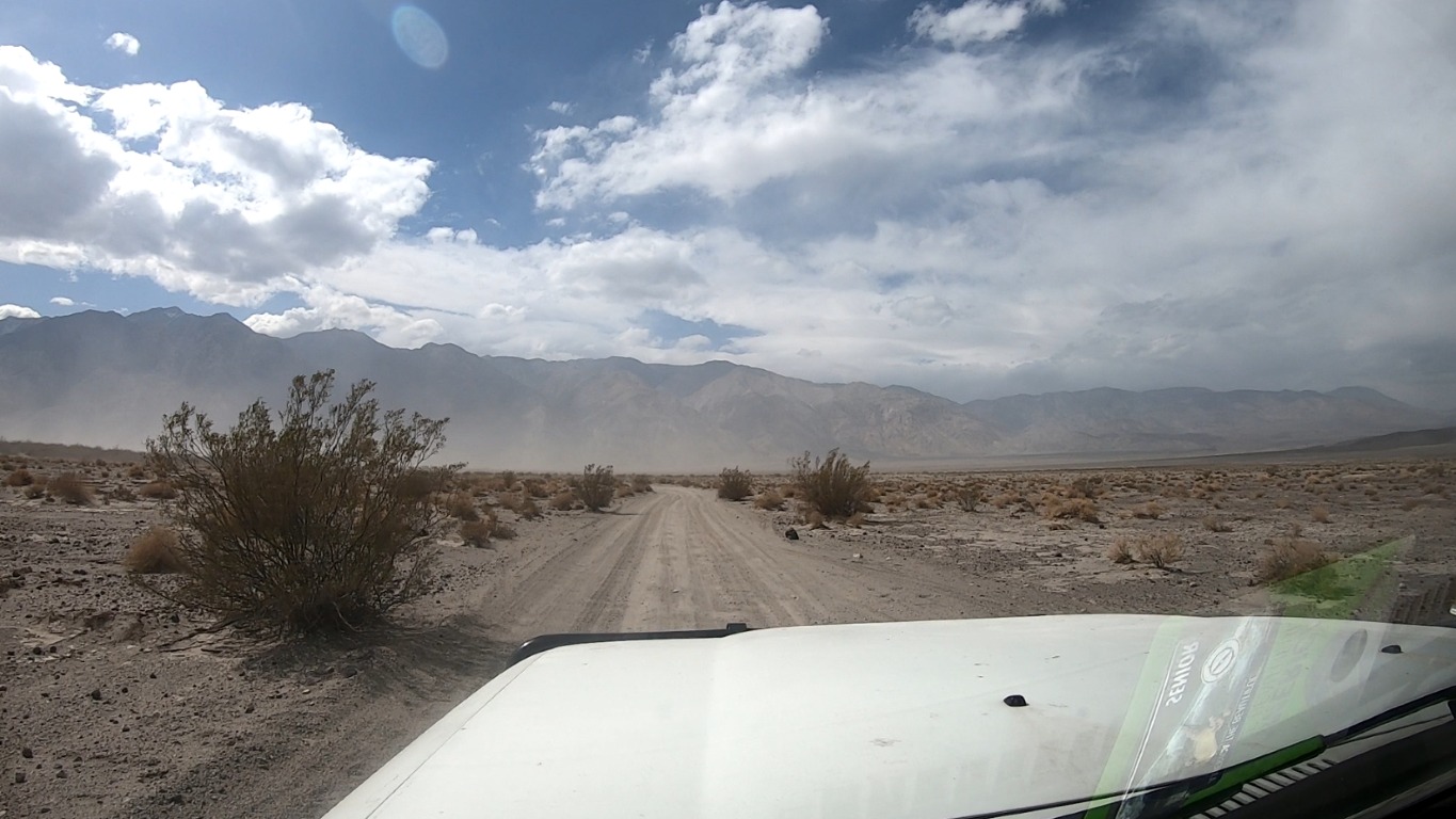
A few miles further east and I reached the western edge of Soda Lake.
Given the very dry winter, the lake surface is dry and no mud to deal
with. Easy to zip along at 30-40 mph.
A mile or so in from the lake edge
(picture is looking west), you come across a pile of rocks that has
been assembled by many travelers over the years. I brought along a
couple of rocks to add to the pile in the spirit of the folk that
started the process. From the rock pile it is about another 3.5 miles
to get to the eastern 'shore'. The road across is well beaten and
compacted, though there's plenty of evidence of folk attempting to
diverge from the road and discovering less compact surface to get stuck
in. Certainly would be a lot more interesting in wetter years.
I had planned the next camp spot to
get me close to where I was going to meet up with my older son and some
of his mates that were tagging along. So, after some research to locate
a nice out of the way spot I found Jackass Canyon. To get here, I just
continued east along the Mojave Road (also in places called Old
Government Road) until I crossed Kelso Road. This is where I got on Kelso
Road heading south. The road becomes quite rough and not at all car
friendly, in fact I'd say it would actively attack cars :). I came
across a pair of students doing some surveying with a Trimble GPS unit
and
mentioned that it was unlikely the road had moved from its original
location... We chuckled and I continued on to reach the road that goes
through Jackass Canyon. Again, I had timed it quite well and found a
nice spot to make camp and enjoy a colourful sunset. Camp set up and
ready to cook dinner, relax a while and then head to bed for an early
start to reach Kelbaker Road (only a few miles away) to wait for the
rest of party to meet up tomorrow morning. The road I'm camped on
crosses Kelbaker and
becomes Aiken Mine road that will take us to the cinder cones (lava
tube), our first site to see and also leads to the continuation of
the Mojave Road.
Early rise and then get to the meet
up point. This is Aiken Mine road and the paved Kelbaker road is just
behind the camera location.
We
reach the parking area for the trailhead - it's only a few hundred
yards. This trail leads you to a permanent stairway that you take to
get down into the lava tube. It's fairly short, but there's a pretty
neat ray of sunlight that gets into the tube from a nearby opening. The
ray lights up the larger tube area and is a good spot to take some
photos.
After spending a bit of time checking
out the lava tube we got back onto the road and back tracked a bit to
get to the Mojave Road and then continued easterly from there. The next
site was the Mojave Mailbox. The rest of the party checking out the
contents of the mailbox and adding a few bits of their own including a
King shock sticker or two (where my son works).
It is worth walking around the area
behind the mailbox since there are various things to find. One such
spot is a frog community. It's interesting what folk decide to take out
to the desert and start something that others then continue. It again
reinforces the need to take such trips with the aim to stretch your
legs and explore. This can often let you discover things that many
others just zoom past obliviously.
So we
zoom along and hit Lanfair/Ivanpah Road and head north a bit till we
again reach the Mojave road (Old Government Road) and head east to the
Penny Tree. One last picture of my son and girlfriend by the Penny Tree
and they and their mates continue east while I head west, cross over Ivanpah Road and then continue west on the Mojave
Road till I reach Fred Welch home .
Abandoned Fred Welch home. A lot of
work went into getting all those rocks to build the home! Now it's just
a partially fenced off monument to desert life surrounded by
Joshua Trees.
My plan was to then head north to
check out Carauthers Canyon. The road I was on is named Carauthers
Canyon Road. On the way I came across 2 ladies driving a car and
heading towards me. I was temporarily impressed, since the road I had
driven up so far had some reasonably rough patches that a car would
find challenging to say the least (total non-issue for a 4wd with
clearance). We stopped along side each other and they asked about some
dispersed camping they were searching for and asked what I was doing on
the road to which I answered "much like you, I'm just driving around
and exploring". This seemed like the wrong answer since they seemed
irritated that I didn't know where I was... Well, I knew exactly where
I was given GPS and topo maps and aerial maps. I never said I didn't
know where I was, just that I didn't know the area and that I had no
idea where the dispersed camping was. To me, you're in the bush,
everything is dispersed camping - just pull over and make camp. Do you
really need a sign to say "dispersed camping here"? Anyhow, I said my
goodbye and continued north. This is where I found the road was very
good and it soon crossed New York Mountain road, a well maintained
gravel/dirt road. Hopefully the ladies turned around soon after where
we had met since they would quickly find themselves stuck if they
continued on.
I headed into Carauthers
Canyon and found a spot to camp. There were already several vehicles in
various 'sites', given I had turned up later in the day. No problems,
since I'm sleeping in the vehicle, I just need a relatively flat spot
and somewhere for me to set my chair etc. Pretty small camp site
footprint.
I figured I had a couple of hours till sunset so it would be a good
time to hike to the end of the canyon where there's an old minesite.
Cool in the afternoon with lots of shade. The following picture is the
view from my campsite, hard to complain.
The canyon has plenty of neat rocks
to look at.
The trail is in the picture
below (where I'm standing to take the picture, not the creek floor) and
from the shade you can see it's pretty late in the afternoon. The mine
area wasn't particularly interesting, but the hike in an out was quite
scenic and nice and cool in the shade.
The next morning I did some exploring
on various tracks. Checked out Keystone mine track - it's reasonably
rough and you have to come out the way you went in. Nothing too
exciting to see, more just a fun drive. Some video of the drive into
the canyon follows.
The next thing to check
out was Sagamore Canyon since it had a mine on the map. I approached it
from the northern track that comes off the Keystone track (off the
Ivanpah road). Picture below is just before reaching the mine. This
road is a little 'interesting' since part of it is a shelf road that
climbs
over a 500' over a few miles. Parts of the road are somewhat washed
out and you end up with the passenger side tyres getting close to the
edge. Without a spotter, I considered spending the night at the mine to
tackle the drive
back down the next morning with a 'fresh' mindset. Fortunately I found
that I could loop back to the Ivanpah road via a southern track that
was in good condition and not a shelf road...
Parked at the entrance to the Mine. I
went in as far as possible until I reached a rockfall area that made it
clear that it was far enough :) I also took some video that I've linked
to below.
After checking out the mine I was
looking for a way out and first came down to the creek. This was NOT
the right way since walking down the creek (to the right of where the
4wd is stopped) had some significant vehicle sized boulders. The
correct path was a track that led off from the minesite itself. That
was
an easy drive back to the main road. Quite a pleasant drive out since
you drive through the Sagamore Canyon, so quite scenic.
On exiting back onto the
Ivanpah road I continued north with the plan to visit Goldome Mine, a
place I'd seen on the maps and also seen some pictures on the web. It
is an abandoned mine site with the processing equipment still mostly in
place. Some local artists have decorated the place with somewhat
tasteful graffiti.
The mills and processing
equipment survives. Lots of steel to recycle if/when it makes sense.
Pretty large sheds that are
still holding together.
This
is the actual start of the processing plant. Ore would have gone up via
the conveyor belt system.
The
mine is just off the Ivanpah road, so easy to get to and clearly gets
lots of visitors. Though, I saw no one while I was there and never saw
anyone on the Keystone track or Sagamore Canyon drive.
After visiting Goldome, it was
time to find somewhere to camp for the night. Checking on the maps I
saw a track that headed to Slaughterhouse Springs (on the west side of
Ivanpah road just a few miles north of Goldome). Drove in but the
springs were dry, so saw no point in camping in the valley. I could see
some mine entrances on the side of the hill, and drove up to check them
out and found my campsite for the night. Fantastic view and the hill
provided a wind break. I also had two small mine entrances (only went
in
10 - 20') that I could use to cook etc if the wind changed direction or
picked up more.
Checking out the mine 'hole' prior to
positioning the vehicle to level it out for sleeping.
That evening while in bed (as
I did most evenings), I checked the maps (topo and aerial) to get an
idea of the next
day's likely itinerary. Prior to this trip, I had downloaded aerial
imagery of the entire area I was potentially going to visit. This
allowed me to flip between topo maps and aerial imagery of the
same area. In doing so I noticed that the other side of the hill I was
camped at showed what appeared to be a road driving into the side of
the hill. Hmmm.... another mine entrance. So, next morning after
breakfast and breaking camp, I drove around the hill to what I'd seen
on the aerial map. Sure enough, something more substantial than the
small holes I had camped next to the night before. Video below...
After driving inside the mine, it
was time to head to Death Valley for the next phase of my trip and this
was the place I'd planned quite a few places that I wanted to visit and
explore. So, headed up the Ivanpah Road to the 15 and the west to Baker
to fuel up and purchase a few forgotten little items. I then took the
127 towards DV, with the plan to visit Saratoga springs and Ibex
springs and then head up and drive along Owl Hole Road to visit an
old ATT microwave repeater and also a few mines nearer Owl Springs.
Then check a few canyons on the west side of
the West Side Road. So, onto the 127 and then turned off on the
Saratoga Spring Road. Aired down to 18psi to take the harshness off the
corrugations and to also make the tyres more compliant for the expected
offroad adventure that was about to start.
First
stop was Saratoga Springs. From a small hill you get a view of the
springs and the amount of water that is out there. An interesting sight
of a significant amount water in the middle of a desert.
I then decided to head to Ibex Spring. The road in
is easy except for one deep dip that would prevent easy access to a
non-4wd. Some sections of the road up from Saratoga Springs have a fair
bit of loose sand, again a non-event for a 4wd. Picture shows all that
remains of an old vehicle.
On reaching Ibex spring, I checked some of the old
buildings around the palm trees. There's quite a few old structures
that were clearly where folk lived that worked at the various nearby
mines. The real task after that was to locate the actual spring! I was
thinking it would be in the middle of the palms, but that wasn't it.
So, I climbed up to the cleared area (north east direction) and spotted
this little structure.
On closer investigation it covered the spring and
there was a nice clean looking pool of water. I figured it was warm
enough to have a decent shower and rinse a few days of dust and sweat
out of my hair. I have the same kind of setup that use in
Australia, a Whale pump, some hose and a portable 12V battery pack that
allows me to run the pump if I'm not close to the vehicle. Filled up
a shower bag with the beautifully clear water. Didn't use it all for
this shower, so
the next evening I got to enjoy a second shower, luxury!
A short video showing the pump in action and the
beautiful clear water pumping into the shower bag.
After the shower I drove around the area a
little to find some of the old mines. This is one of just a few.
This was just a hollowed out 'room'.
I'm guessing it may have been a place to store explosives given it
looked like a small store room.
It was then time to head back to the Saratoga Spring
Road and get onto
Harry Wade Road to take the Owl Hole Spring road to get to the ATT
repeater. That was also my planned camp spot for the night. The road is
in decent condition and nothing a 2wd vehicle with a bit of ground
clearance couldn't handle.
End of the road and you arrive to a cleared off hill top where the
microwave repeater tower was built. Fenced off and abandoned. I parked
the 80 and set up camp for the night. Simple to do when you sleep out
of the back and all that is involved is pulling some stuff out to cook
dinner and then enjoy the view before getting into the sleeping bag for
a good night's rest. I had excellent cell coverage here and could
whatsapp my family and even stream video if I wanted to. Trona is about
20 miles away and given the elevation I'm at it would essentially be
line of sight. It's likely where the right facing microwave horns are
pointing at. Edit 2025. I found some history (actually, there's a LOT!)
regarding the ATT microwave network, that dates from its start om the
early 1950's to its demise in the 1980's. Fiber and satellite
technology put an end to microwave towers.
This one in the southern Death Valley area is decently preserved due to weather conditions and remoteness.
And yes, the right horns point just north of Trona to a site labeled
Slate. The left horns point to another repeater called Ibex and visible
from CA 127.
This link has maps of the network and also pictures and information.
More can be found by just doing a websearch of "ATT long lines". Pretty
neat rabbit hole to go down :)
Afterrnon and looking east over the valley.
Good view of some of the Owlshead Mountain area. Behind the hills in
the middle forefront is Lost Lake, a dry lake bed that's 4 or so miles
from the road.
This is the road that leads up to the ATT tower. I'm
heading back this morning to head up into Badwater to visit a few
canyons/mines.Just east of the hills in the forefront is the end of DV
and the start of the Military no-entry area, i.e. Fort Irwin. Big chunk
of land locked up.
Heading back I popped into Sagenite Canyon where
folk use to collect Sagenite (google it). Seems like the area is well
picked and I didn't find any specimens to photograph during the 30
minutes or so that I explored.
Heading out of the canyon I noticed what looked like a strange rock in
the middle of the road then realized it was a desert tortoise. Stopped
to take photos and some video. I also provided the hardy fellow a
bottle cap full of water to enjoy.The little fellow was about 10" in
length.
Continuing on I reached Owl Hole Spring. The only
positive thing I can say is that it has water, though definitely not
enticing water. I then decided to visit the New Deal mine and after
that went and checked out Black Magic mine. Neither mine is
spectacular. New Deal has a near vertical shaft that is best observed
and not entered. The following picture is some of the holes (not the
main shaft).
A view of some of the mine tailings and where I parked. The mine was a
manganese producer in years gone by.
With the goal of visiting Queen of Zeeba and Galena
Mines it was back on the road and heading to Harry Wade road and then
onto the West Side road. I popped in to see the Queen of Zeeba and it
was pretty boring and not worth the drive in. So, back out again and
just a couple of miles north got onto the Galena Canyon road. Getting
later in the day and I was on the search for a decent spot to camp.
Success, found an old cabin structure that was going to be my campsite
for the evening.
First task was to have a nice shower with water
still from Ibex Spring. DV can be pretty dusty and one's hair does get
very dry and dusty. So, really rinsing your hair is the main reason for
showering every few days. At this time of the year you really aren't
sweating much and BO is only an issue when you can't stand being next
to yourself :)
The cabin provided a handy place to set up for a shower and even had a
concrete floor - perfect shower opportunity. I put a wood plank down to
have a spot to stand and let the water drain. All the modern
conveniences.
The cabin was also a nice spot to do all the cooking since it still had
some shelves and stuff to sit the stove and gear on. Very civilized.
Next morning I did a bit of exploring of the Galena
mine area. You would have to be very picky to find reason to complain
about the million dollar view of my camp area. Looking down into the
badwater valley.
Some of the remains of the mine. There's a tunnel into the side of the
hill and the rails are still in place that were used to roll the ore
carts out and dump them off the wooden structure. The tunnel is
partially blocked off and I decided to make the smart choice of not
going in any further.
Then it was time to head out and back down the West
Side road to meet with the Warm Springs road. The next part of my trip
was to visit the geologist cabin and hopefully find it unoccupied. With
the following day being a drive to Mengel Pass and through Goler Canyon
to get to Panamint Valley.
Some pictures of Warm Springs. And yes, there's a great source of water
here and it's very lush. Plenty of shady trees.
Lots of buildings here and this is the creek that
has formed by the springs. You get an idea of the size of trees that
are are growing here from all the water in the following picture.
There's an informational sign that describes a bit of the history of
this spot. The 'owner' Louise Grantham appears to have been less than
ethical about the ownership grab of the area. The desire for ownership was to grab
control to then mine Talc. Talc is used in various products and the
sign states that by the 1960's about 25% of the nation's talc
production came from this area. As the Midnight Oil song goes, "... and
nothings as precious as a hole in the ground" appears to repeat itself
throughout the world to the detriment of many.
One of the rare things to find in Death Valley. A
swimming pool :) Unfortunately it isn't filled since it would require a
lot of maintenance to keep it clean. Too many Burros around, along with
other desert life. It would need a pool cleaning service to visit every
week or two...
Time to move on and get to the Geologists cabin.
It's only the middle of the day, so there's hope that it hasn't yet
been grabbed. The drive along this section of Warm Springs road is easy
going, basically just a dirt road and easily traversed. The 80's
upgraded coil suspension soaks up the small bumps and it is a
comfortable run to the cabin.
As I enter Butte Valley where the cabin is located the road turns sandy
and the drive becomes even more comfortable as the suspension eats up
the undulating terrain. As I get closer to the cabin I'm squinting to
see if the flag is up and it appears it isn't. Closer and closer and no
flag and no vehicles to be seen. I'm in luck, no one has staked a claim
and I pull up to the cabin door to check things out. All looks great
and I quickly grab the flag and raise it, the cabin in mine for the
night :) Striped Butte is in the background - just to the left of the
flag.
This cabin is a one of the best I've found in Death
Valley. Even a composting toilet has been installed. I considered
myself fortunate to have reached the cabin early enough in the day to
lay claim to it. Within a couple of hours of setting up roost, several
vehicles had popped in the check out the cabin and see if it was
available. I had to educate some that the flag is used as an indicator
of occupancy, which they all considered was a neat idea. All of the
folk were pleasant and it was an opportunity to chat for a while - like
minded people out enjoying themselves.
I've moved in and even lit a candle in an alcove in
honour of my wife that had suggested I take an extended holiday versus
just a few days. The cabin is well outfitted by various people that
have left things for fellow travellers. The totes and the blue water
container on the shelf/table are mine as is the tote and pot on the
left side of the picture. The rest of the gear belongs to the cabin.
There's even a few gallon jugs of water for folk that are in need. I
found such water jugs in quite a few spots in Death Valley and presume
that Park Services sprinkle them around in case people are in dire need.
My view from the cabin porch - the local Burro tribe coming for a
drink. Just below where the cabin is you can find Anvil Spring, though
due to all the Burro activity the area around the spring is severely
polluted.
A picture of Anvil Spring. You can see all the hoof
marks in the muddy area. The picture doesn't catch the polluted nature
of the spring. There is a pipe where the water is coming out, so if in
need you could at least get water 'direct from the source', before it
hits the ground. Of course you have to consider where the source that
feeds the pipe is and the state of the pipe. Best to bring your own
drinking water...
The next morning I visited a couple of other nearby
cabins. A couple in a Subaru that had visited me yesterday and checked
out the inside of the Geologist Cabin mentioned they were heading to
this cabin (Stella's Cabin) and I could pop by the next morning to
check it out. As you can see, they have put the flag up and I popped in
to visit. It's in decent condition, but not of the same amazing quality
as the Geologist Cabin, but still not bad as a fall back.
I then drove a little further down the road and
checked out Russell Camp. This is a fairly 'rustic' assortment of rooms
that have been knitted together into a 'cabin'. I took video as I
walked through and around, but no pictures. You can catch video in the
early part of this longer video that covers the drive from Geologist's
Cabin out into Panamint valley. The video also covers a quick drive in
to the old Manson hangout (Barker's Ranch).
This video is nearly 1 hour 50 minutes in duration. Russell camp can be
seen at around the 1hr 40min mark. Video of Geologist's Cabin is at
around the 1hr 23min mark.
The drive from the
Butte Valley to Mengel pass is only a few miles, but it is the roughest
part of the road. A vehicle with good ground clearance is highly
recommended and it certainly helps to have low range to negotiate the
few rocky stretches. Once you get the Mengel pass the rest of the road
all the way through to Panamint Valley is an easy dirt road. Below is a
monument with a plaque to Mengel.
The view back into Butte Valley from Mengel
Pass. As can be seen, it's not very far at all, but as written above,
the roughest stretch of the road is back there. Going west involves
climbing the rough stretch, so going east is definitely the easier
direction in terms of traction.
A few miles further and you reach a turn off that
takes you to Barker Ranch - made infamous by Charles Manson and his
group. This is the only remaining structure, the other main house
burned down a bunch of years ago.
The remains of the burned structure. Just parts of
walls and a bunch of rocks. A lost piece of history now.
Some miles further along the road you
come to Lotus/Keystone. There's an old stone cabin and some mining gear
left from previous gold mining operations. Goler Wash/Canyon road is
running left to right just below the left side tank. I've just driven
across the road to get a picture of the cabin and the road leading in
and the switchbacks on the hill that lead to the actual mine entrance
towards the top/middle of the picture. It's not a bad place to stop to
eat some lunch before heading on.
If you look carefully you can see a wire rope
leading diagonally up across the blue sky background. It is the remains
of an aerial tramway that allowed ore to be brought down from the
canyon hill top to the wood/steel structure at the road level. This
would have allowed the ore to then be trucked out into the Panamint
Valley. Clever way to get ore down quickly from otherwise vehicle
unfriendly hill tops.
There's quite a few springs along
Goler Wash as can be seen by the damp area down the middle the road. In
some places the damp 'stream' can go a mile or two as the road descends
towards Panamint Valley. As can be seen, the road condition was
excellent when I drove through here.
There are several aerial tramways along the road.
The topo maps mark them, so keep an eye out as you get close to where
one is. They can be hard to spot if you aren't looking in the right
direction. This one is anchored to a large rock and someone put some
blue marker tape to try and catch your eye so not to miss it. Bright
orange tape would have been better :)
Once I exited Gowler Wash I headed
through Ballarat and then took Emigrant Canyon Road to get to the 190
to head to Beatty to refuel at Nevada fuel prices versus the inflated
Death Valley prices. Additionally I was planning to drive through Titus
Canyon, so heading to Beatty was the correct direction anyway. You can
see snow on the Panamint Mountain Range. Telescope Peak in the that
Range and is the highest point in Death Valley. From the top of the
range there is a nice campground called Mahogany Flats and you can look
down into the Badwater Basin.
So, the plan was to head to Beatty to
fill up with cheaper Nevada petrol - versus the thieving that goes on
in the DV NP. I had bumped into some folk a couple of days earlier and
was told of a decent spot to camp outside of Beatty and not far from
the Titus Canyon entrance road. So, off to Beatty, fuel up and then
camp the night ready for an early morning start. Nothing too exciting
and no pictures of the nothing exciting :)
First stop along the Titus road was Leadfield. It's an abandoned mining
town (Lead ore) with just a few structures left to show of its passing.
The mining town lived for less than a year and after allegations of
fraud surfaced it was all done for. The only thing left is 22 miles of
road that winds through Titus Canyon and the remains of the town. At
least the road is a positive that we all get to enjoy. It's a one way
road that you enter from the Beatty side and then drive west to exit in
the DV NP. Not sure why it's one way, since it's hardly narrow enough
to justify it, I guess it's so touristy that the NP decided that the
average tourist couldn't be trusted not to drive head-on into an
oncoming vehicle.
Stopped at Leadfield for a quick look around. There were several other
vehicles since this is definitely on the tourist path and easily done
in pretty well any vehicle.
I did chat with a fellow and after some talk he mentioned the rough
road. To which I asked if he was running street pressure or had let some
air out (he had an F150) to which he answered street pressure. Hmm, I
recommended he drop some air to improve ride, he even admitted to
having a compressor. Surprises me how many folk run street pressure
when you're going to be on these kind of roads for a few days. I ran
18psi while in DV except for the paved drive to Beatty where I aired
up. 18psi is a sweet spot for the 80 with the tyres I run and the
weight in the vehicle while still being able to maintain higher speeds
when feasible. The lower pressure helps take the harshness off the
corrugations of the major dirt roads and helps in the rocky areas.
Picture taken looking towards some of the remains of the mining area of
Leadfield. The tailings are pretty indicative of how little material
was mined before the show was done.
Just one picture while driving
through Titus Canyon. I did take some video, but that will end up on
youtube at some point. This is a somewhat wider point in the canyon,
but it's smooth driving all the way, basically a dirt/gravel road.
Came out the other end and there were a
considerable number of vehicles parked the western entrance to the
canyon, but since it's one-way, people then would hike in from the
parking area. A couple of folk in a camper van waved me down to ask if
I thought their vehicle was capable of driving the road, yeah, of
course, it's just a dirt road. Of course that meant a drive of about 40
miles to get to the Nevada side entrance. They were on holidays, so
hopefully not in any rush to enjoy the views.
Well, next stop was the Ubehebe Crater since it was part of my loop to
get to the Eureka Dunes that day. The crater is, well, a crater :) I
was happy enough to take in the view from the side accessible from the
parking lot. The adventurous can hike down into it and/or hike the
entire perimeter. There's also a baby Ubehebe that I walked to that is
basically to the right in the pic below. And yes, it's a smaller
version.
So, after checking out Ubehebe, it was time to head north to Crankshaft
Crossing. I took Death Valley Road that runs north to then loop down to
Eureka Dunes. It's a decent road, but clearly off the tourist radar
since I never came across another vehicle until heading into the dunes
area.
The corner has some crankshaft 'bits': I'm happy that the 80's
crankshaft remained inside the engine and kept doing what it was meant
to be doing.
After a quick stop, I continue on, following the winding Death Valley
road and the next stop was at Crater Sulphur Mine where there's some
remains of old mining activity. After a bit of exploring it was time to
head to the dunes which were my planned camp spot for the night.
When I reach the dunes I bumped into a Socal 4wd club (mostly Land
Cruisers) and stopped to chat for a bit. It was funny, since a bunch of
them are on Ih8mud and I recognized their 'mud names. It was like a
little re-union. They were planning to head south through Steel Pass in
the morning and that fit in well with my plans. I camped some distance
from them, since I'm use to camping alone and didn't want to push
myself into their group, especially only for the night.
Anyhow, moved on and made camp which is pretty basic in my case since
I'm sleeping on the platform in the back and all I need to pull out is
my camping chair and a few odds and sodds. Relaxing and then this chap
wanders into my camp covered in silt/dust - looked like he had been
rolling in the dirt. Told me he had bogged his vehicle and needed help.
Offered him water which he initially refused, then realized he was
thirsty and accepted a couple of cup fulls. Then he explained that his
vehicle had a cracked sump (a car) and he had borrowed his brother's
4wd/camper and was driving out to get stuff to fix his car and had got
stuck. His brother wasn't there either. So, not sure how the whole
process worked since there was his broken car and now a bogged
4wd/camper and he was on his own. Oh well, some kind of weird shuffle
going on. Anyhow, here's his stuck vehicle. I lent him a shovel to at
least remove some of the 'wall' he had dug in front of the tyres. A
mate on seeing the picture, say's it looked like an animal that was
trying to bury itself :)
On the second attempt I managed to pull him out. Took some 'teaching'
to explain that flooring the accelerator is only going to dig deeper.
The area has a lot of silt that has been pulverized to powder and it's
easy to get stuck. Momentum is definitely your friend, but then you
can't go too fast since you don't know what's under the powder - is it
smooth or a large rut or...
So, got him out and he then said he was going to head to town (wherever
that was) and get stuff to repair his car. I went back to my camp and
made dinner and got myself settled and relaxed. Nice view of the dunes
as the sun sets.
The Socal group are camped somewhere near the right edge of the dunes
in the picture, maybe 1/2 mile or so away.
So, night falls and I head to bed in the 80. Relaxing and then I hear
the sounds of a vehicle reving and reving etc etc. Clearly some vehicle
stuck in the silt powder. All goes quiet, fine, will check out in the
morning. Still laying I hear someone outside the vehicle, slide open a
window and it's the same fellow that was stuck before. He said he had
come back with his brother and this time his brother had got the
4wd/camper stuck. Well, I said, we'll figure it out in the morning,
time for sleep now :)
Next morning, I make breakfast, then pack up and head over to where the
brother duo were stuck. Younger brother is working on his car while
older brother is with the bogged 4wd/camper. Hand the shovel over and
get him working. Then the Socal group turn up and I ask if a couple of
them want to help extract this fellow. So, Dat offers his winch to use
alongside mine and Joe volunteers to coordinate the extraction and
direct/instruct the older brother. Bit of video of the extraction here:
After that 'fun' we motored on to catch the rest of the Socal group
that had gone ahead and were at the entrance of Dedekera Canyon and
surveying the options to get over the three obstacles. One minor one
that leads to a short/steep climb (baby waterfall) and then through a
notch. While there, a couple of jeeps arrived behind us and after
watching a few of the toyotas go through decided to turn around and not
attempt it. Any of the toyotas with locking diffs made short work of
it, the stock/unlocked had more of an issue getting traction to get
through. After all were through, the rest of Steel Pass is an easy
drive and quite scenic. I allowed the group to move ahead as I was on a
slower plan and had many more days for exploring.
Entrance to Dedekera Canyon with the Socal group stopped for their surveying (screen capture from my gopro):
Silly me didn't get a single picture of video of the group getting through the obstacles. Oh well, next time.
Screen capture after the obstacles and one reason I wanted to fall
behind. Not enamoured with driving in dust...Said my goodbye and
thankyou to Joe who was behind me and running tailgunner. Turns out we
would meet a couple or so times again.
After a few more miles and letting them move further ahead, I could
drive at my own pace and enjoy the scenery. On exiting the canyon area,
Steel Pass continues on to some Warm Springs. This is some of the view
along the way:
Steel Pass road takes you to Saline Valley road
and becomes an easy drive as you exit the hills and pass. It gets very
dusty as you approach and go through the warm springs camping area.
Other than the springs, I see little reason to camp in such dusty
conditions. I bumped into the Socal cruiser group and the springs and
then continued on to Saline Valley road to head south to the Lippincot
Road entrance.
This is the road heading out to Saline Valley road, dust everywhere
since it was quite windy. It's a good road and with tyres down at
around 18psi, travel was smooth.
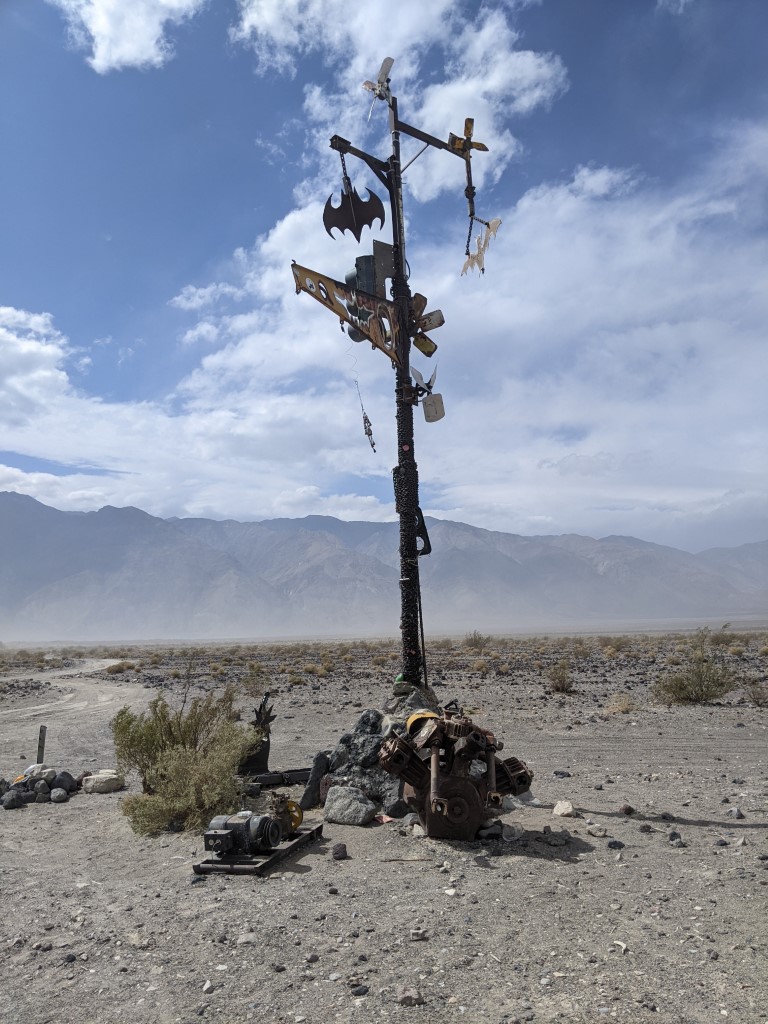
There's often strange things that people have put together, it this
case a kinetic structure. A wind driven top that was spinning nicely.
Nothing too interesting on the Saline Valley road, so the next picture
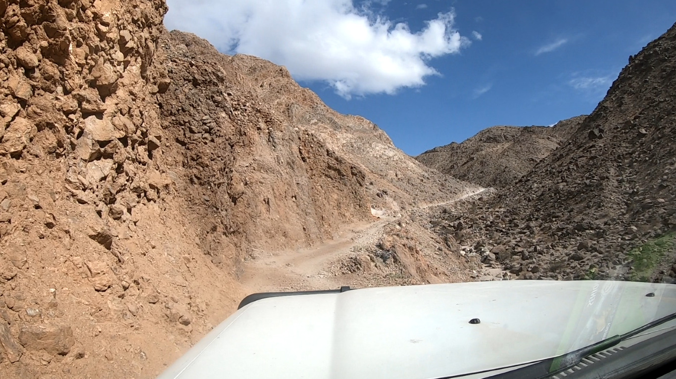
is on the Lippincott road at the 'bad' spot. This trip, the 'bad' spot
was actually in good condition and easily traversed without worrying
about it being narrow on the turn. Would be more of an issue with a
wide vehicle or if pulling a trailer. Since I'm heading uphill I
nominally have right of way. This is essentially the worse bit of the
road and further up it gets relatively rocky for a bit before becoming
nice again.
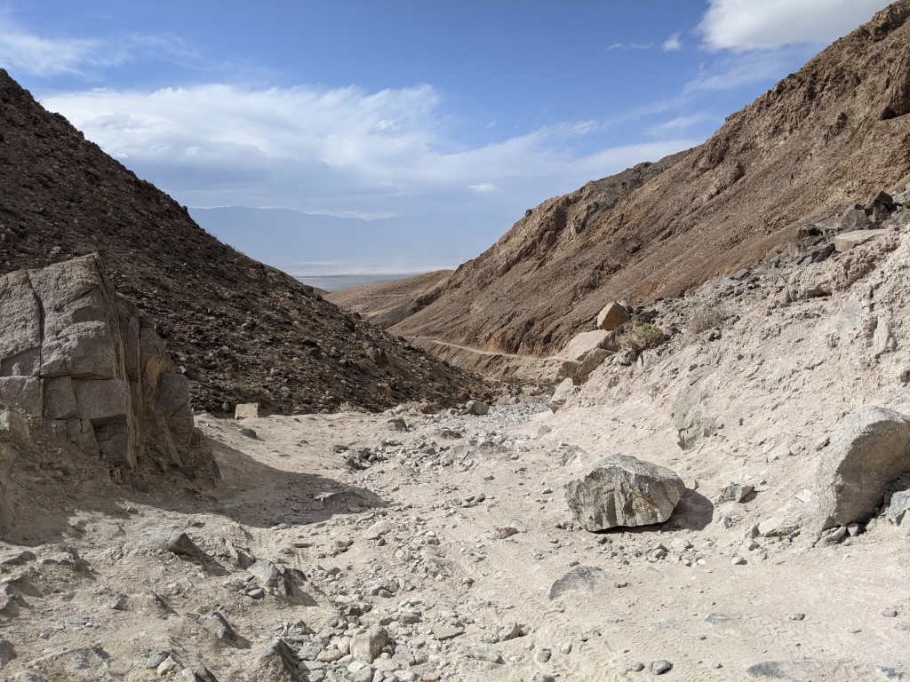
This is what the rocky stuff look like. This picture was taken looking north and back where the 'bad' bit is.
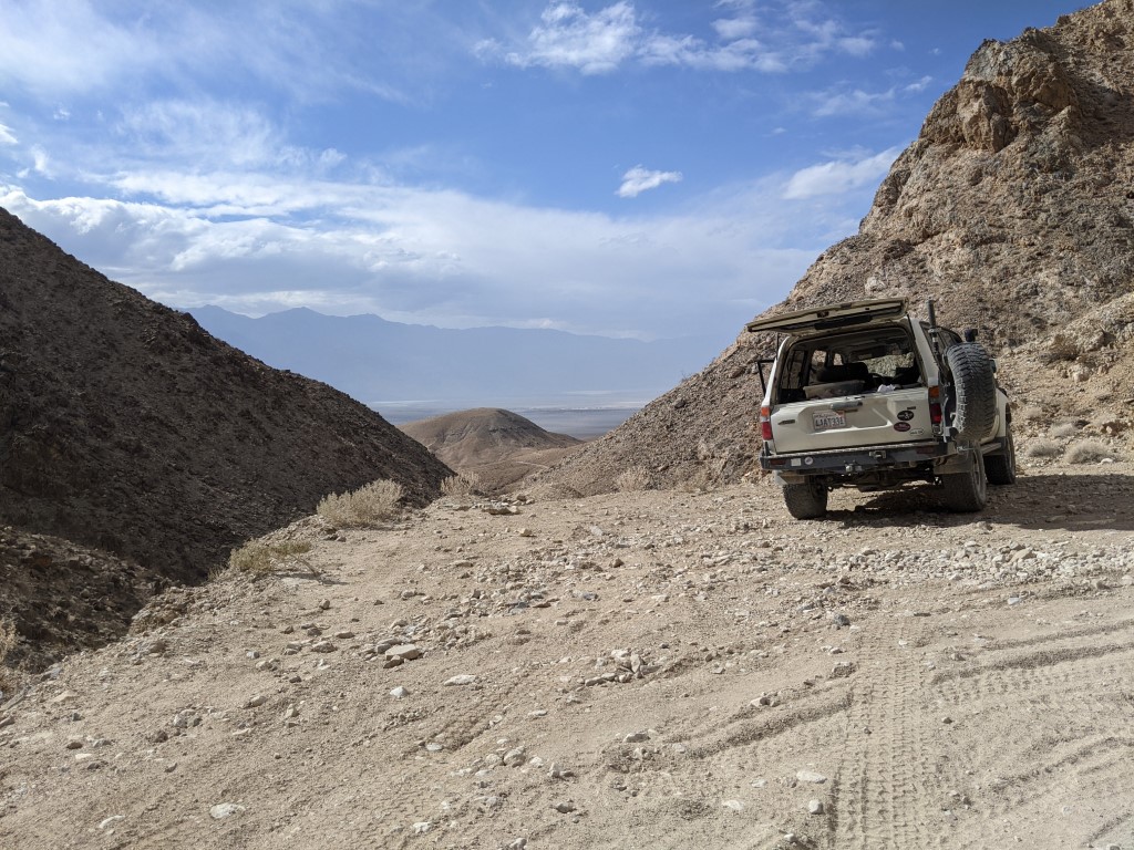
I found a nice wide spot to stop for a bit to relax and take some
pictures. At this point I heard the socal group on the radio as they
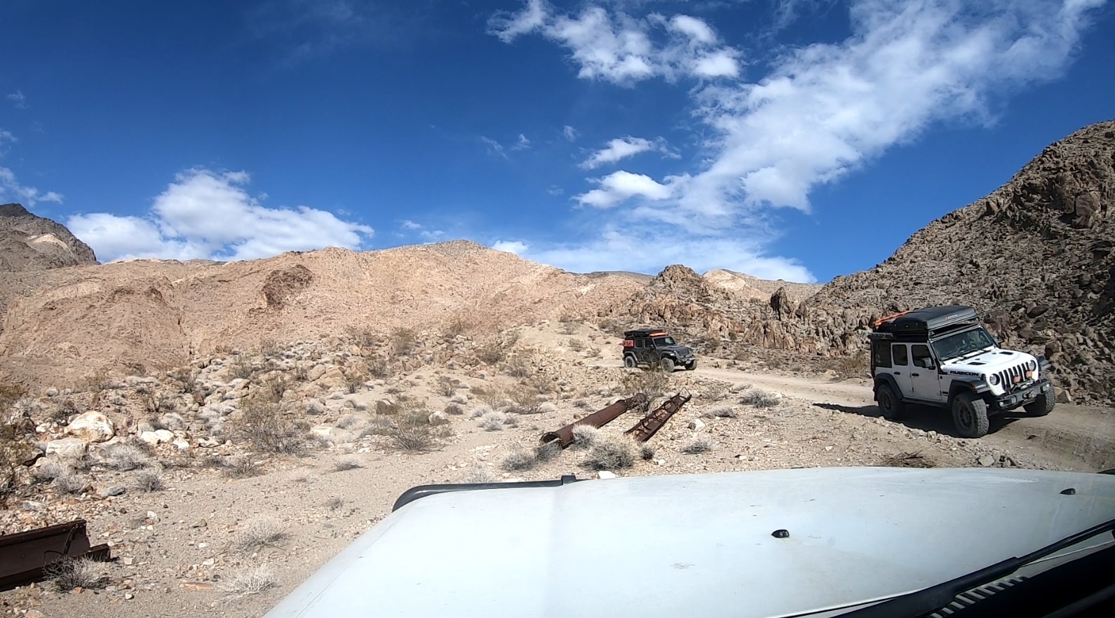
were heading my way. I waited for them and also flagged down 2 jeeps
that were heading downhill and told them they should wait a bit for the
socal folk to go passed. Better to do it where there was plenty of room
for them to pass each other.
I'm waiting for the socal folk and the jeeps are pulling over to wait
for them as well, since they are heading downhill and would need to
give right of way and further down there is very little room to pass
each other. Beautiful weather!
Not done, much much more to come. Check back for updates coming soon.