 e
e2 Week trip
to the Lake Barlee area
Yet another trip to the bush, all up a total distance of about 1800km.
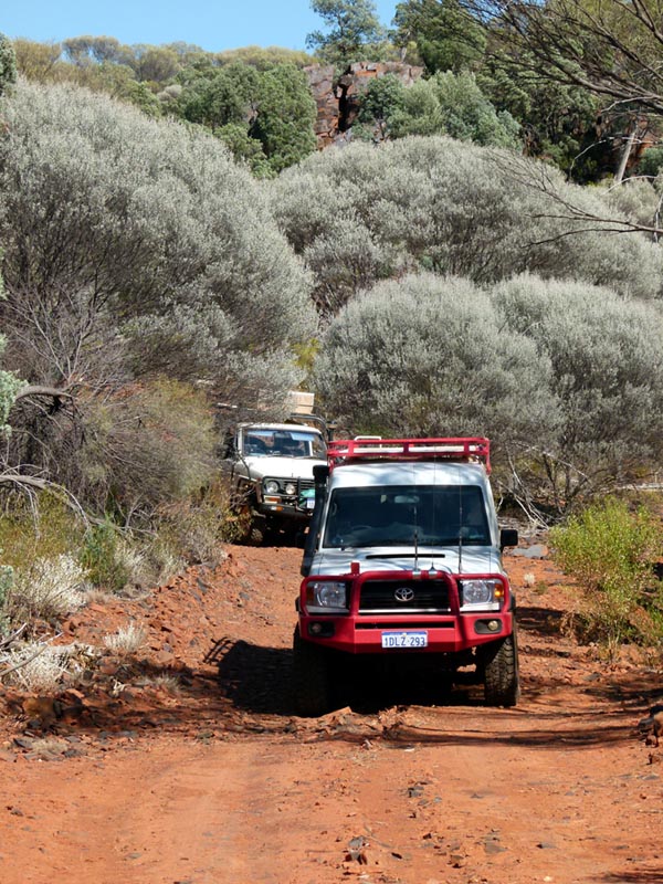
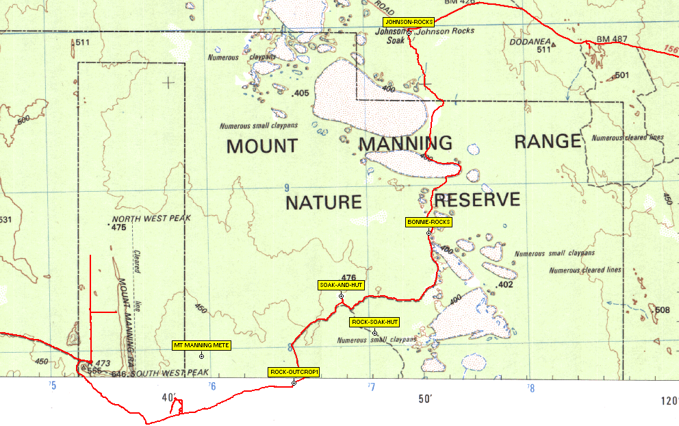
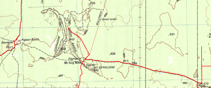
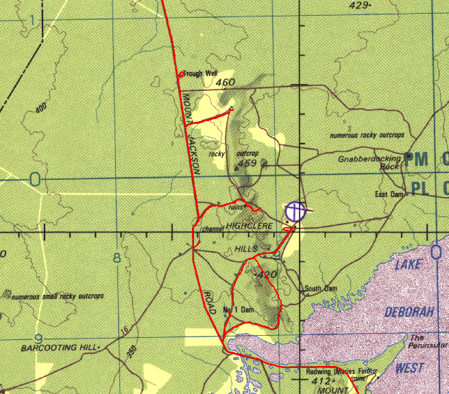
The basic trip was from Perth to Bullfinch and then up to Pigeon Rocks via the Mt Jackson Road. From there we went up to Diemals and then up the west side of Lake Barlee and across the top to Cashmere Station (refilled water). Then to the Mt Forrest area and back down to Metzke's Find (refilled water), Illaara and then via the super graded road to the Diemals/Menzies road. We then went back up via older tracks to Galah rocks and then across via Tom Rock to the Kurrajong Gorge area. Then across to Lawrence Find and back to the Diemals/Menzies Road to Johnson Rocks (refilled water there).then south to Reid's Hut and west to the Mount Manning Range. Up the west side of the Mount Manning Range to explore the old tracks on that side, then back down to the main track and west to the Evanston Road. Checked out Mt Geraldine a bit and then went in via a west access track to Faye's Bluff. Back to the Evanston Road and south to investigate the ongoing devastation of the WIndarling Range, then back south to Marda dam and then west to Mt Jackson Homestead and back down the Mt Jackson road for a bit of exploring/camping before getting back to Bullfinch and then west to Perth via Mukinbudin/Wyalkatchen/Dowerin/Toodyay.
It was a great trip and revisited some old places and a few new spots and tracks..
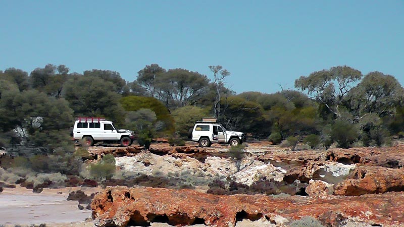
Following are some of the pictures from our trip. The participants were:
Thanks to Rod & Richard for their photos, some of which are in the trip report below.
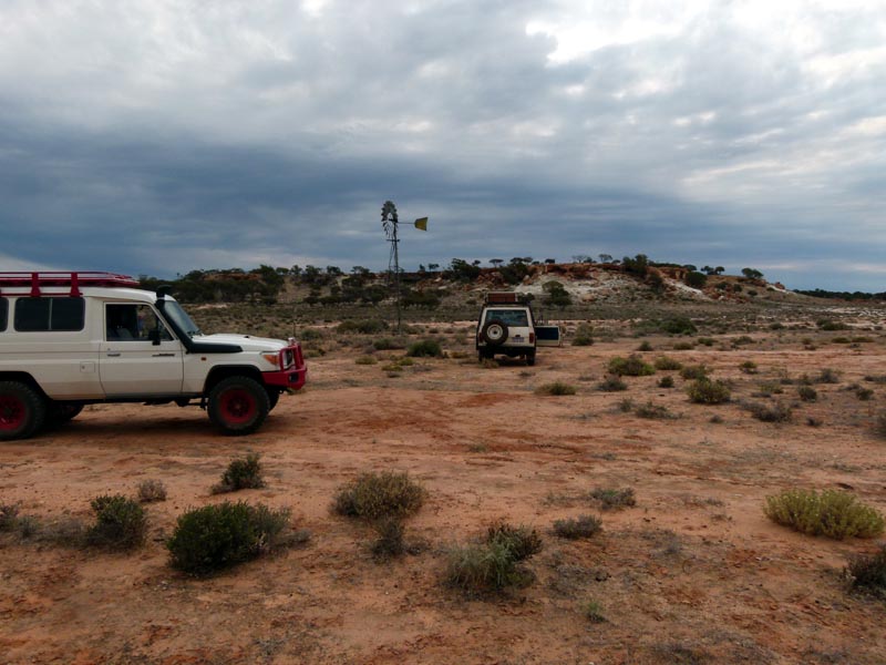
First camp stop on Ennuin Station near No. 1 Dam. Old records show that Ennuin was named Enuin. A bunch of Rod's friends turned up for some camping/prospecting and it was quite a circus for 10 - 15 minutes as they drove around to locate the ultimate camping location. We watched with some amusement while relaxing with some cold beers. My research shows that gold was first discovered in Enuin in 1887, so it predates many of the commonly known finds such as Southern Cross, Coolgardie and Kalgoorlie.
e
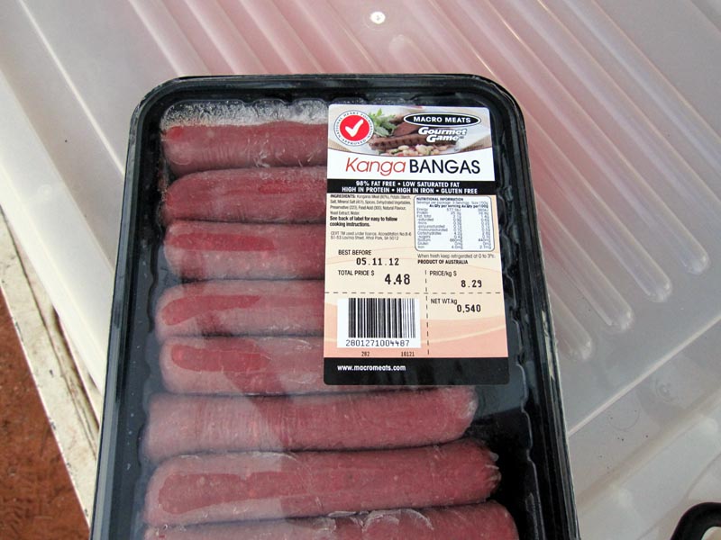
First meal it seemed fitting to consume some local fauna :) The fridge was doing a good job as can be seen from some frost/ice in the package.
The next day we headed up to Pigeon Rocks via Mt Jackson homestead and the Clampton Mine. At Clampton we talked with Vern and are told that lots of the tracks leading up to Clampton have been staked (supposedly) to prevent illegal metal detecting/prospecting on already claimed land. The "nice" thing is that it is ILLEGAL to stake tracks as Rod discovered when he contacted the Mines department. They recommended contacting the police department - but given the "importance" of mining in Australia, I'll bet that absolutely nothing is done about it.
The Mt Jackson homestead is decomposing as each year ticks by. Another pastoral station that no longer exists.

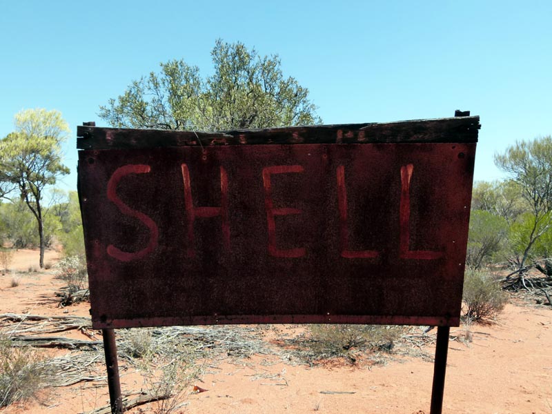
Shell fuel sign while heading to Pigeon Rock, though we found no sign of the fuel station, must have been around the next corner :)
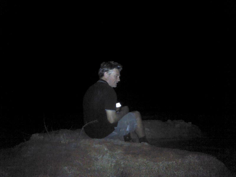
We camped at Pigeon Rocks for the night. On the top of the outcrop we had Telstra cell coverage thanks to the repeater at Windarling. It was somewhat amusing and incongruous to be able to surf the web and send emails. It's night time on Pigeon Rock and Richard is nerding on his smartphone. I took a picture with my Android tablet :)
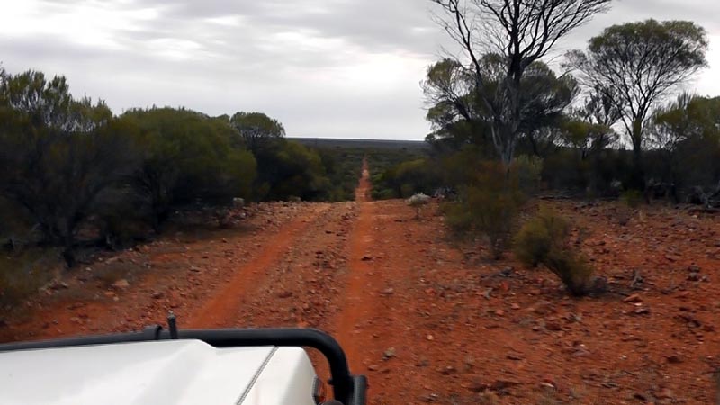
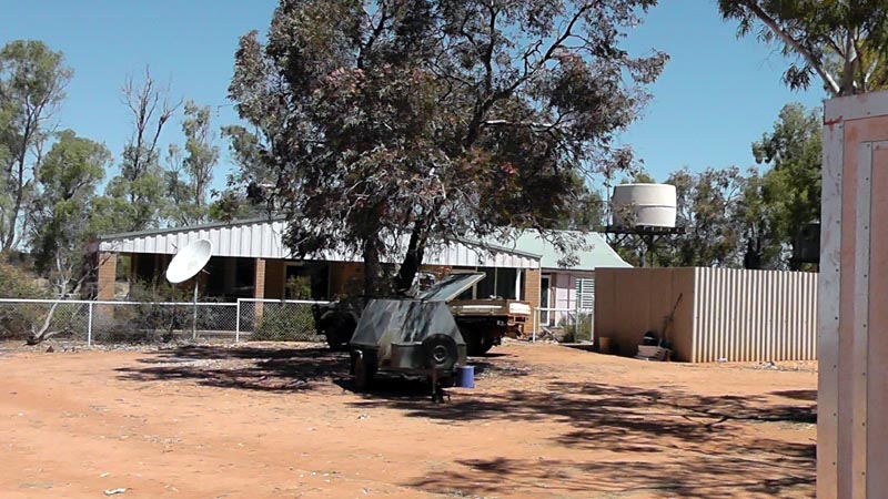
The next day we headed up to the Diemal's Homestead. The track is in great condition.
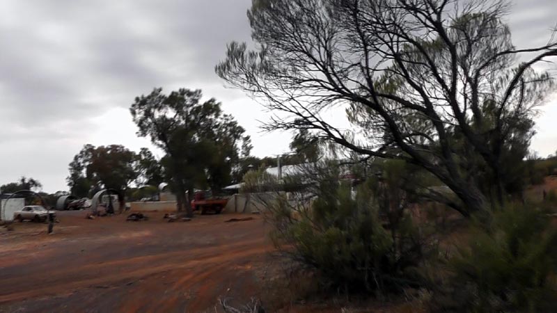
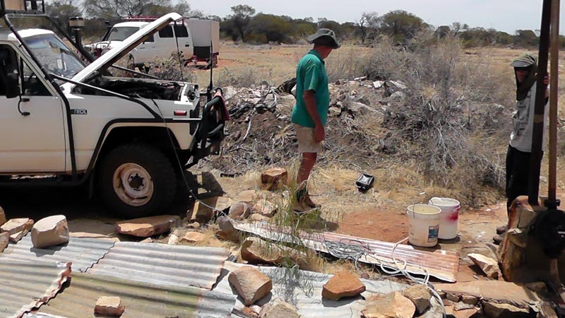
We are pulling into the homestead and Tony arrives to chat and make tea with us. He has been busy pumping water for the remaining animals around the homestead. Tony owns the homestead but no longer has the station since the "powers that be" have decided he isn't taking care of it properly. The reality is that Windarling Mine is on the Diemal Station and they appear to have worked with the appropriate government body to have the station returned to crown land and to de-stock it. I'm of the opinion that mining companies in the area are doing their best to steam roll the various stations and gain full control and access for their own profits. Tony was very vocal about protecting Windarling due to the endangered and rare plant (Tetratheca paynterae) that grows in that area and that is just not politically correct in our modern Australia where Job #1 is to remove all mineral wealth ASAP and ship it to China with no thought for the future and certainly no attempt to build up manufacturing in this country. Windarling Mine just continues to grow in size and there is only a small amount of the range still left intact. It will be interesting to see if any is left by the time the mine closes down and I'm laying good odds that they will NOT fill in the holes they are making and will NOT rehabilitate the area, we'll see... It is a despicable situation that Tony has been placed in due to the conniving government and Mining company - they should be thoroughly ashamed of their actions.
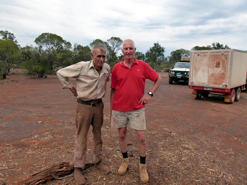
Tony (left) posing with Rod for a picture. A man of the land and in his own words, "I'm greener than a greenie", by which he means that he has the best interests of the land with NO political agenda. Unfortunately being 'green' does not bode well in a mining-centric country. Update, Tony McPherson (RIP) passed away June 4, 2016 at the Southern Cross Hospital.
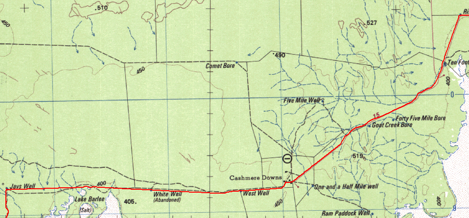
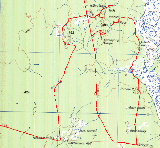
After tea with Tony and hearing about his desperate attempts to retain the homestead and possibly getting some of the station back, we headed off along the Diemals/Barlee road (Trainer Rock road) heading in a northerly direction to go up to Lake Barlee. We made good time and crossed the western arm of Lake Barlee just north of the Barlee homestead. We then took tracks to take us along the northern edge of the Lake to head east to Cashmere Downs. Below you can see the red tracklog from Oziexplorer running on my Acer A100 android tablet.
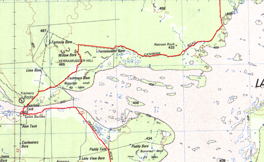
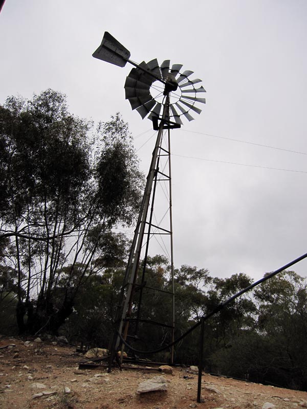
Willow Bore had some interesting breakaways to look at, though we didn't spend much time there. The track along the fence line past Yerramudder Bore was rather 'overgrown', but Cashman Road was in very good condition. Willow bore with a rare working mill is below, with some of the breakaways in the background.
Near Retreat Rock we found that Mickey Mouse was waiting for us. Richard went to say hello and asked if we could camp nearby. Mickey was very happy to see us and gave permission for us to camp :)
Retreat Rock (and Lake Barlee) were some of the places that John Forrest visted and named in this 1869 exploration to search of the remains of Dr. Leichardt and Party. See http://www.gutenberg.org/ebooks/9958 for a great free book/journal that covers many of his explorations. It makes wonderful reading and provides the history of some of the place names in the bush.
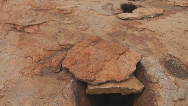
Some small Gnamma holes on Retreat Rock. The flat rocks near them would have been used to cover the holes in days gone past to prevent evaporation and to protect the water from use by animals.
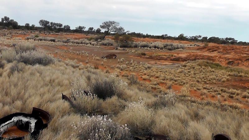
The following shows the Retreat Rock area and some of the 'junk' from a previous generation. Parts of vehicles and other debris litter the area. We use some of the tin to make a small windbreak for our cooking fire. That night while laying on the outcrop to watch the sky we saw quite a lot of lightning to the south and north, but other than being cool we didn't get any rain.
The following day we continued heading along the Cashman Road and found some breakaways right on the edge of Lake Barlee. Good excuse to stop and stretch our legs etc. Referring to the above map, this spot is where the track changes to a due north heading after 'kissing' the edge of the lake.
The map below shows the next part of the trip over the top of Lake Barlee. We stopped at Jays Well, but there's nothing left of the windmill and only a hole exists for the bore. Dropping in a rock didn't sound like it hit water. White Well had water in it, but it was at least 40' down.
Just before Jays Well, there's a water course (seen on the map above). It is quite large and spectacular relative to the norm for the area. Obviously a lot of water catchment occurs and flows into Lake Barlee. Rod caught me in "mid-stream" taking some video.
Jays Well, not much left. The windmill has been removed and only the cutoff legs in the cement remain.
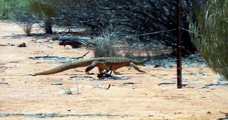
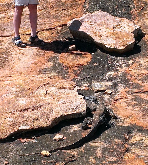
Just before West Well we spotted this fellow (Perentie) casually crossing the track. Quite a sizeable specimen.
Cashmere Downs was our next stop and care of a friendly workhand we had the opportunity to top up our water tanks from one of their rain water tanks. I thanked him with a nice cold can of Coke (he wouldn't accept a beer since he was working).
We filled from the rain water tank that uses the roof of the shed for catchment. Hard to beat the taste and quality of rain water.
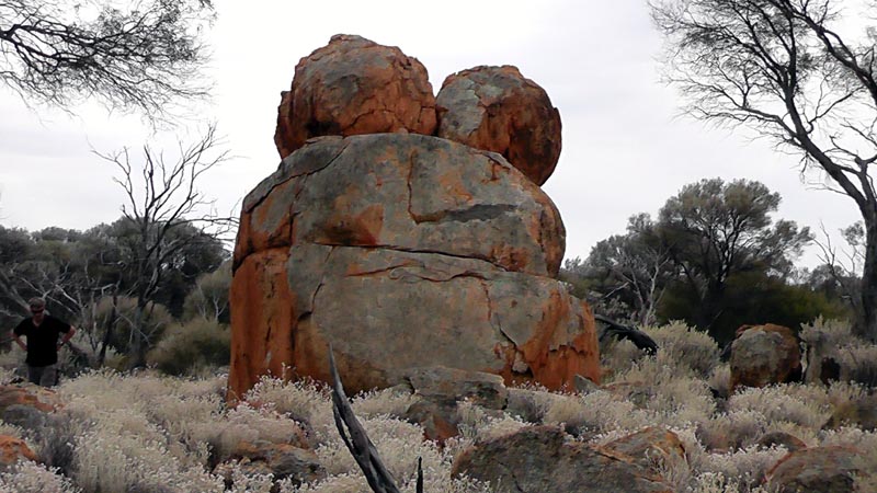
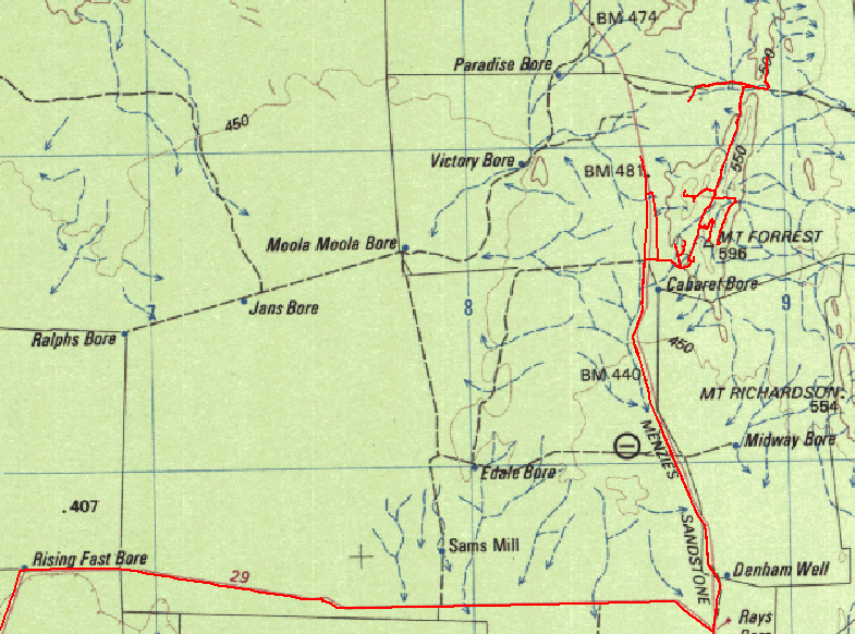
After Cashmere we headed east to the Sandstone/Menzies road and then up to Mount Forrest. Rod had seen a picture that indicated it could be an interesting area to visit and it certainly was justified. The tracklog on the map below shows that we explored quite a bit of the area. Quite a lot of stuff to see and even a billabong with water. It would be a very interesting area to visit after some big rains.
In the Mt Forrest range, lots of banded iron, so let's hope the mining company greed (and government complicity) doesn't destroy a very unique area. Though unfortunately it would appear that the Mining Monster has plans to ship this off to China as well http://mindax.com.au/?id=211. Will we be left with ANYTHING that protrudes above the ground by the time Mining has finished defacing our state? Short term greed and no foresight to the future.
The entire area is fenced and has CALM signs and areas that have signs stating rehabilitation is in progress. What a JOKE, once mining gets in there - there'll be nothing left to rehabilitate after they've turned it into another hole!! Let's see them CONSERVE Mt Forrest!
These beautiful structures must make the greedy Mining Monster salivate.
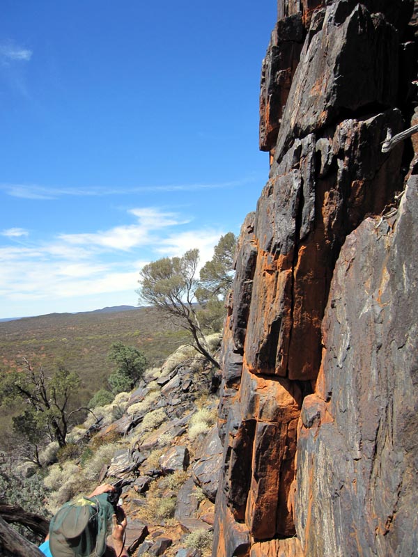
A lot of the area has sheer or near sheer cliffs of reasonable height.
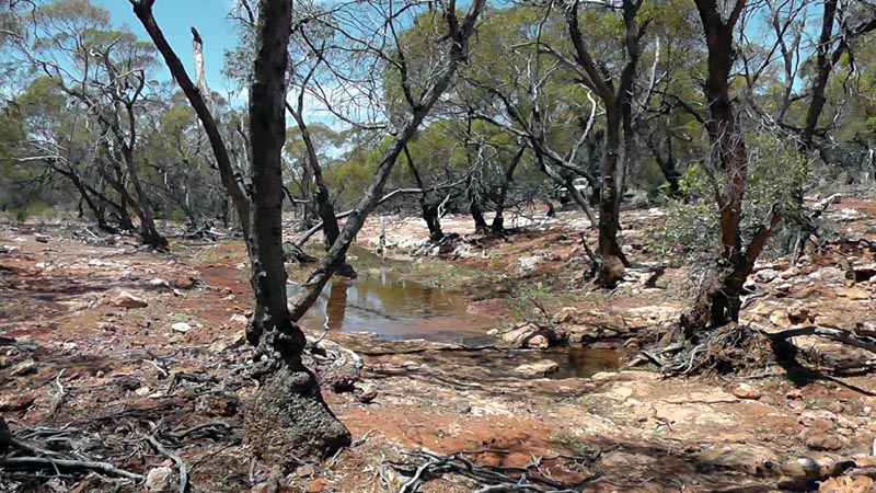
Billabong laying north of the Mt Forrest range, presumably fed from water soaking from the range. Unfortunately nearby cattle have polluted the water.
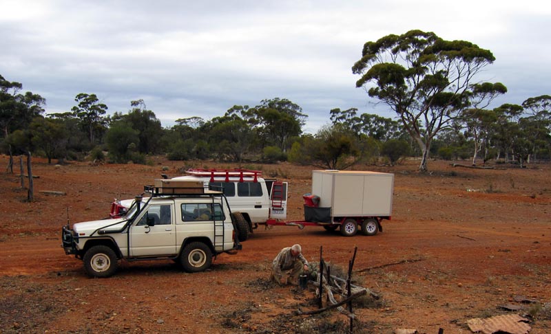
Going exploring in the morning before heading out of the area and on to Metzke's Find. Rod has left his trailer at camp while we explore.
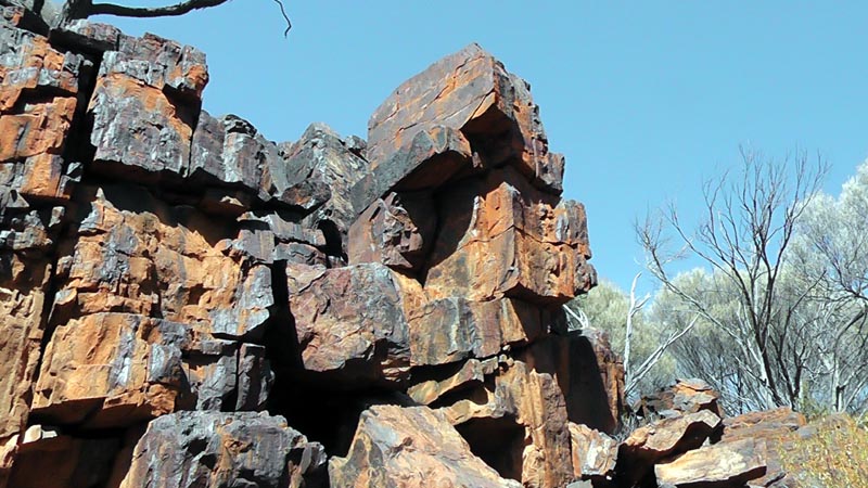
We saw a cut while on the track and then on the way back did some exploring on foot. It was well worth spending some time checking it out, fantastic view and it would be a very interesting place to be after rain. The cut channels through solid rock to form a water course down from the top of the range. This area really reminds me of the Pilbara. Certainly an area that is worthy of a re-visit in the near future - if it hasn't been shipped to China.

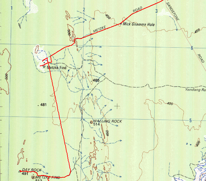
We then headed back south east along the Sandstone-Menzies road until we hit the track that leads south west to Metzke's Find. There is now an excellent road that heads south west of (the lower tracklog segment heading left near the mine icon near Metzke Find below). This road continues all the way down to the Diemals-Menzies road. Rod has driven on it before, I figured we should head south to Illaara since Rod had never been that way. I'll save the other road for another trip.
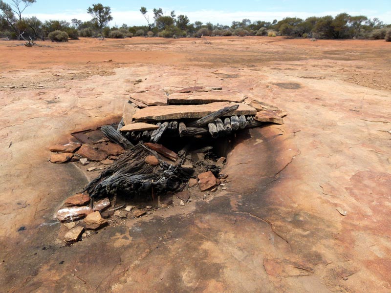
First stop was Mick Gnamma hole which has some massive rock slabs that once must have covered the entire gnamma hole. Of course the weight has broken many of the timbers... The track is somewhat overgrown and in similar condition to the last time I was through this area with Lionel in 2000.
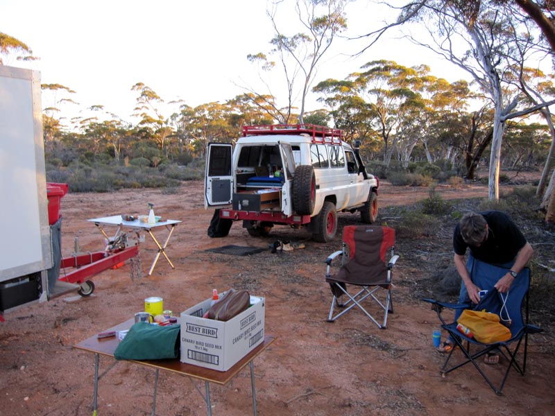
After lunch we continued west to Metzke's Find where we camped for the night. Again, there was some water left in one of the 200L containers (visited last year), so we took the opportunity to refill our water tanks. This trip I had a 12V submersible water pump that made transferring water fast and easy.
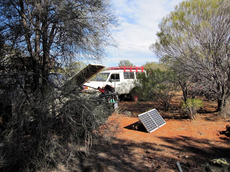
Camped and 80W solar panel connected to keep the aux battery charged while running the fridge 24/7 to keep food and beer nice and cold. The panel in full sun provides 5A or more to the aux battery, more than sufficient to keep up with the fridge over a 24 hour period, even with the warm/hot weather we were experiencing on this trip.
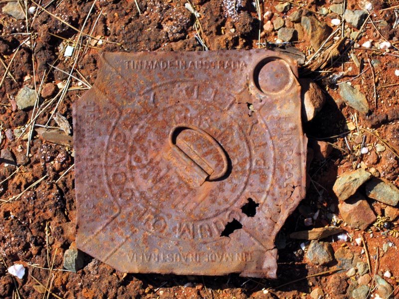
Not sure how long we'll find anything "Made in Australia" in the new world of exporting rocks to China and importing junk back from them.
We then headed south of Metzke via the graded "superhighway" where we can easily sit on 70 - 80k/hr and make good time till the track that veers off to Day Rock and the Illaara abandoned shed. The "superhighway" is a relatively new road that was pushed through by the FPC (the Forest Products Commission of Western Australia). The purpose of the the road is to provide access for Sandalwood cutting which appears to now occur on a huge mechanised scale versus the days of old. With a long regrowth time, I really have to wonder how "sustainable" this now is. We have mining digging holes everywhere and FPC turning sandalwood areas into bulldozed war zones with piles of scrap wood chips left as monuments to their sub-contracted work. It is "intriguing" that the FPC did not push their superhighway all the way to the Diemals/Menzies road, maybe they want to keep their handiwork hidden from prying eyes??
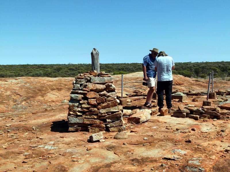
Next to the cairn/trig point on Day Rock.
Another Perentie (3rd one we saw on this trip) that was sluggish due to the early part of the day and cool breeze blowing. It gave us an opportunity to take lots of pictures.
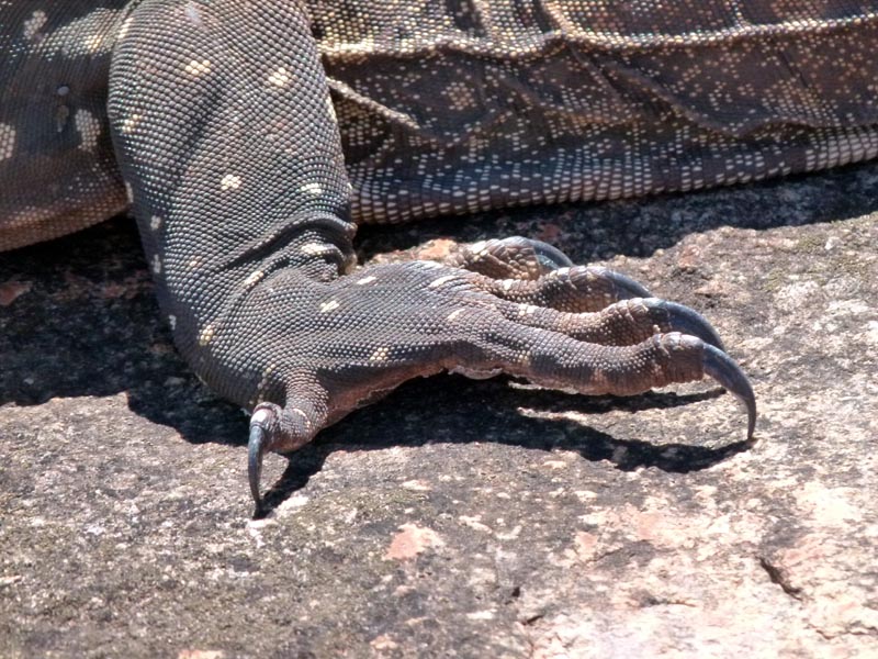
A very sharp set of long claws! You would definitely not want to piss it off and get a set of those claws into you. They're about 1" in length!
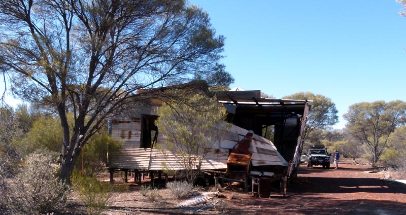
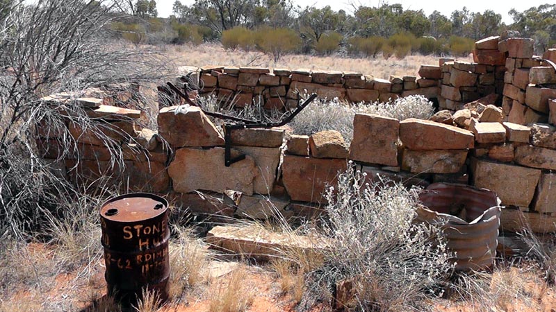
From Day Rock we headed to Illaara to see how the old shed was going. Unfortunately it is showing more signs of damage since the wind can now get in and push it to the breaking point. Compared to just last year (see 2011 trip report) and you can see that it has reached the point of no return. I'll bet after next year's winter the wall will be down along with that portion of the roof.
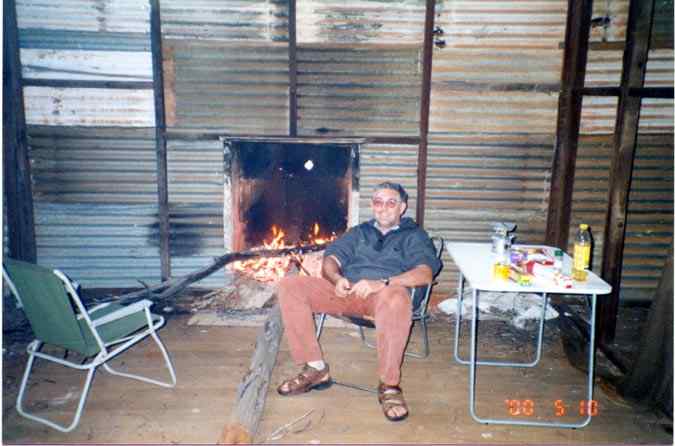
Here's a picture from 12 years ago while inside and enjoying the fireplace. Some serious firewood in use ;)
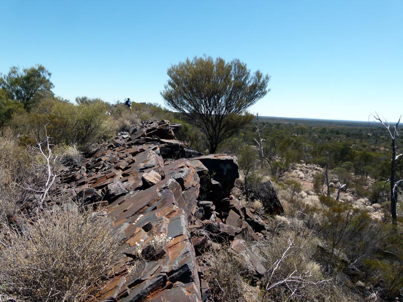
We camped near Illaara the night and then next day moved south along the superhighway to visit Kurrajong Gorge. Along the way we took a side track and visited Halag Rock. Before reaching Halag Rock we took a detour on some bulldozed tracks and found a nice ridge that showed evidence of mining exploration drilling right near it. Seems like every ridge or hill is a magnet for the Mining Monster.
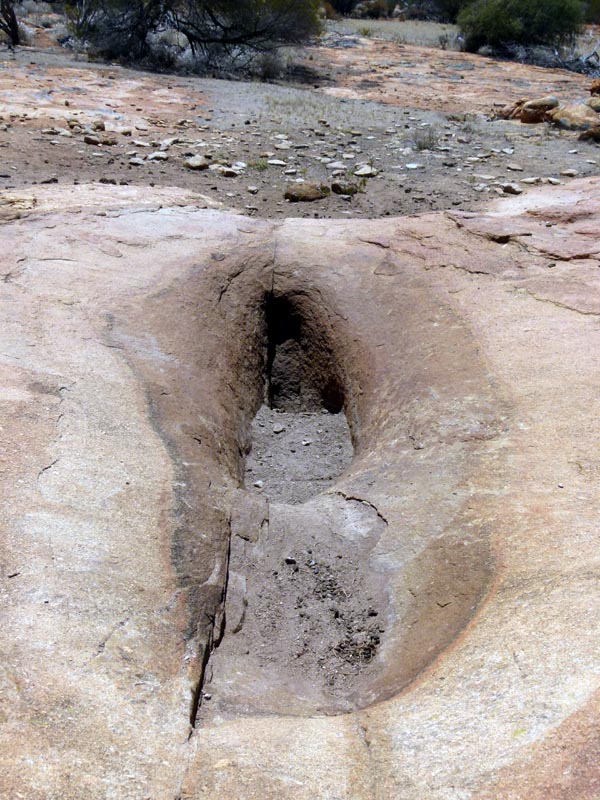
Halag Rock is not very memorable except for this one "interesting" gnamma hole that requires no further comment.
We then headed back to the superhighway after unsuccessfully trying to find an old track that would lead directly to Toms Rock. Once at the superhighway Rod wanted to see where it would come out on the Diemals/Menzies roads so we continued down. The map segment below shows this part of the trip. We do seem to have taken a rather circular path to get from Halag Rock to Kurrajong Gorge:) After following the superhighway down to the Diemals/Menzies road we headed east and then took the track north via Rundle Rock/Galah Rocks/Tom Rock and finally to Kurrajong Gorge (or Curragong Gorge). The track through Tom Rock to Kurrajong is now a very nice road care of some bulldozer work by a sandalwood cutting contractor.
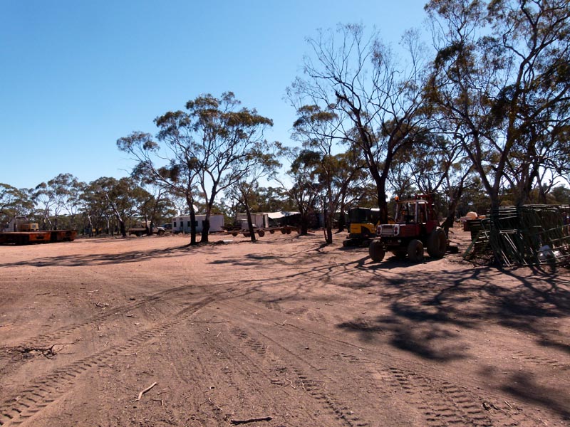
The sandalwood cutting is contracted out by the FPC and they have been there 3 years with a projected 2 years to go before finishing up in the area. Consider how much sandalwood is being removed in FIVE YEARS by a proficient contractor with heavy equipment. There are bulldozer cut lines all over the area and of course trampling over the OTHER native bush/wood/scrub. The cut lines are to provide access to a machine that grabs the sandalwood by the trunk and rips the entire tree out of the ground, roots and all. Nothing subtle about this procedure and apparently they 're-seed' as per FPC by throwing 3 sandalwood seeds into the ground where the original tree was ripped out. Bet those seeds successfully germinate. We were quoted something of the order of 70 years for a sandalwood tree to be ready for harvesting from germination... The contract requires ALL trees of mature age to be harvested. Let's not leave anything for the future, eh?? They are working a 30km radius from their base (close to 3000 square kilometres!!). And that's only from their current base. Evidence of similar wholesale harvesting was seen even near Metzke's Find 45km to the north. Looking with Google Earth the area to the east of Lake Barlee shows a criss cross of tracks 30km to the west.
Here's their camp and some of the equipment. The harvesting equipment is out in the field at work.
Sandalwood sorted by size (value) and ready for loading onto a semi for the drive down to Esperance. Yes, only some of the raw sandalwood is processed locally, the rest exported to other countries. Seems just like our stupid Mining Monster that just digs rocks to export out of the country. Yes, Australia remains a PRIMARY industry based country and heaven forbid we actually try to export anything but raw materials - which Prime Minister talked about us being a Banana Republic??? (Hint: Paul Keating back in the early 90's!).
The 'remains' of Sandalwood harvesting, a pile of wood chips/bark from the tumbling/stripping process. Thank you FPC (Forest Products Commission - a State Government body)!
Here's something I found with some searching. Looks like it confirms many of my simplistic deductions:
http://ccwa.org.au/media/fpc-must-be-held-account-sandalwood-and-forest-mismanagement
Quoted here:
Western Australia’s peak environment and forest conservation groups have called for a major review of the Forest Products Commission after new revelations showing mismanagement of the state’s sandalwood and native forest industries.
Conservation Council Director Piers Verstegen said “For years we have known about serious mismanagement of our native forests with unsustainable and unprofitable logging activities continuing in our Southwest.
“Now it has been revealed that extensive illegal sandalwood harvesting is also occurring under the management of the FPC, putting this resource at serious risk.
“These revelations show once again that the FPC is badly failing at its job of managing our natural resources in a sustainable way.
“In our Southwest forests, clear-felling of ancient forests is exempt from wildlife conservation laws while the FPC fails to deliver any financial return to the State from these activities.
“Now we see that our Sandalwood resources are also being plundered under the management of the same agency, with no effective sanctions or prosecution.
“This is yet another example of certain industries allowed to operate outside the laws that are supposed to protect our environment.
“The idea that a government agency like the FPC should exist in order to facilitate the destruction of natural resources at a loss to the state is bad enough.
“Now it has been revealed that under the management of this agency, serious criminal activities are allowed to take place with little or no penalties for their destructive impact on the environment and the state’s natural resources.
“It’s time the Forest Products Commission is held to account for its ongoing failure to properly manage the natural resources under its stewardship.
“The Forest Products Commission must be reviewed as part of the process of upgrading the State’s biodiversity protection laws, which is a major commitment of the Barnett Government.
“We cannot allow the situation to continue where certain industries and government agencies have no effective regulatory controls, and are able to operate outside the laws that exist to protect our environment” Concluded Mr. Verstegen
Now, doesn't that just confirm the obvious. I'm sure there's a few high up folk making some serious money...
After visiting the Sandalwood cutting camp we moved on to Kurrajong gorge, just a couple of k's away. We camped just south of it and the next morning headed back out. Before leaving, Richard convinced us we should go and walk to into it. It is not much of a gorge :). Essentially, just a small hill of rock and a water course/gully. Whoever named it as a gorge had a pretty powerful imagination. Given all the bulldozing and cut lines, finding it is a bit tricky, but easy to access once the correct track is located to drive on.
Lionel and I first visited this same spot in 2000, it is remarkable to me how much this entire area has changed in the past 12 years due to Sandalwood cutting. What was a very remote and pristine area is now criss crossed with bulldozer cut lines.
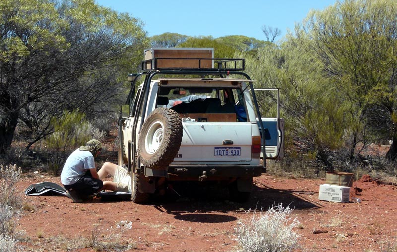
We then headed back to the superhighway and across to the track that took us to Lawrence Find. On the way I started hearing a noise in the rear of the nissan that was getting louder. We stopped and banged on things to try to reproduce it, no luck. Jammed a few sticks into areas that looked like they may be rattling and took off again, still making the noise. We stopped again and this time I went all the way under while Richard rocked the vehicle. It was the passenger side rear shock, the bushing on the top eye of the shock had chopped out and the shock's eye was banging on the pin when the suspension sufficiently cycled. We drove on to Lawrence Find and then I got under to remove the offending shock before it removed itself.
We ran the rest of the trip without the shock, funny thing is that it made negligible difference to the suspension. It was only on undulating road surface at speed that I could feel the suspension oscillate a bit. Back in town I bought new bushings for all the shocks, top and bottom and replaced them all. I also now have a spare pair of pin and eye bushings in the toolbox for the future...
From Lawrence Find we continued south until we hit the Diemals/Menzies road near Hospital Rocks and then headed West towards Johnson Rocks (always a nice place to stop - lots of water).
We stopped at one hill (where we drove past some signs MacArthur Minerals have erected). Good view of the Mt Manning Range in the distance.
Then on to Johnson Rocks to refill our water and to camp. The nissan aux +12V battery is being used to power the Whale pump that has been lowered into the rock hole. First job was to fill the buckets up for some well deserved showers. I then ran the pump through my Sawyer gravity filter to top up all our drinking water. With the warm/hot weather we were definitely using quite a bit of water. This was our last top up
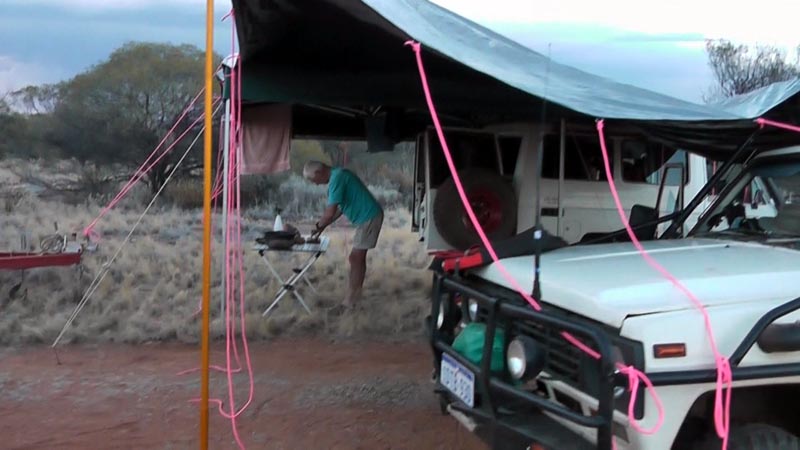
Rod couldn't get red ropes from his tarp, so had to make do with Pink ;) We had some dark clouds moving in and some gusty winds so seemed prudent to set up some cover in case of rain. As it turned out we did get a sprinkle but no downpour. We did see signs of downpours from the clouds around us, but nothing close by.
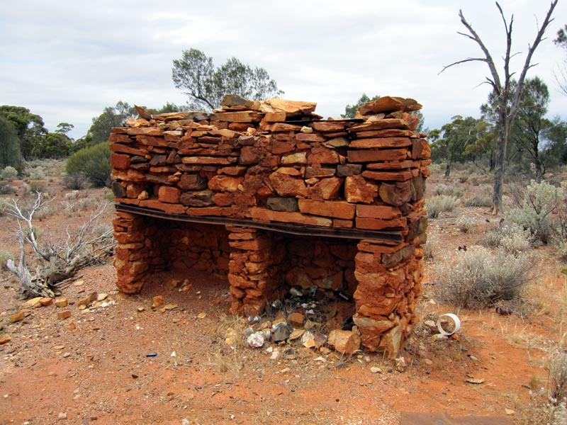
The next day we headed south of Johnson Rocks and visited Reid's Hut. It would be very neat to have a picture of it in its original glory. Someone spent considerable time and effort building it from various rocks from the nearby outcrop. The whole area was bone dry, so no real rain fell out this way.
After our stop we continued on towards Mt Manning to the west of us. We gave the east side a skip since we'd been there several times before and the temperatures were getting up in the 38C/100F range and folk were getting a little warm under the collar. I suggested visiting the west side of the range since there is a track marked on the geology 250k maps. Turns out the track was fairly overgrown for the first portion but then opened up and went through some nice clearings.
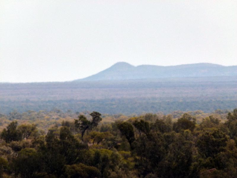
Once we camped under a little shade and got some nice cold beer into us, the cloud cover started to roll in and temperatures dropped to a more comfortable range. The picture below is near our camp site looking directly towards the east is the Mt Manning range.
From the map and tracklog above, the track up the west side is very straight and has a track heading off east right up to the range that we explored the next day. A pleasant cooler day and we're all feeling refreshed and more lively and ready to investigate. Richard was feeling energetic and climbed up the side of the range and near the top his smartphone beeped as it picked up some queued up emails. We were again within range of the cell tower covering the Windarling Range. Wonders of modern technology.
On a low ridge to the west of the track and looking east towards the Mt Manning range as we drive around exploring the various tracks.
We then returned to our campsite where Rod had left the trailer and hooked up and we headed south to the main track and then west again towards the Bullfinch-Evanston Road. We stopped in the area marked Olby since it shows a mine icon on the map, but there is definitely no old mine anywhere in that area, it is basically just a sand plain. My geological map of the area does not show any mine, just a rock outcrop to the west a couple of k's (which we've visited on previous trips). Wouldn't be the first time a topo map has had an error on it...
We then continued to the main road and then Rod took us to Faye Bluff on a fairly direct track from the east side. The tracklog on the map below shows the track heading north-west to Faye Bluff in the Die Hardy Range. We made camp and then hiked up to the top of the bluff for some pictures and of course cell phone and web access (I sent an email to my wife back in the US via my Android tablet and Telstra connection).
This is the western entrance to gain you access to the top of the bluff. It is a narrow cut that you can easily climb to get to the top. Richard is getting his cell phone out in preparation to "call home".... Not yet, we need to get to the top first. The hike along the edge has small tags on the rocks near several of the rare and endangered plants (Tetratheca paynterae) that are also on the Windarling Range. One can only hope that the Mining Monster has been excluded from this area.
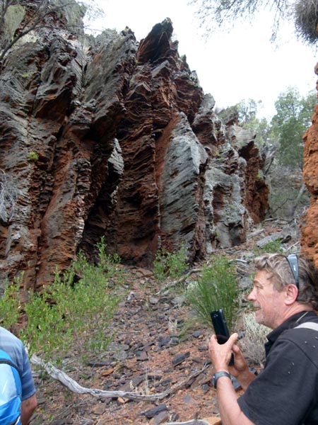
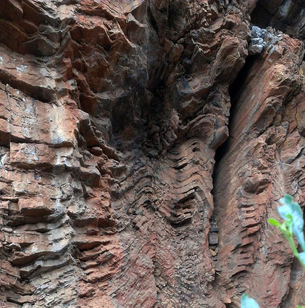
Closeup of the entrance area. The sediment layers show some buckling from aeons ago.
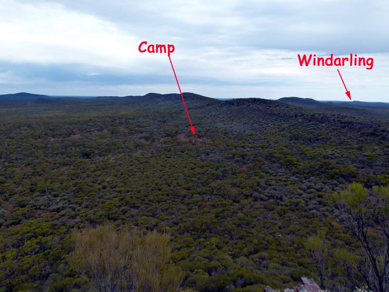
View south (and a bit west) from the top of the bluff. The camp is where the vehicles are parked and we've made camp for the night. Nice cold beers waiting for our return. Windarling is in the distance where the Iron Ore mining is going on. The scar on the Windarling Range is visible with the naked eye from the top of the bluff.
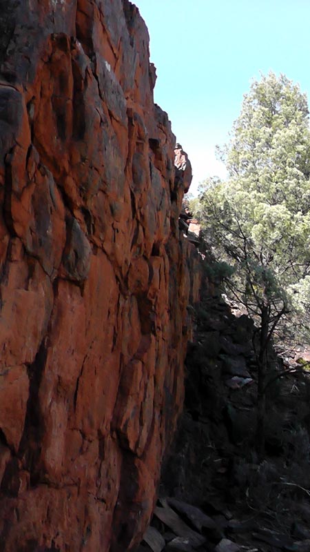
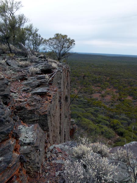
The obligatory view of the sheer cliff face on the bluff.
The next day we headed back to the Bullfinch-Evanston road and checked out a track near Mt Geraldine then headed south to investigate an old track that leads to the Windarling Range. Of course the Mining Monster has put up signs closing the road, even though it is a gazetted road on the maps. They seem to have unlimited power over mere citizens of this country. The WINDARLING waypoint on the map below shows the spot where years ago we parked to hike up the range. Now that spot IS a hole in the ground. The current Google Earth aerial photography (as of Nov 2012) shows only a fraction of the current Windarling Mining devastation.
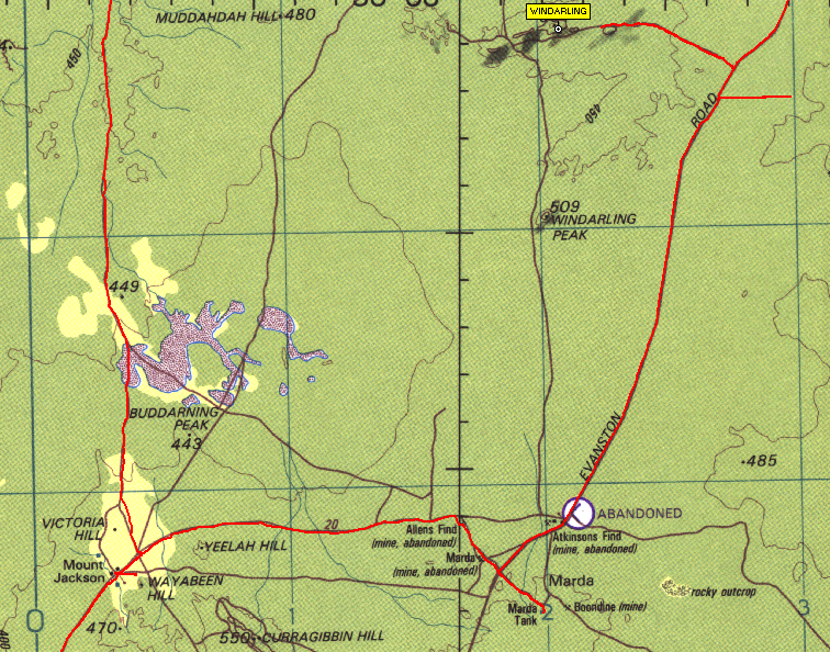
A mining truck carting off a bunch of rocks from one of the Windarling pits to ship to China. No processing, just primary industry at work.
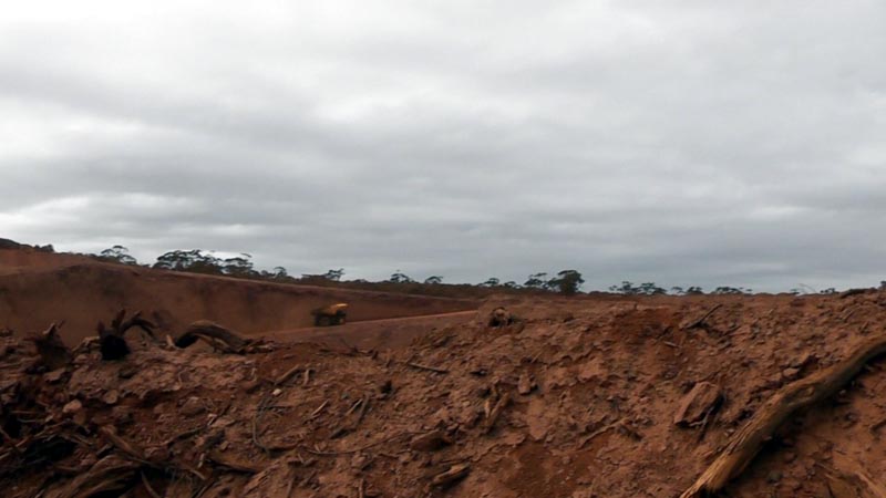
Closeup of the truck near the top of the pit ramp.
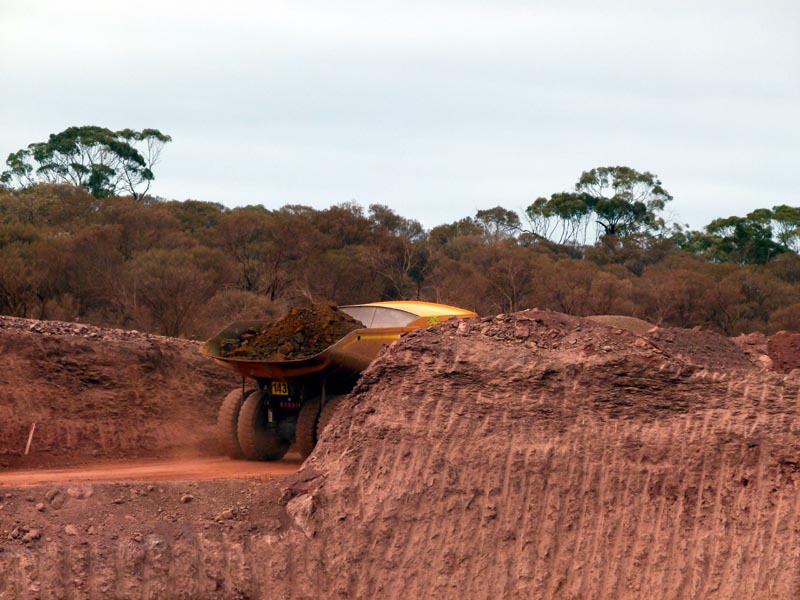
The scarred face of the eastern side of the Windarling Range - does that look like minimal impact??
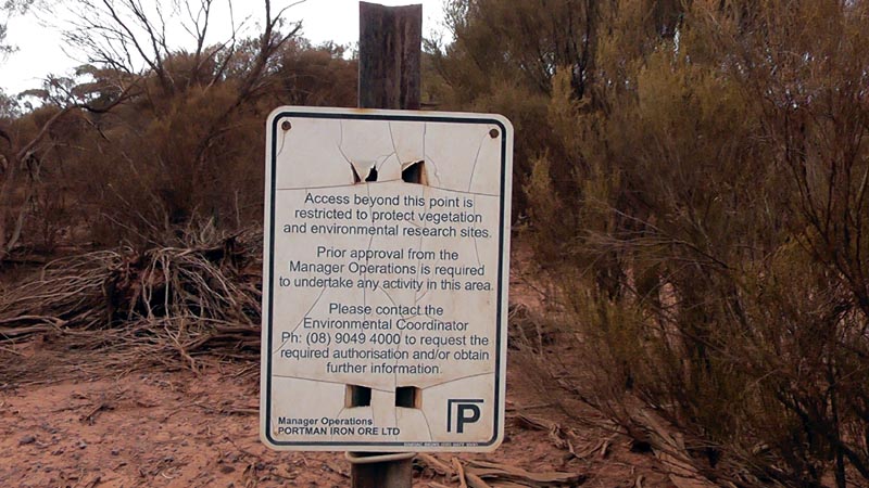
One of the great jokes of the Mining Monster. The area behind this sign has been bulldozed and crushed, but by placing a nice little sign on a wooden post we're lead to believe that the area is protected. Excuse me while I have a big laugh at our own expense. I wonder if the "Environmental Coordinator" personally installed the sign?
This is what the area looked like on google earth in 2006:
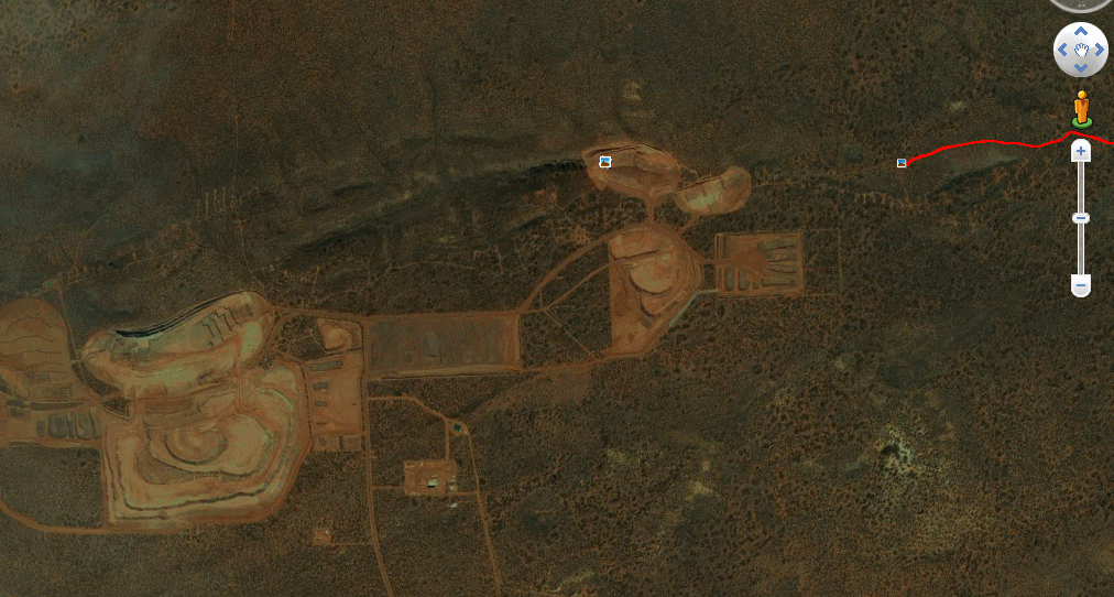
A bunch more years and now in 2013 we see the following. The are digging deep into the side of the range - I guess the range can't erode/fall into the hole eh? What a nice ecological mess they are making! The picture icons on the google earth are mine. I remember a guy working at the mine complaining that I had labeled one of the pictures as "Windarling Range - Prior to mining devastation" and he took me to task for posting a political statement (the name of the picture) and claimed minimal impact was being done to the area and he should know... what a load of bullshit! The large area in the middle of the picture is 1km x 1km in size, let alone the rest of the works... The left (darker side) is still 2006 imagery, so when they update that I'm guessing it'll be larger and even more lost range. See next image.
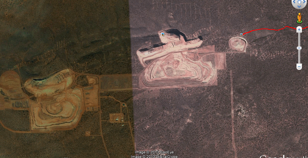
Sure enough, now the 'left' side of the area above has been updated on Google Earth and the devastation there has grown more. How the Mining Monster can get away with hacking up so much of the range is boggling to my mind, but obviously with a corrupt government that only cares about the short term everything is up for grabs. Yep, minimal impact :(
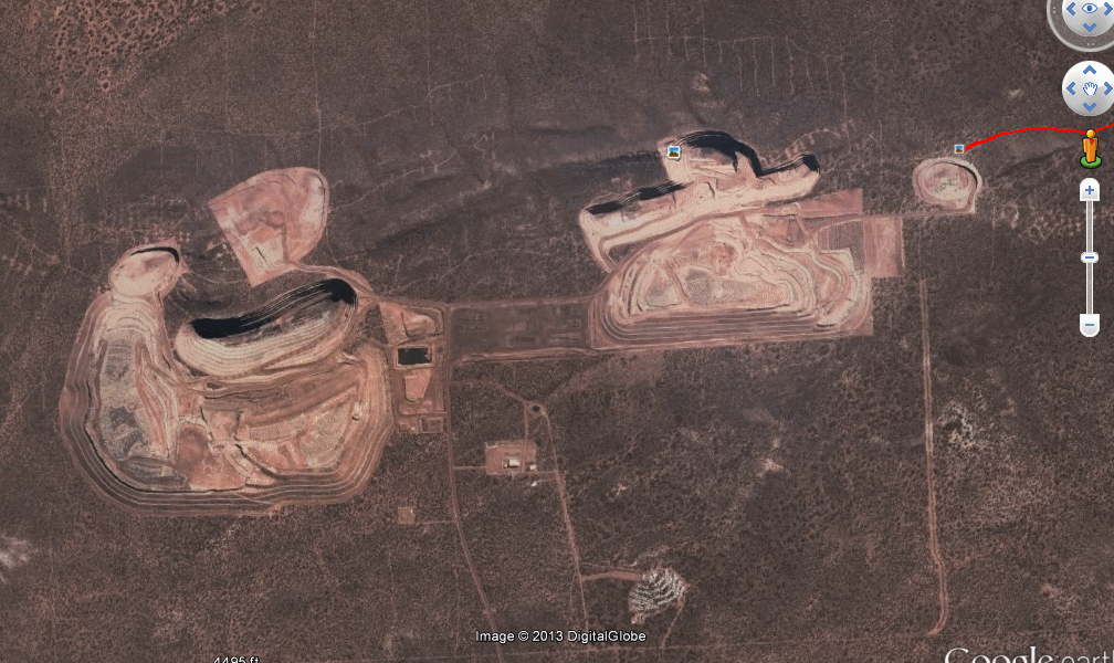
Ok, another update. We're at July 2015 and new imagery is available. It keeps growing and absorbing more land.
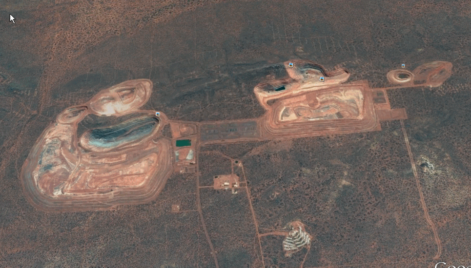
Interestingly the mine decommisioning is meant to be sometime in 2019. Pits will be left to fill with water that will miraculously not leak into the other groundwater (per Cliff's report/plan for the mine dated 2012). I suppose the soil there is magical. Apparently one of the pits is projected to stabilise (whatever that means - maybe the rest of the range will stabilise by falling into the pits) within 29 years... Poor WIndarling Range - I guess that'll have to rename it once they've finished since 'Range' will be a bit of a misnomer at that point. Hopefully the Helena Aurora Range will be protected from these companies.
After taking our look at some of the Mining Monster's handiwork we headed back to the Evanston Road and then visited their airstrip to the east (paved!) and saw a Skywest turboprop unload a bunch of fly in workers and load up a bunch of fly out workers. All wearing their "uniforms" (hi-vis jackets) - their mum's would be proud.
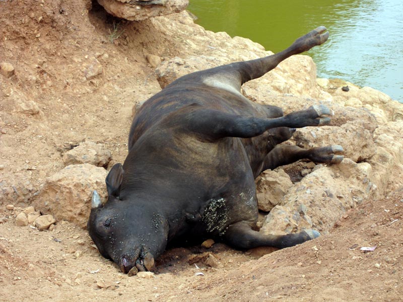
We then headed down to Marda Tank to have a look-see. The "Tank" or dam is lined with bitumen and was originally tin covered. This was a government dam to provide a permanent water source.
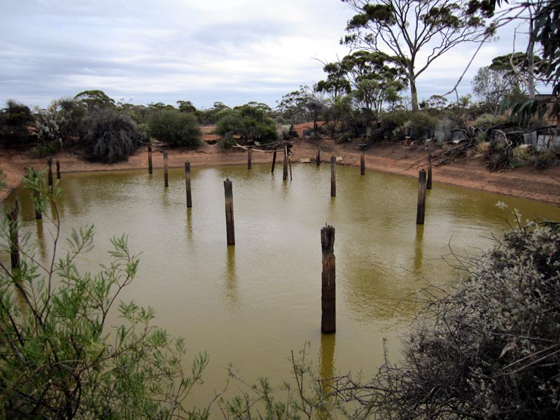
No longer maintained or serving human needs, the contents are definitely not 'potable' and certainly not with this casualty next to it.
Rod felt it was a good spot to boil up some water (not from the dam!) and make some tea and coffee. Top job having such a keen fellow with us.
Near Marda we found this sign. Seriously, do these Mining idiots think they OWN the tracks on their MINING lease? All they have is a lease to mine, not outright ownership of the land. Rod got in touch with the Department of Mines and Petroleum, they advised that they have received similar reports and it doesn't come under the mining act, it's a Police matter and it should be reported, which he did. Now can anyone guess the likelihood that the Police will do ANYTHING at all in this or any similar case?
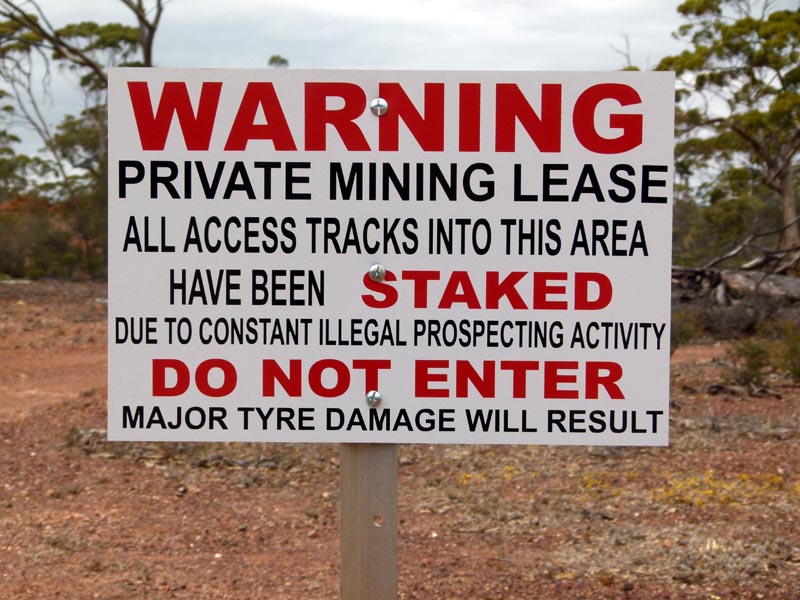
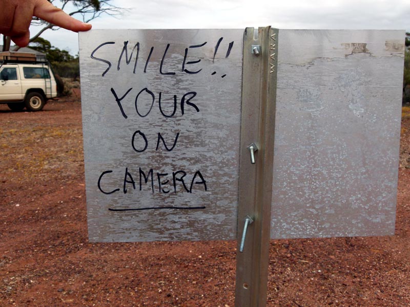
Ok, so firstly the Mining folk think we're stupid and believe they actually have cameras out there catching pictures for them to then prosecute us (of course the Staked Tyre sign is illegal, but we'll ignore that). Secondly they appear to have never progressed past the first few years of primary school since there are just a few things wrong with the second word...
From Marda Tank we headed west, through Marda and Allens Find and then back to the Mt Jackson homestead to close our loop.
Old double chimney fireplace at Allens Find. The only structure we found other than a bunch of mine shafts from days past.
Various diggings/mine shafts at Allens Find
Heading down the Mt Jackson Road.
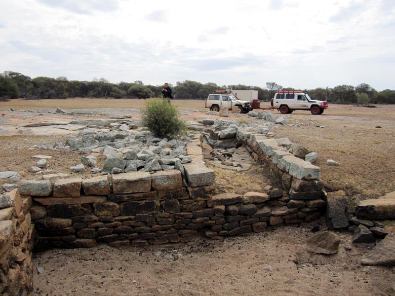
Once at the Mt Jackson homestead we headed back south along the Mt Jackson Road (the way we had first driven up). We stopped at Trough Well to have a look. It is a rock outcrop where a well had been blown into solid rock and lots of catchment has been constructed around the outcrop edge. Unfortunately the water was quite putrid with dead animals including a reasonably recent Emu.
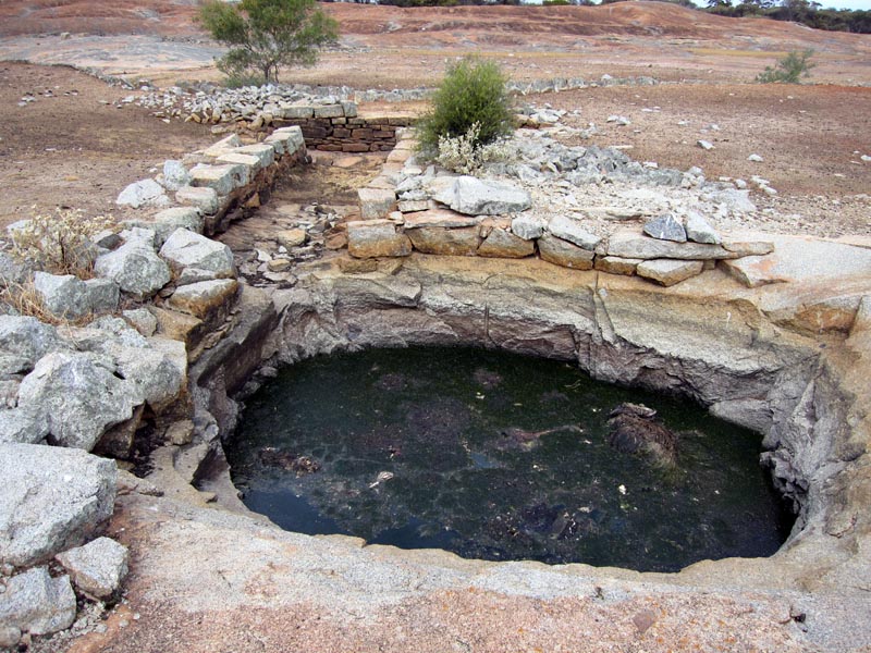
You can see how much work was done to create catchment from the outcrop to feed the well.
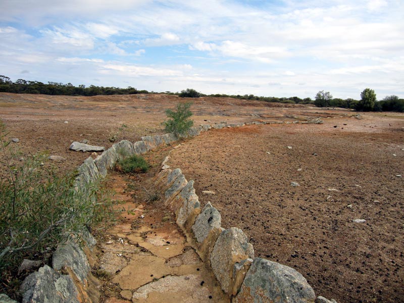
A lot of work went into Trough Well and it must have been quite an important water source many years ago.
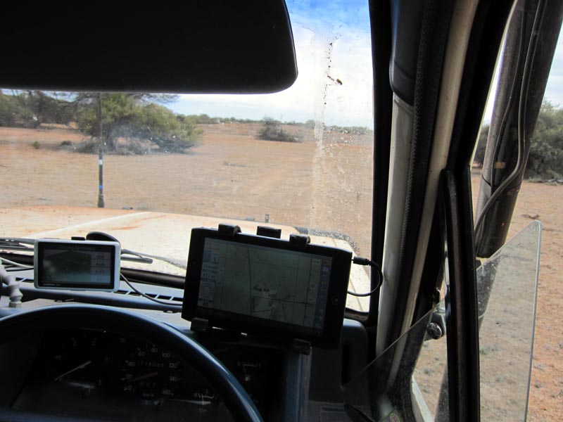
View from Nissan's driver's seat. The Acer A100 running android oziexplorer mounted to the windshield. It ran flawlessly for the whole time we were out and faithfully recorded our tracklog for the entire trip. The Garmin Nuvi to the left is a backup and running a copy of Shonkymaps though most of the time it was turned off.
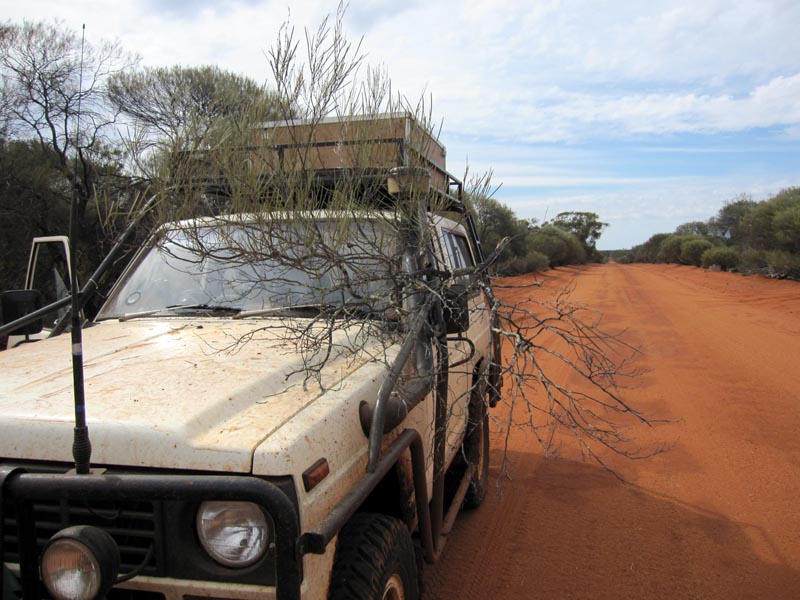
A little foliage wanting to hitch a ride after exiting from Trough Well on the right.
South of Trough Well we headed east to a dam, bone dry.

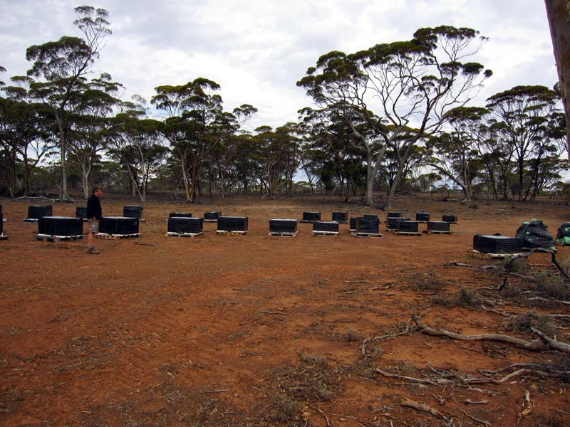
Near the dam was a lot of core samples or nicely wrapped and strapped to pallets and then just left. I wonder if this exploration company went belly up after draining some investors of their money. Apparently when you're spending money that grows on someone else's tree there's no lack of its availability :)
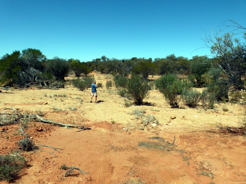
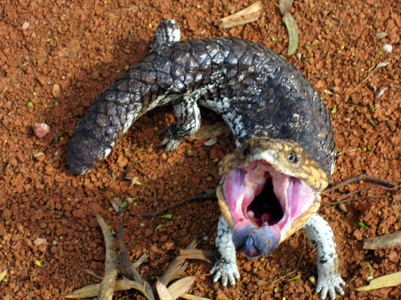
Leaving this area we headed south again on the Mt Jackson Road and then decided to take another track east to see what the marked ruins on the map were about. On the way in I passed this fellow on the side of the road - seemed eager to try to scare me off if I got the camera too close.
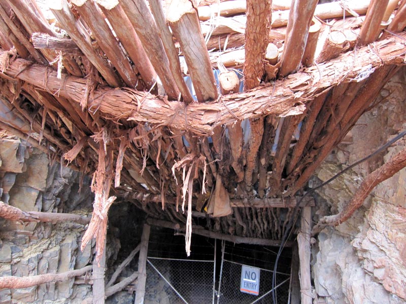
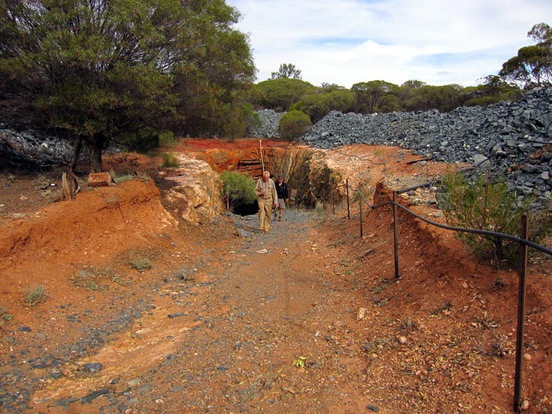
When we reached the ruins area, it was basically an old gold area and just a further bit on we found a very neat and reasonably modern gold mine. LOTS of material dumped on top that came out of the mine. The entrance runs downwards at a slight grade and the rotten wood appears to have been left more as a deterrent rather than a true safety indicator.
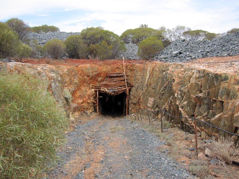
Rickety entrance disguising an otherwise structurally strong inside.
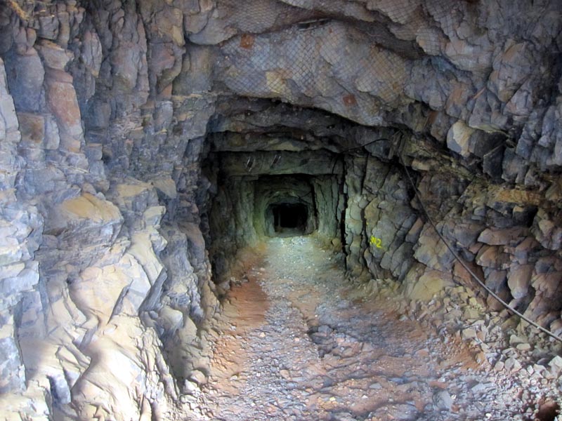
With a strong torch we could illuminate deeper into the mine entrance and it looked to be solid rock all the way.
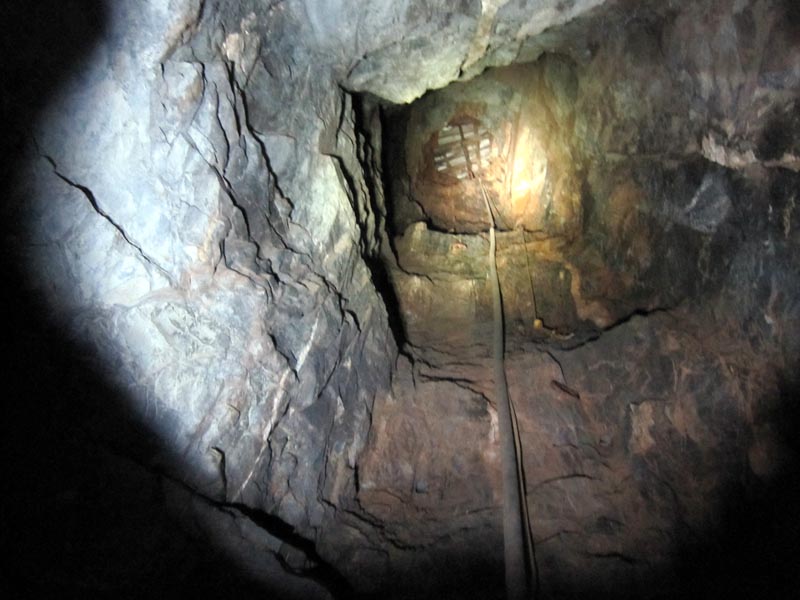
Vertical shaft leading up to the surface. It has been covered for some reason, maybe to prevent water/debris from entering. The mine continues in a considerable distance and we only explored past the first corner. It certainly was quite a piece of work.
After our little exploration it was time to move on to check the area out a bit more and to locate a camping spot for the night.
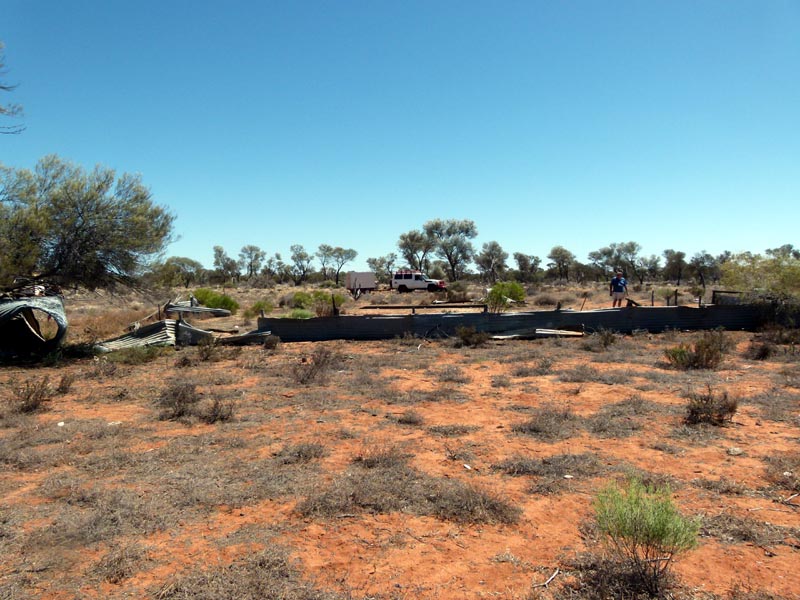
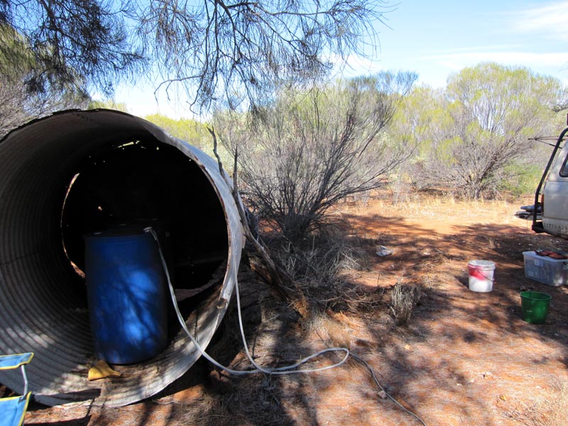
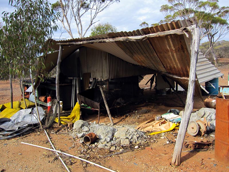
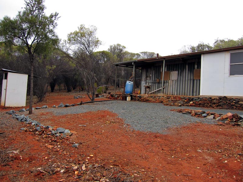
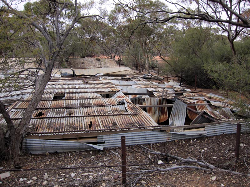
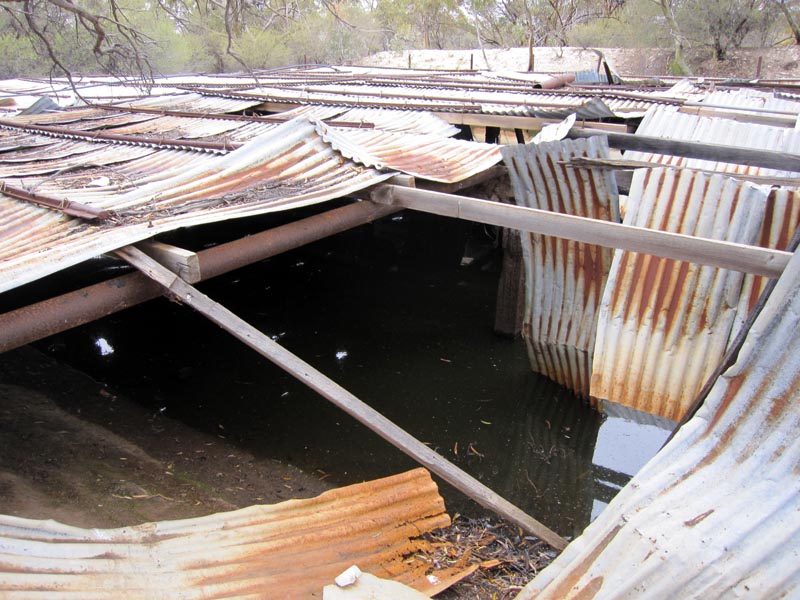
A bit further in from the mine and we found some of the storage areas and living quarters. This shed was a bit worse for wear.
The living quarters were in quite good condition and nice and clean/tidy inside. We ended up camping near this shed for the night. From this camp spot which has reasonable height and a view to the south we had Telstra cell access. Richard did some experimenting to locate the tower we were accessing and it appears to have been 78k (as the crow flys) and on the Great Eastern Highway.

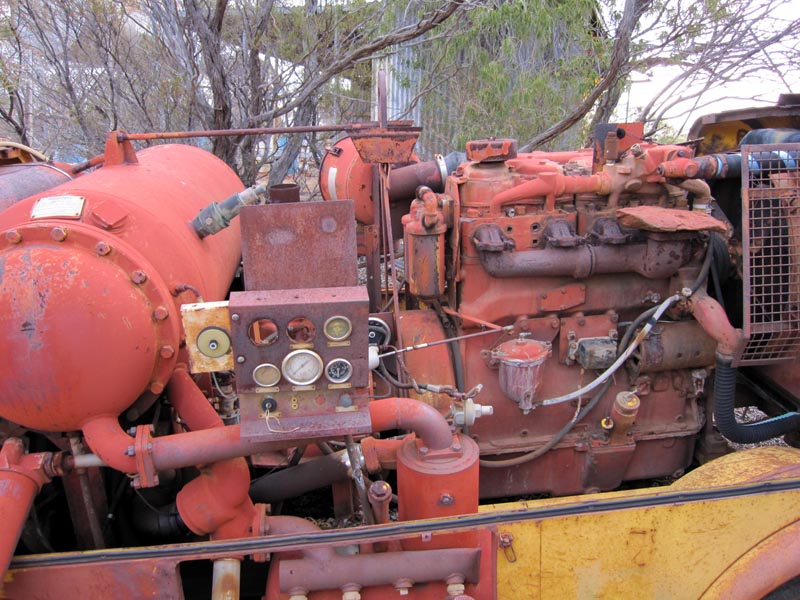
We walked around the mine area and found lots of old machinery relics from when the mine was active.
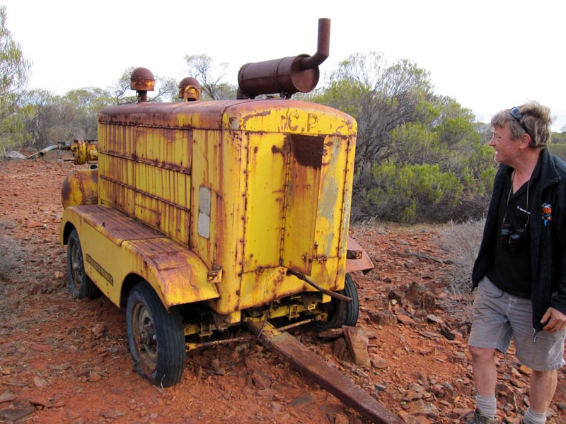
We found several compressors looking a little worse for their age.
Old diesel & petrol tanks at the top of the hill.
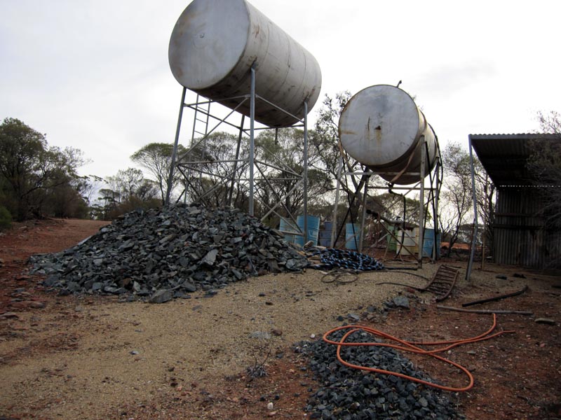
Further down the hill was a more modern and more recently lived in set of quarters. Appears that folk must still be come out to the area to mine or prospect or maybe just to enjoy the solitude/isolation.
The next day we packed up and got ready to head back to Perth. We first visited Ennuin Tank which is disintegrating as the years go by. It will slowly decompose and become like Marda Tank. These are relics from days gone by when government dams were the only source of water in otherwise arid bushland.
A rare sight indeed for this trip, a functional windmill. It was turned off, presumably to protect it from high winds. The windmill feeds through a holding tank that then feeds into the dam/tank.
This was our last 'bush' stop and we then headed to Bullfinch via the Mt Jackson Road. From there we returned via Mukinbudin/Dowerin/Toodyay back to Perth.
It was a great trip and we visited several areas that were new to some of us.
![]()