3
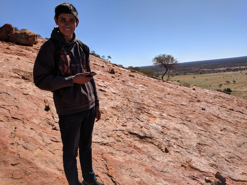
1/2 Week trip with freshly minted mechanical engineer son
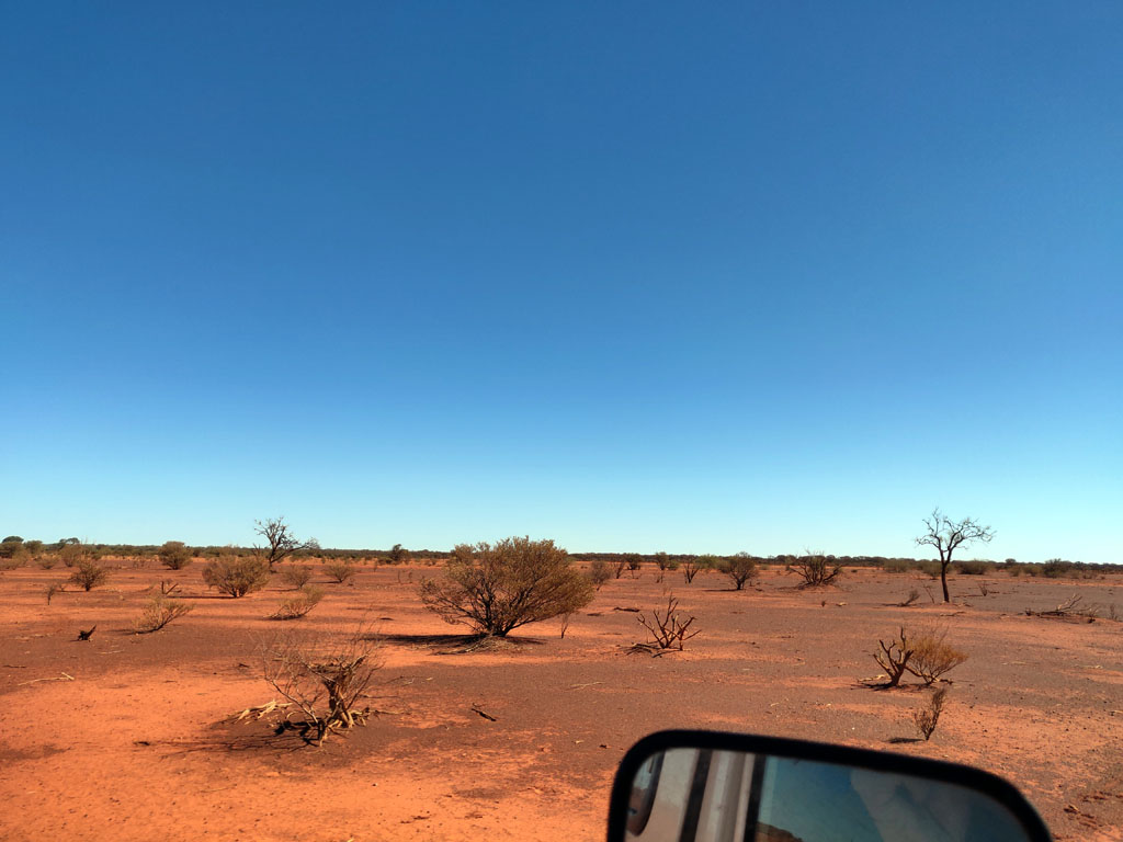
Yet another trip to the bush,
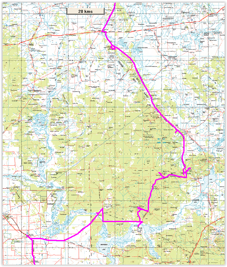
all up a total distance, a hair under 4000km. Trip was July-Aug 2019.
Weather was fantastic. The trip was instigated by my dear wife that
suggested it would be a great father-son adventure to cap off my older
son's recent graduation with a bachelor of science in mechanical
engineering.
The basic trip was from Perth
to Westonia on the
pavement
and then up to Mt Jackson, across to Mt Manning range and then up to
Johnson Rocks and on to the Diemals-Menzies Road. Up to
Metzkes
find. From there we went
across to Leonora (via the Leonora-Mt Ida road) to fuel up and purchase
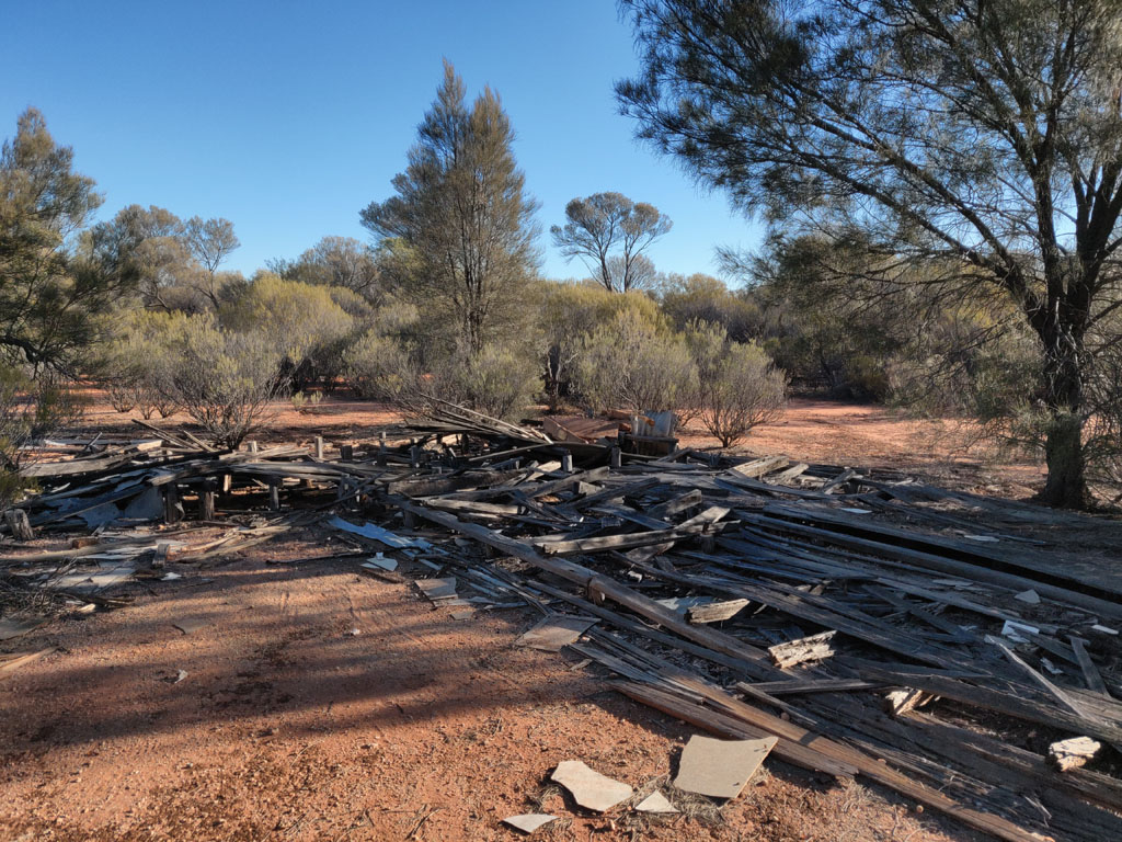
a few supplies. Down to Kookynie and Niagara Dam and then via some
tracks/roads to old Yundamindera Woolshed (all gone). Down towards Mt
Celia and then to Moon Rock/Elora and the southern edge of Lake
Minigwal to Thelma's
Tank. Then east along the southern edge of Lake
Minigwal and up along the northern side and hooked up with an older
mining track to get us up to Lightfoot Lake (the Stella Range is barely
a range...). Then up to Laverton via old/new mining areas including
Burtville. More fuel and supply stock up. Then on via the Erlistoun
road and Nambi road, just south of a "prohibited area" (over the
horizon radar) and up to Melrose (Lake Darlot area) and north again
with some westerly to head to Wiluna. Then off to
Meekatharra via a detour or two. Fuel up at Meekatharra. Take the Meekatharra-Carnavon road west
and visit some nice pools on the Murchison. Then continue on to the
Gascoyne and a nice remote pool (pity about all the cow crap).
We
then head west until we hit the Carnavon-Mullewa road and head south to
the Beringarra-Byro road and then east and end up just a few miles
south of the pool on the Murchison we had camped on a day or so prior.
We continue on and head towards Cue but then veer off to Big Bell (too
touristy) and then to Walga Rock (way way too touristy), but find a
nice old and dilapidated fence line track to Woolgerong Rock
(taller than Walga and totally 'private'). Then via the old and
decrepit vermin proof fence (fun drive) back to the Dalgaranga Road and
down to Yalgoo. Onwards via the Yalgoo-Ninghan road and
Warriedar
Road to the Coppermine Road and on to the Rothsay Road and to
fuel at Perenjori and back to Perth via Wubin etc.
It was a great trip and
revisited some old places and many new spots and tracks.
Following are some of the
pictures and writeup from our
trip. The participants were:
- Myself in the old nissan
(Keeper of the holy path and in charge of finding water and other neat
spots).
- My son (Peter), co-pilot,
co-navigator and tent put-her-upper and pull-her-downer. Firewood collector and burner.
- Rod in his white troopie V8
TDI only for 2 nights.
- Richard
(with Rod) and also only for 2 nights.
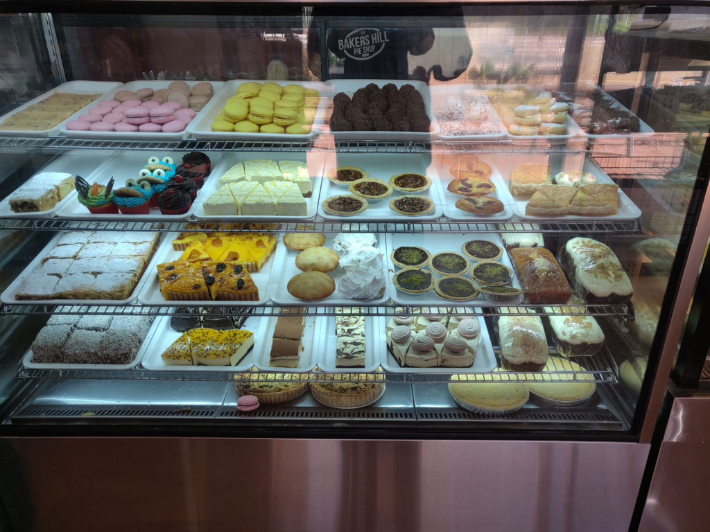
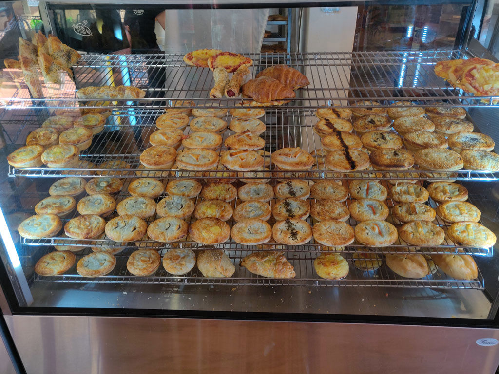
Rod was hot to trot to take off early
in the morning
so we could hit the Bakers Hill bakery before the goodies sold out.
They do have a pretty decent selection and Peter was happy to take an
assortment with him.
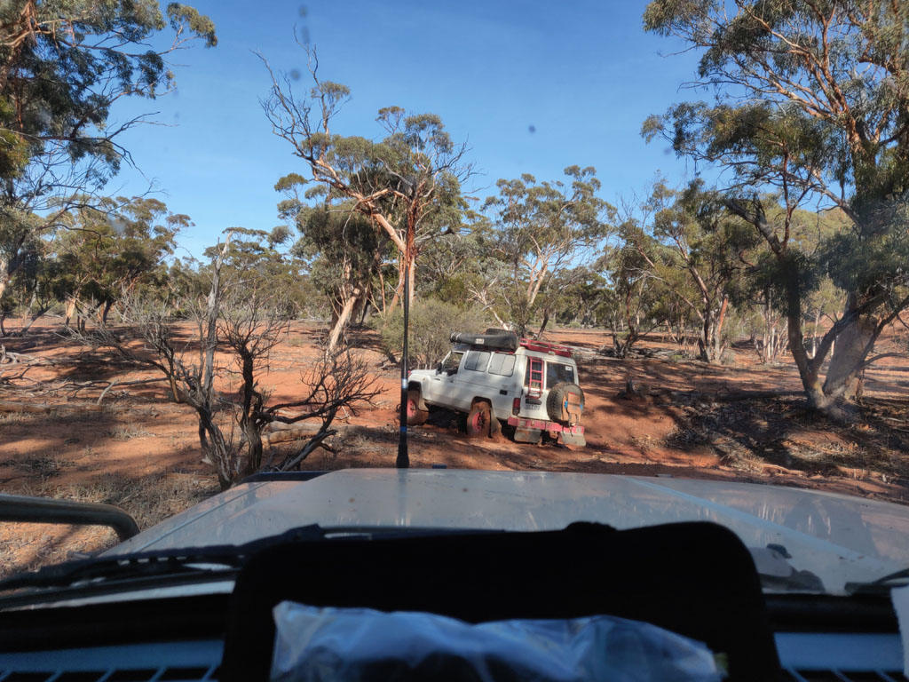
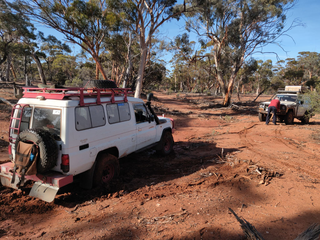
First
camp stop was at Ennuin Station. Rod has a fondness for the area and it
is
easily accessed from Perth. Next morning Rod tried to take a short cut
but his troopie decided it was having nothing of it. Short
slippery/muddy water
course and the troopie was spinning wheels. Our view from behind of the
beast rotating but not moving forward...
So,
it was time for the nissan to help pull him out. Drove across the water
course a little further down and then positioned to pull. The troopie
came out
easily, nearly like it was only in 2WD high range, or its V8 TDI is
not what it's cracked out to be. I'm also not convinced the wide tyres
Rod runs are good in mud. It was crazy watching the troopie sit and
spin tyres in a few inches of mud. I have always run narrower tyres in
the oz bush and am still of the belief that they provide the best
overall solution for the range of terrain I'm usually traversing.
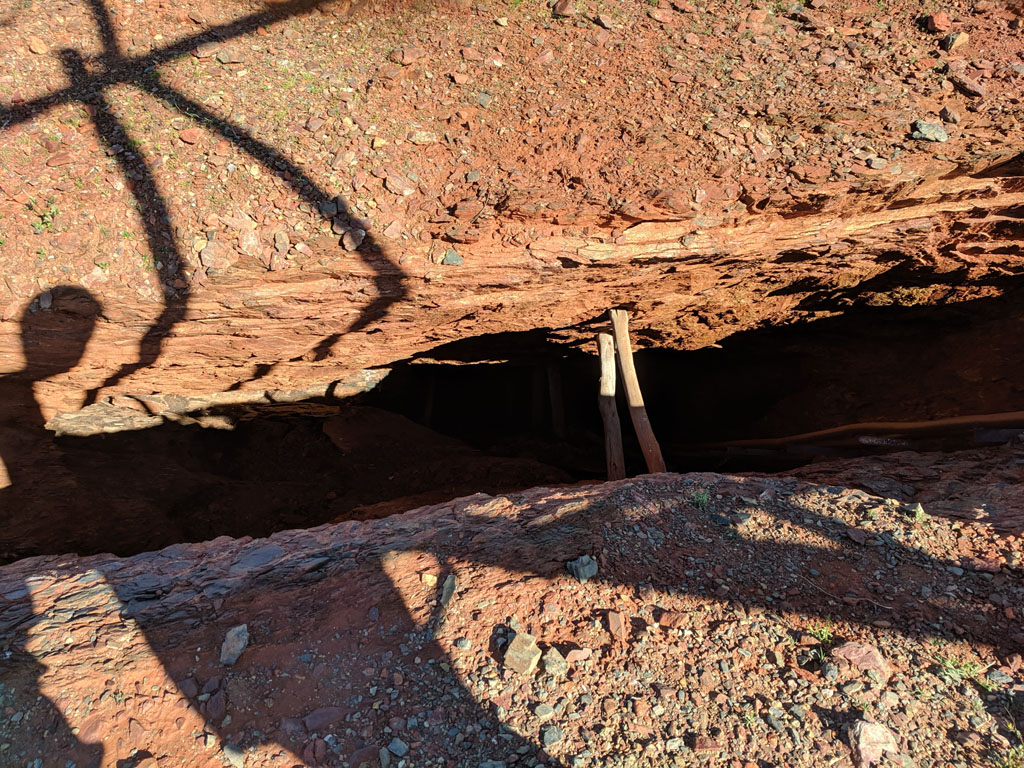
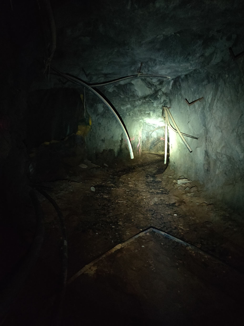
We
visited Birthday mine again and this time all 4 of us ventured quite
deep inside. 2 Lights with us just in case. Once down a couple of turns
I can state that it is VERY dark down there with lights turned off.
This is a picture with one of the torches lit up, the walls/roof
& floor are
essentially solid rock all the way down. We didn't go all the way to the end, maybe next time. We did go quite far in though.
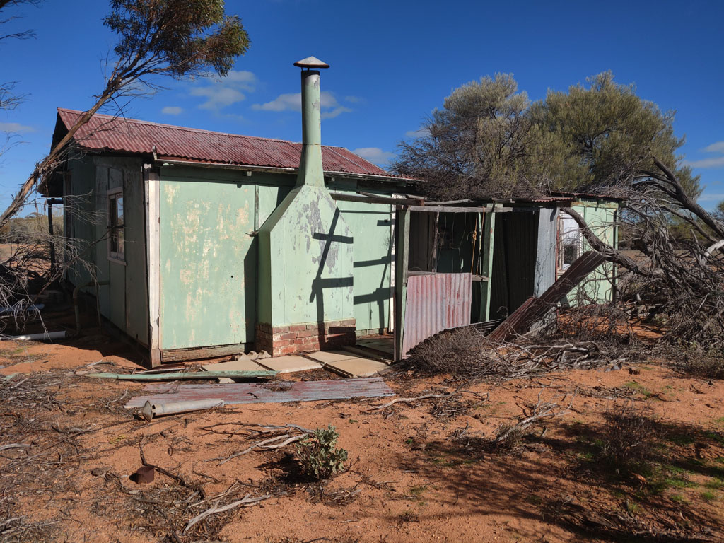
With Rod
in the lead, we headed off
the next day and found
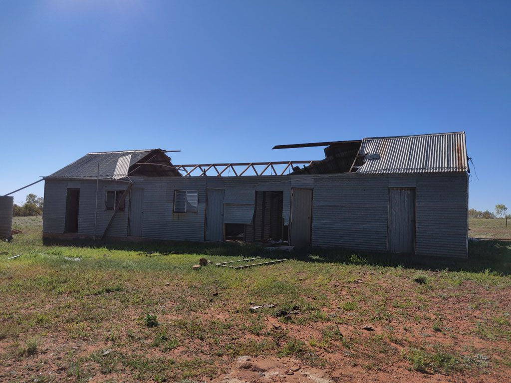
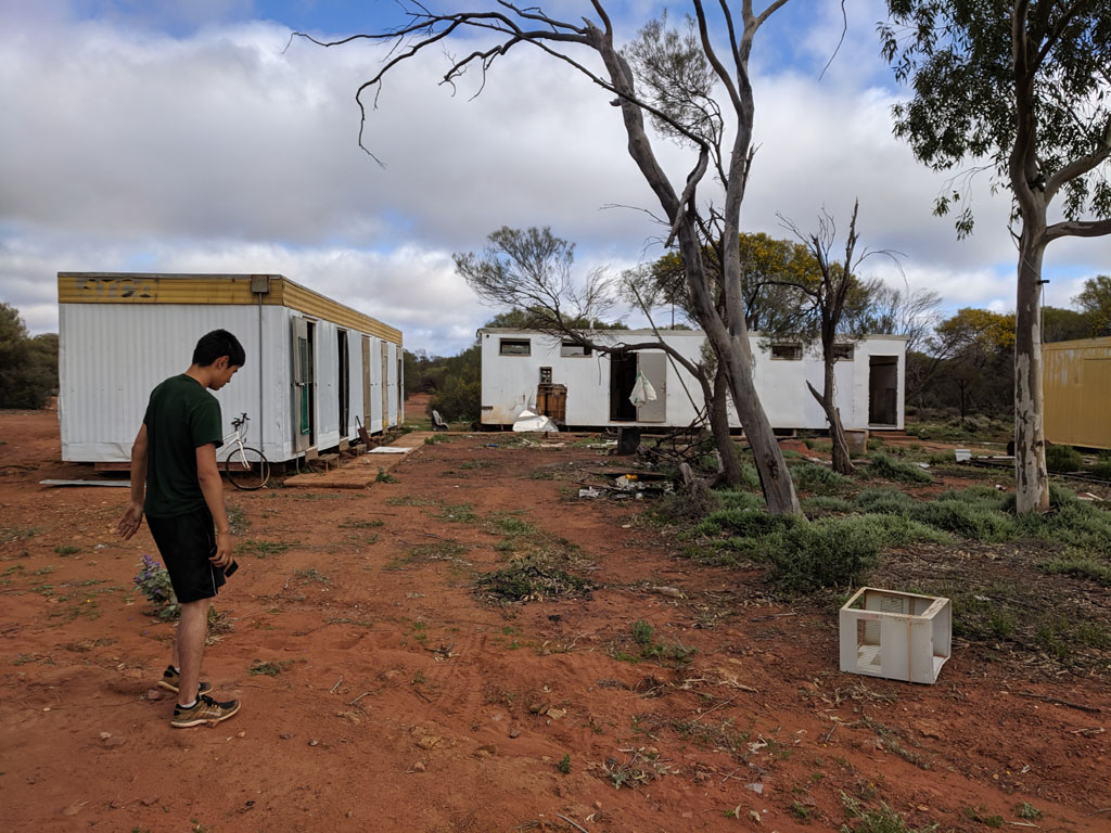
another abandoned homestead in disrepair. This homestead (or maybe an
old outcamp) is about 25k south west of the Mt Jackson homestead (also
abandoned and much more in disrepair).
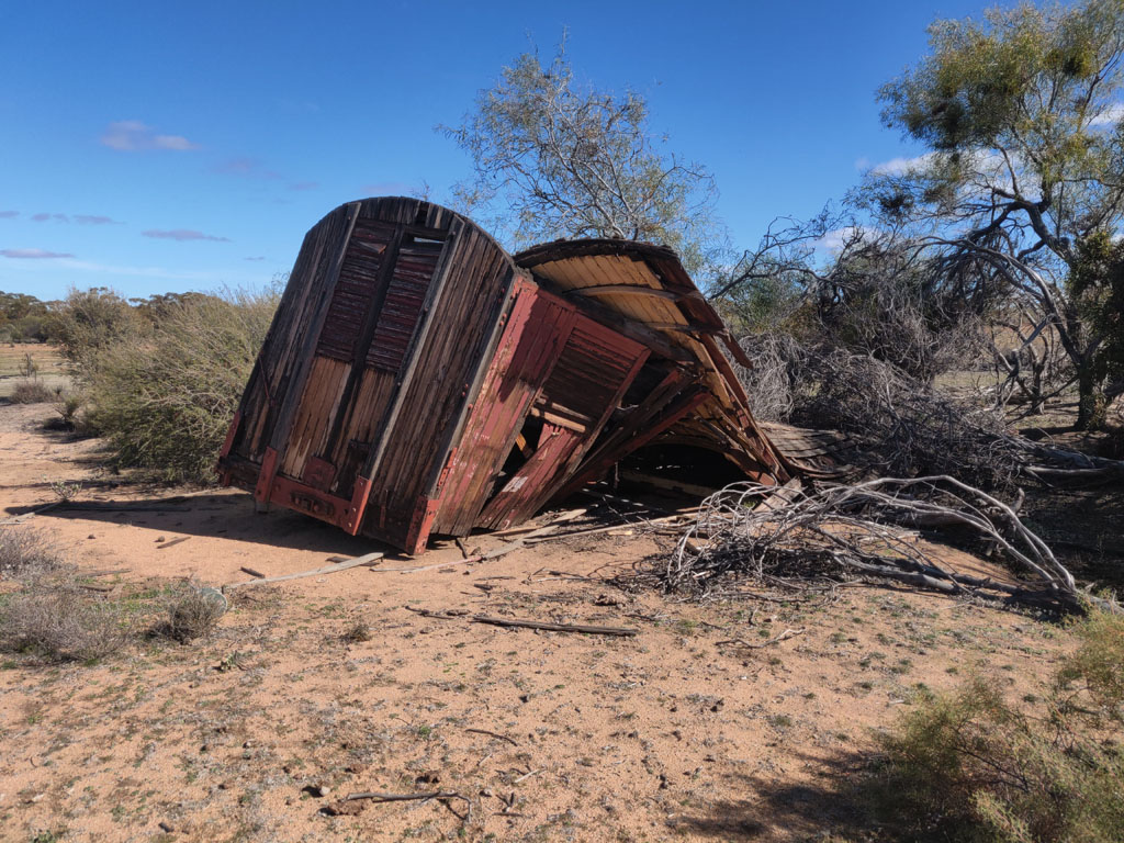
Near
the back of the homestead is an old tram carriage. Its mate is on the western
side of Pigeon Rocks. It is hard to imagine the work involved in
carting the tram out in its heyday and why it was taken out there in the first place.
There must have been lighter stuff available to be used as a storage
shed.
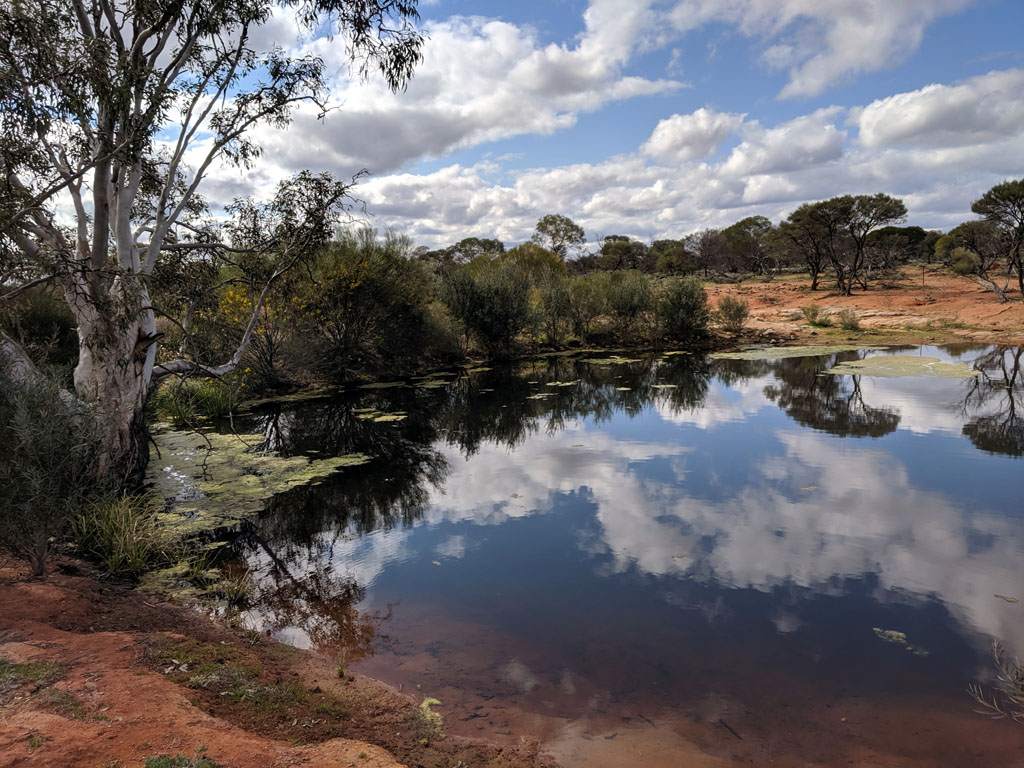
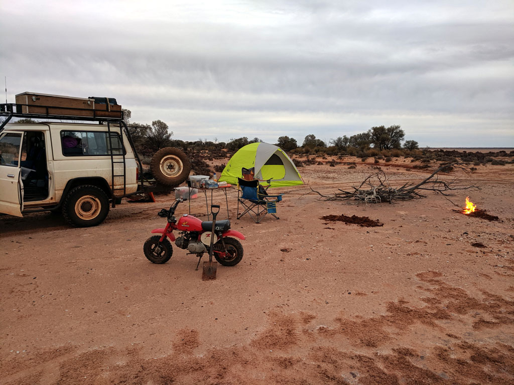
Second night's stop was near the
edge of a lake. Wood has been collected ready for a decent campfire and
also to do our cooking on. Next morning was pretty chilly with frost on
vehicles' windows and on camp tables etc. Peter buzzed out on the lake
on the Z50 - good opportunity to learn how it handles and to be exposed
to an engine that has a choke :)
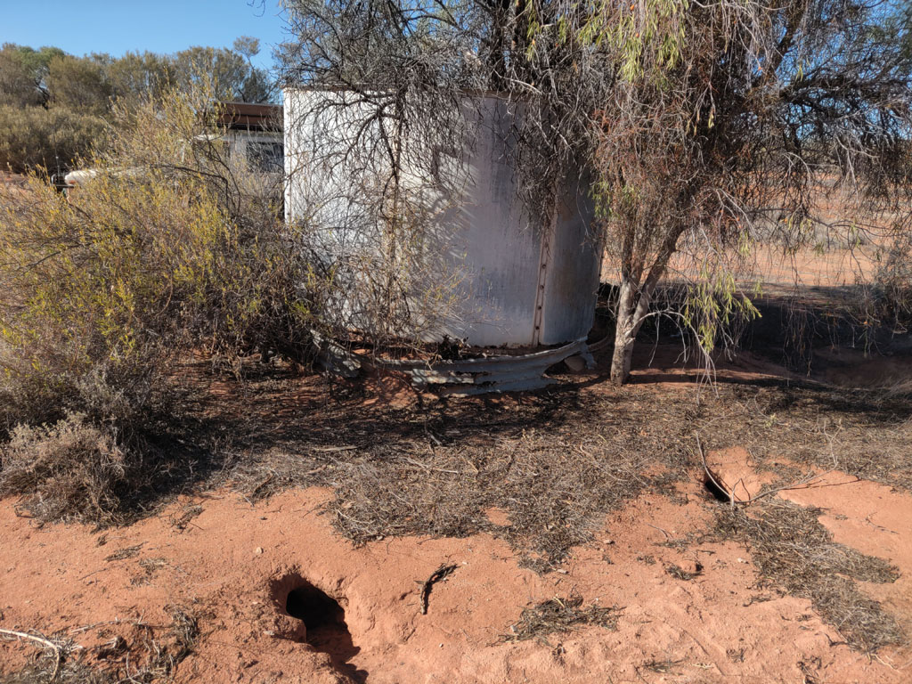
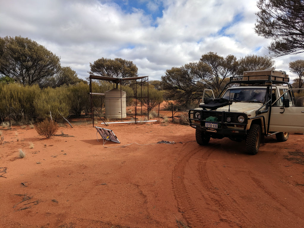
Near
our campsite was
an old shed with a 1000L water tank, though it was empty. The roof is
not catching water for the tank, so likely it was filled by pumping
from a
truck carting water. There are gold plated taps in the bath/shower...
We left
Richard & Rod after
visiting Marda Dam and they headed back to Perth. We on the other hand
have just started our trip and headed north on the Evanston Road and
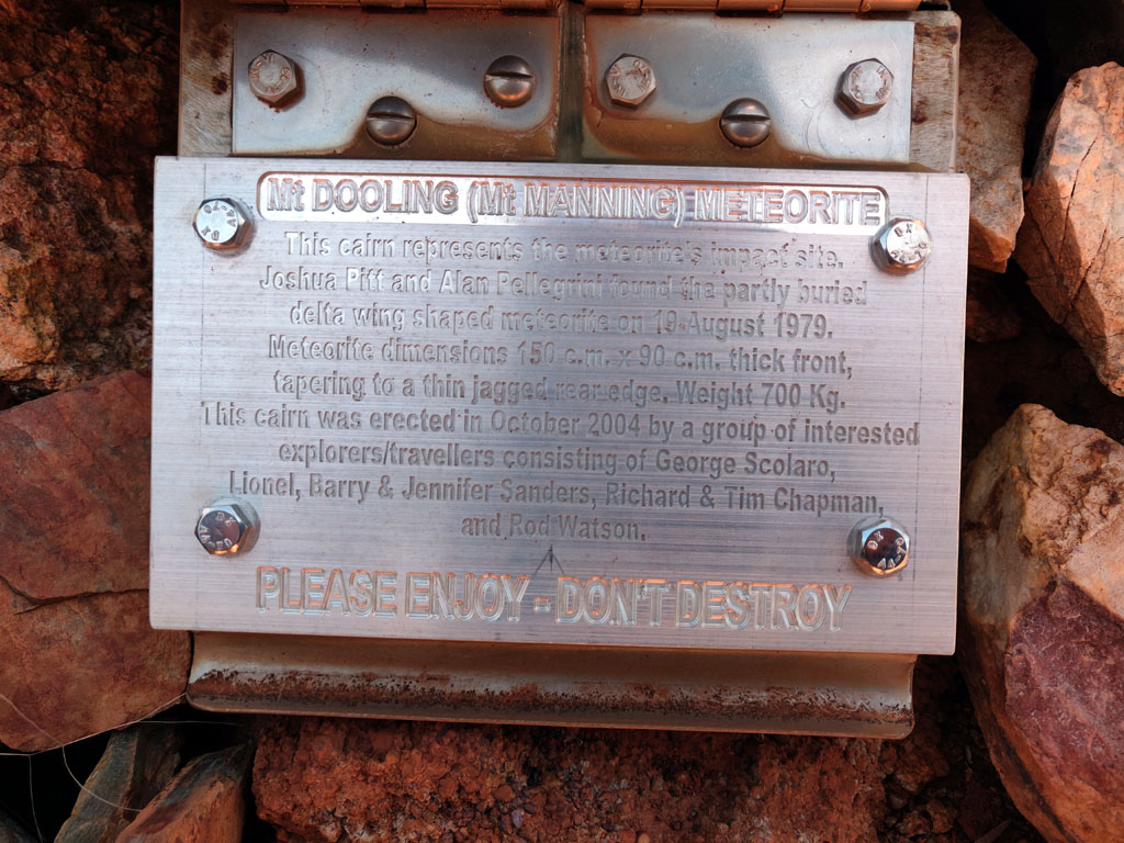
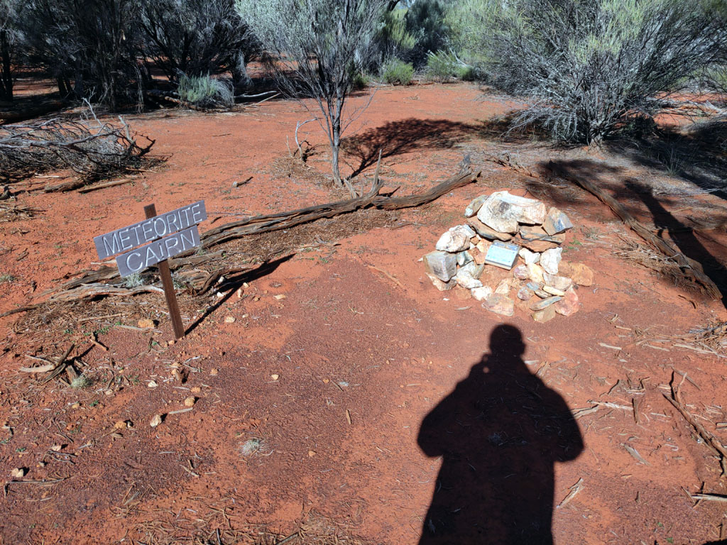
then turned east onto the track that heads to the Mt Manning Range. We
headed into the location of the Mt Dooling Meteorite cairn to check it
out and to give Peter a chance to add his name to the log book at the
cairn. The plaque and box (yes, there IS a log book in there if you
open the lid) is Rod's work, he's a keen fellow when it comes to such
projects :)
While at
the cairn 4 guys on trailbikes turned up and we chatted for a while.
They were doing day rides out from their camp. We bumped into them a
few times, at Johnson Rocks and again at Metzkes Find. Pretty rare to
meet up with similarly minded folk that are just out in the bush to
enjoy and explore.
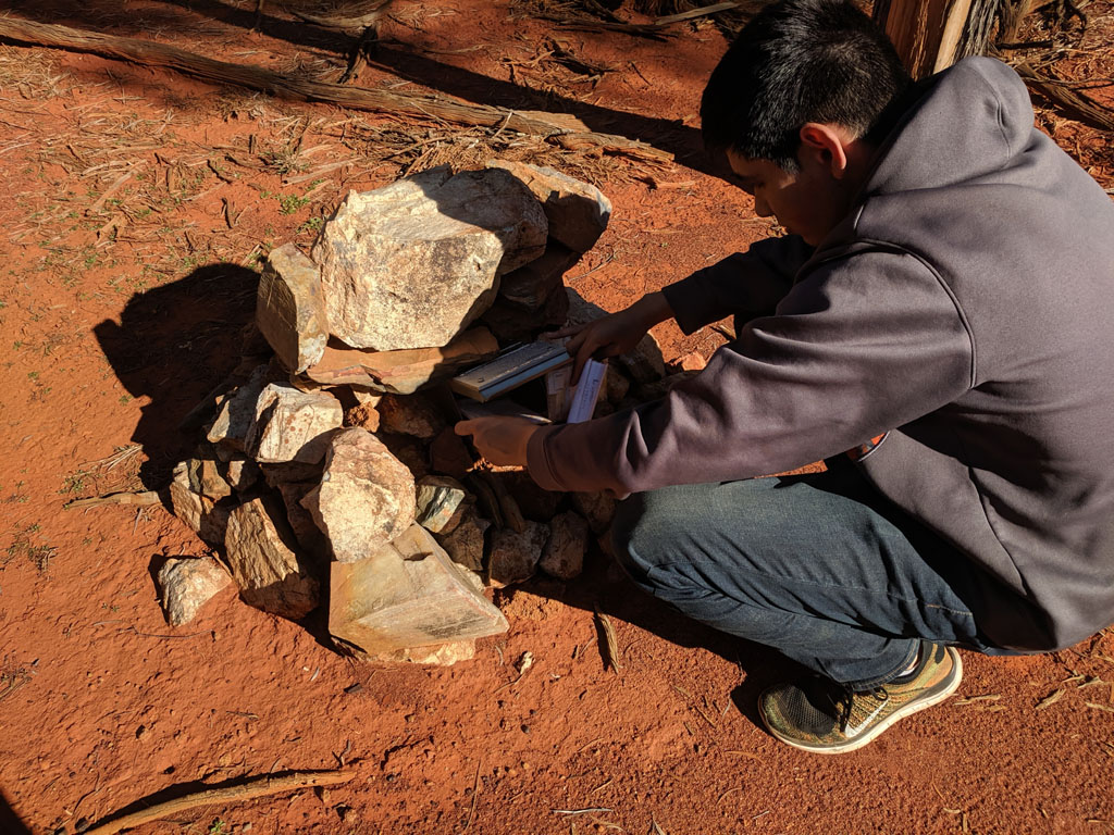
Peter
pulling out the logbook to enter our names and dates. Rod and
I started the logbook on our first visit when installing the
original box and cairn back in 2004. It's 15 years later and Peter gets
to add his name officially, now having visited in person.
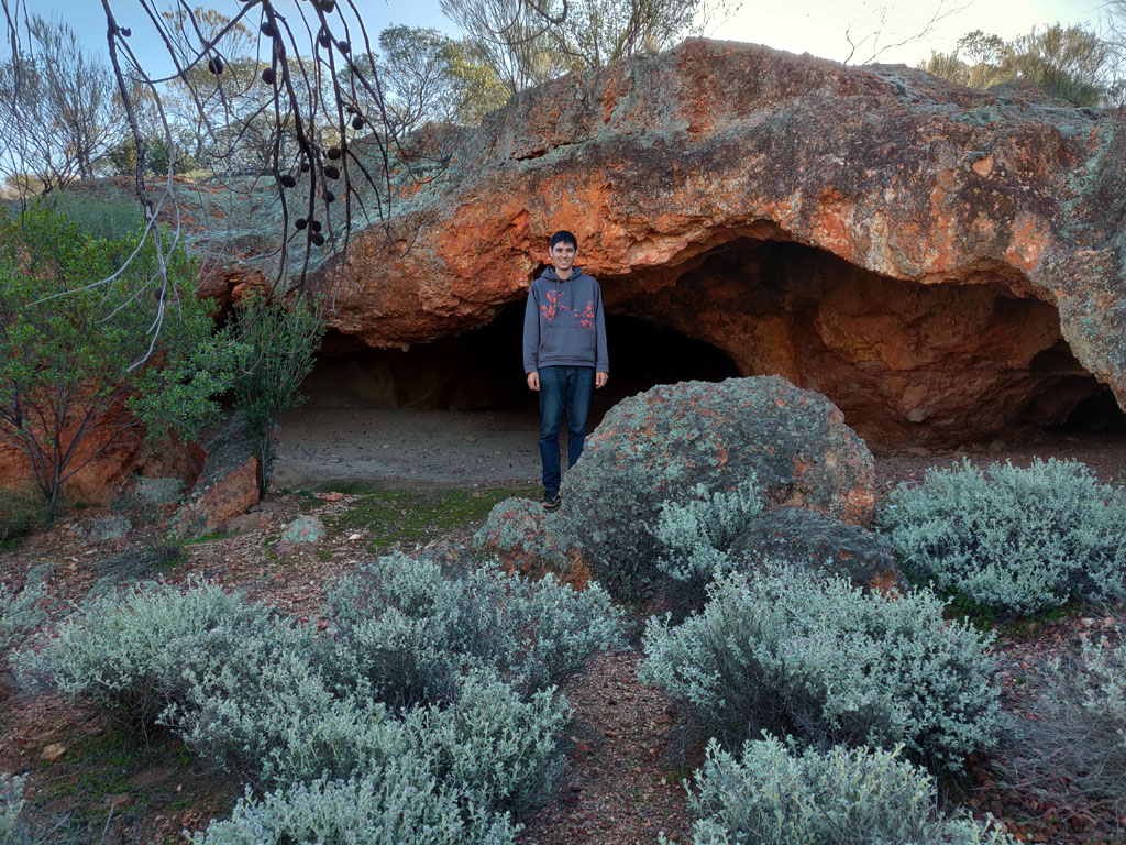
Once
done with chatting & filling out the log book we headed back
out towards Mt Manning and a little north of the junction to a camp
spot we've used several times before. It offers some interesting
exploring around a gravel outcrop and also easy access to climbing to
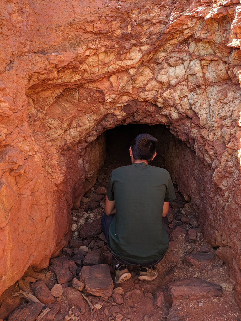
the top of the range. Peter posing in front of the cave entrance. Cool
weather being mid-winter. Minimal flies and just an awesome time to
visit the oz bush.
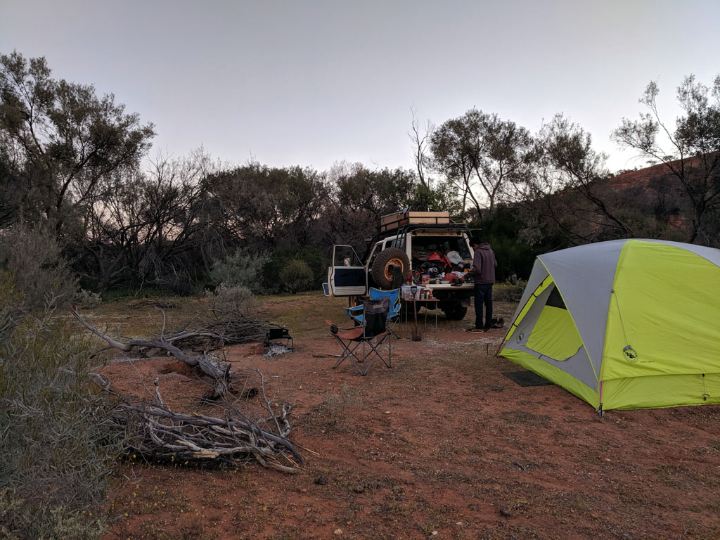
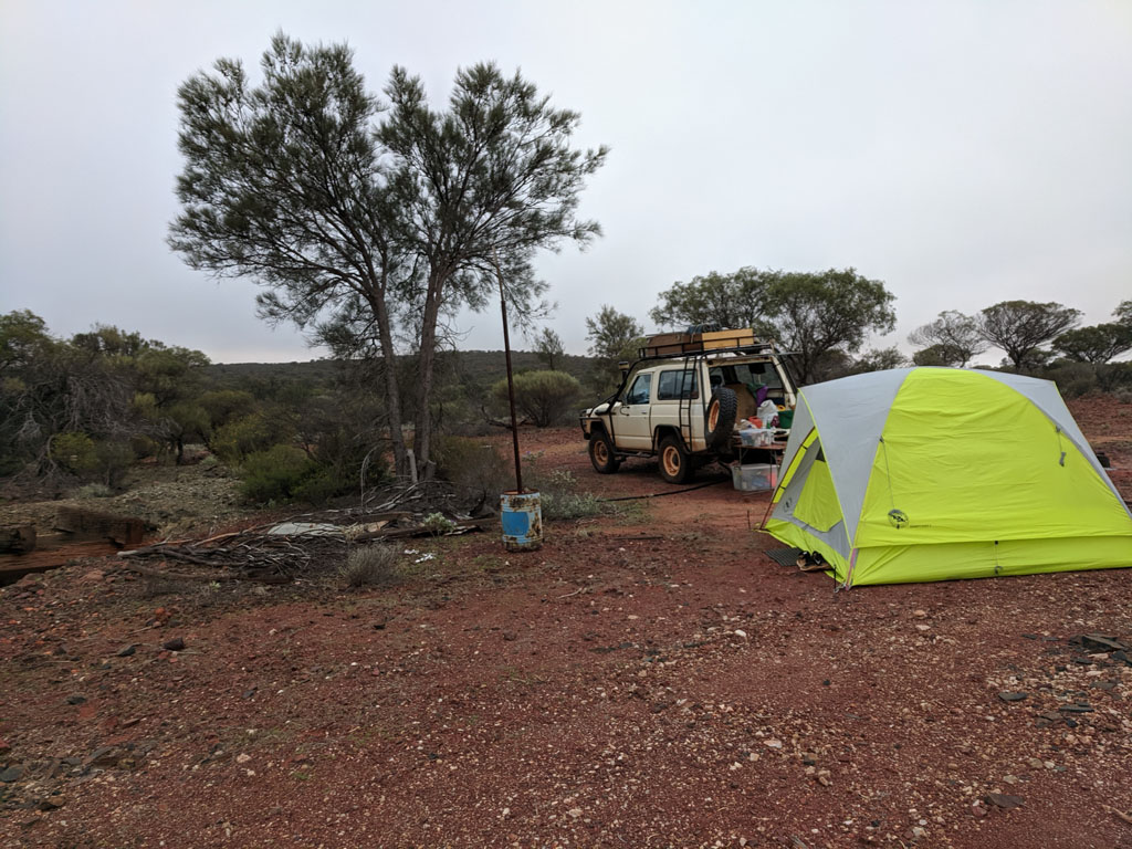
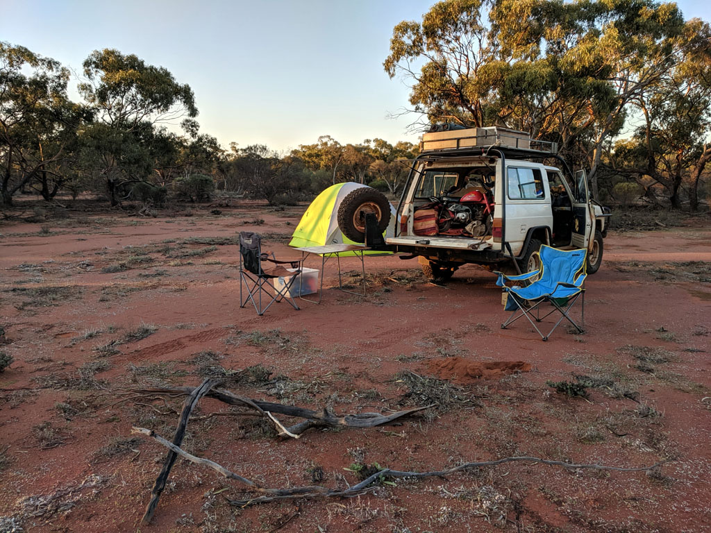
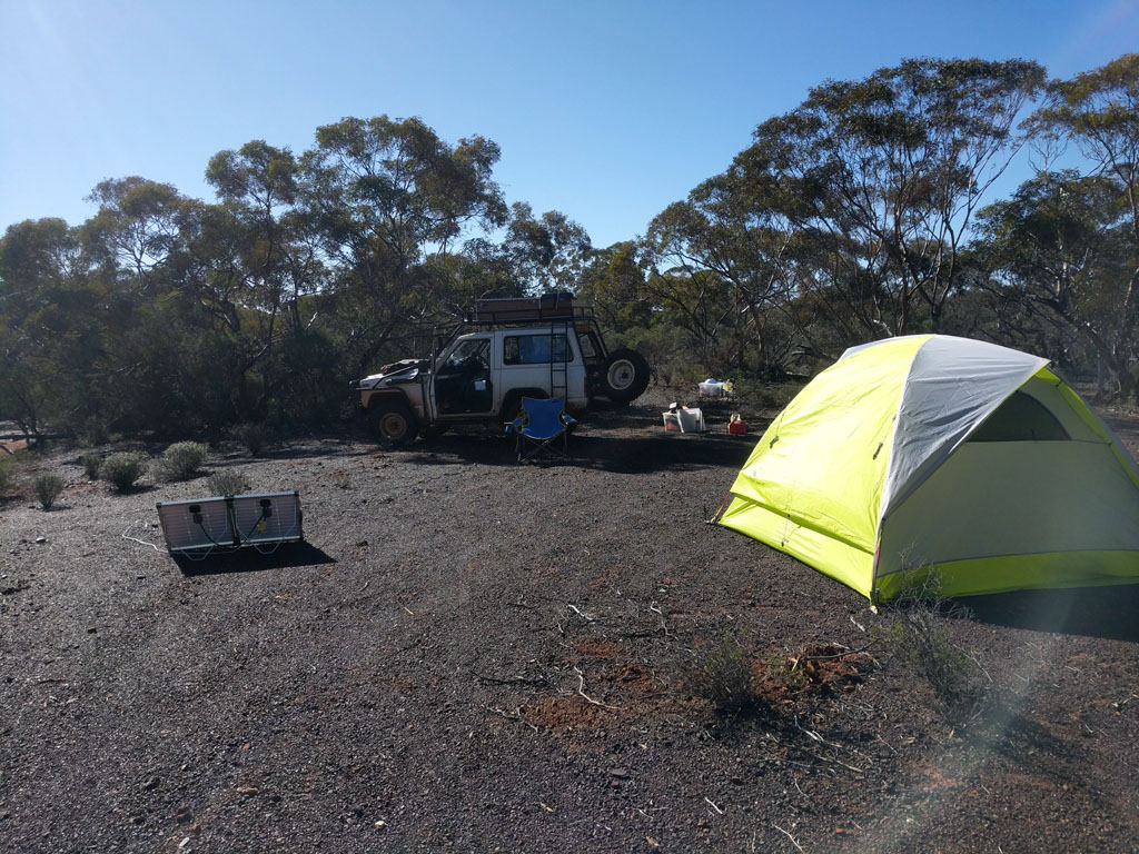
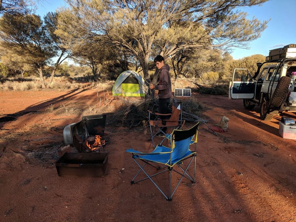
Our camp site. Tent
& sleeping pads/bags all set up for the night. Solar panel out
and topping up the aux battery that runs the fridge and all other
camping loads. With the cool weather, the ARB fridge is cycling maybe
1/8 of the time on for the later afternoon, night and early morning. I
measured about 3A draw when the fridge temperature has reached its set
point and is just cycling. So, even in winter from 5pm to 7am (14 hours
of non-solar time) the average current drawn is only 14 hours x 3A / 8
= 5.25Amp.Hours so just an hour or so of morning sunshine and the aux
battery is back to fully charged. Most of the time the mppt controller
would get into 'float' state by 10am (if we stayed put for the day). We
never got near needing to consider running the engine/alternator
for battery charging purposes. I have 2 decent length SB50-SB50 cables
that can be used singularly or in series to give quite a reach for the
solar panels. This allows putting the vehicle in a shadier location
and then placing the panels optimally to catch the sun. The panels only
need re-adjusting their aim 3 or 4 times per day as the earth's rotation
changes the aim point.
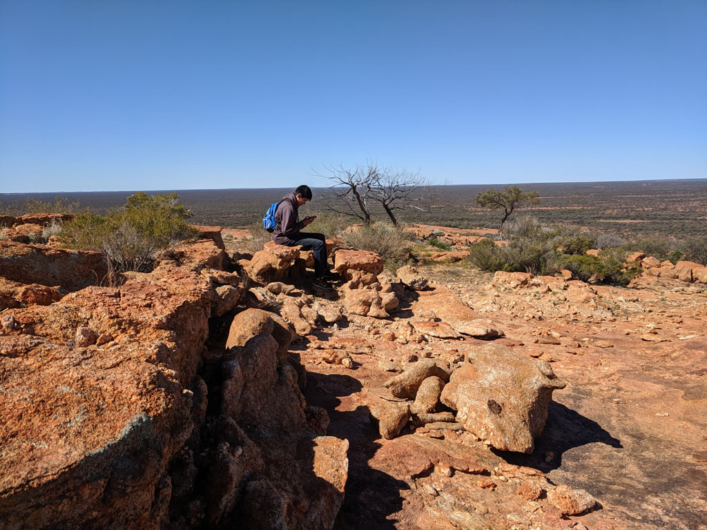
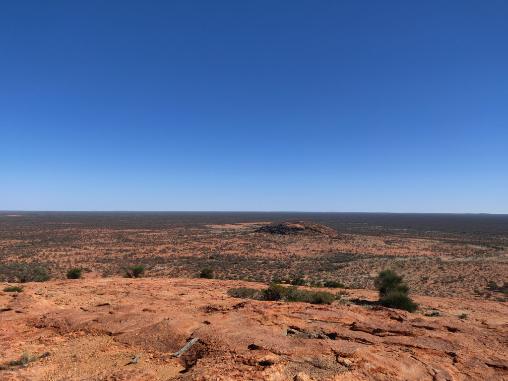
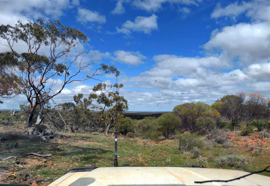
Peter decided he wanted
to do some exploring and rode up the track in the Honda Z50 and
then on the way back down decided to climb the range and take some
pictures. The picture below is his view looking east and you can see
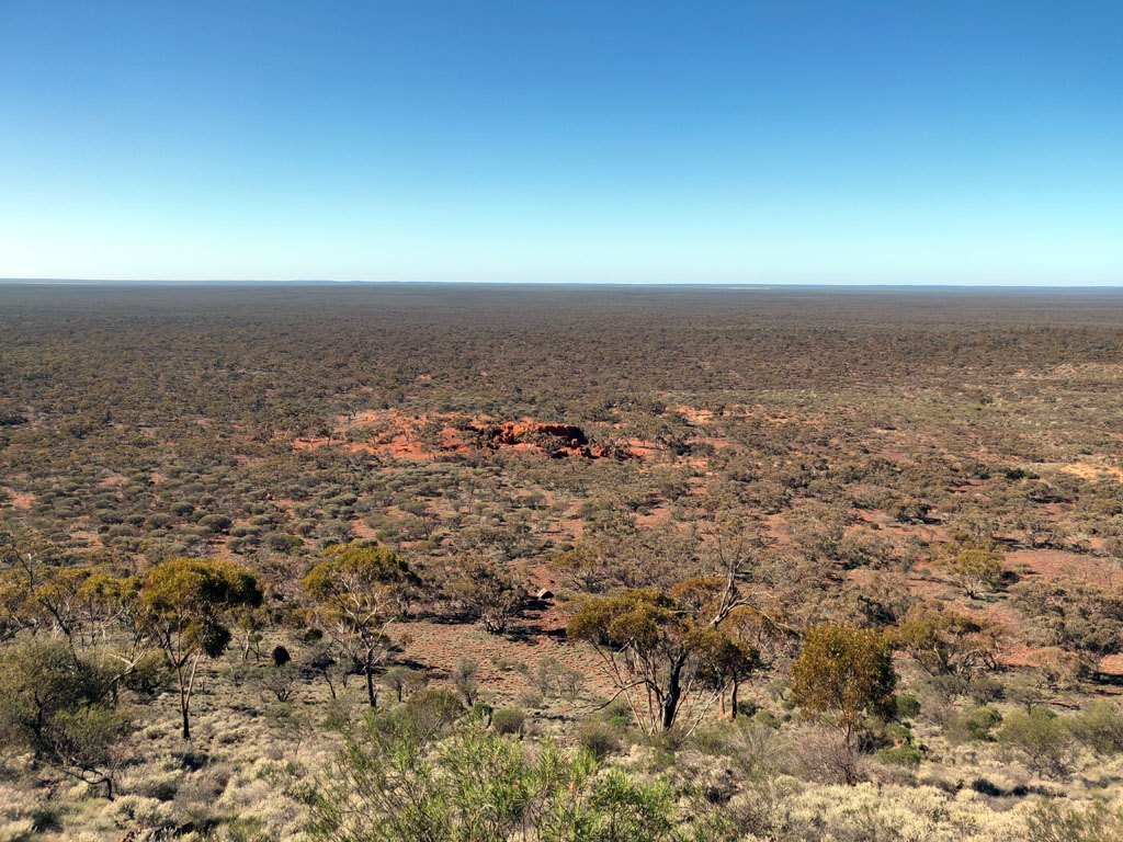
the outcrop mid-frame. Beautiful clear day and yeah, it's pretty flat terrain out there.
The following day we
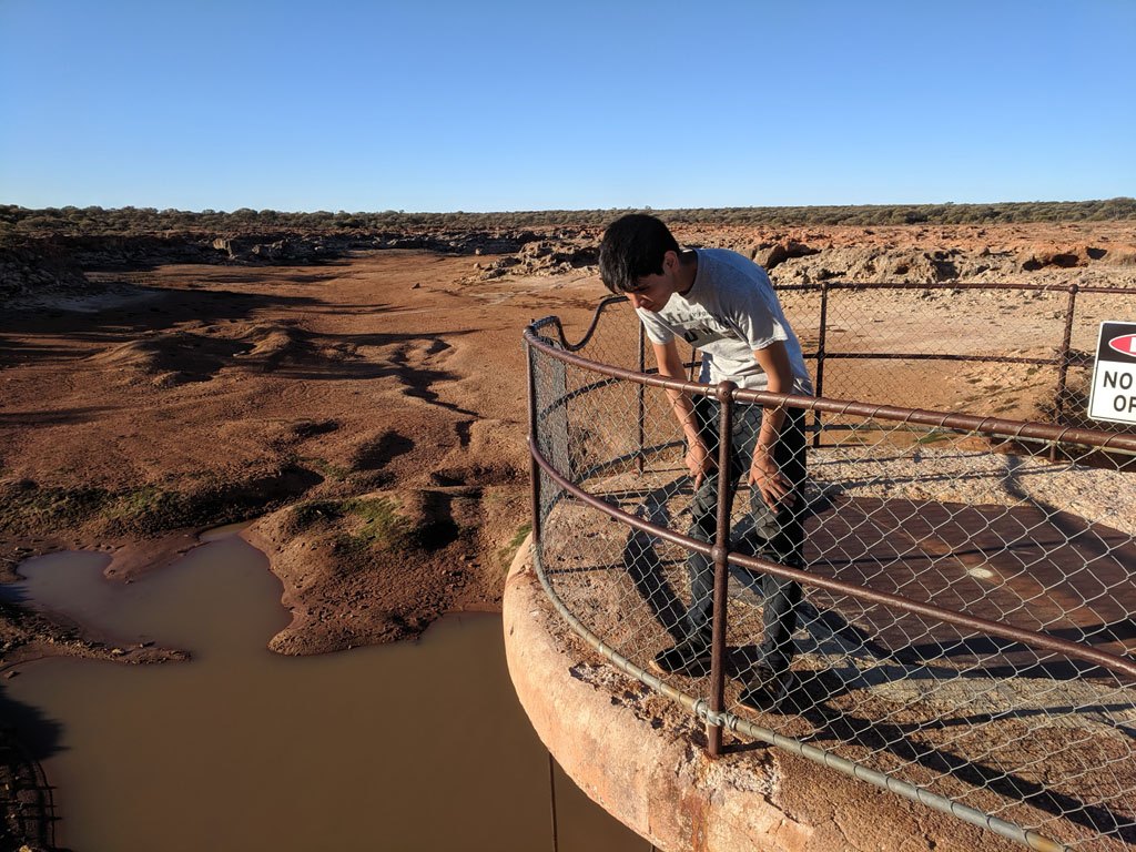
headed off to get to Johnson Rocks where I expected to find good water
and have a shower and top up our water supply (more later).
On the way we passed by Wolgling Soak (no longer marked on
the newer topo maps - care of our stupid mapping organizations). Plenty
of water in the soak and an excuse to stretch our legs a bit and wander around.
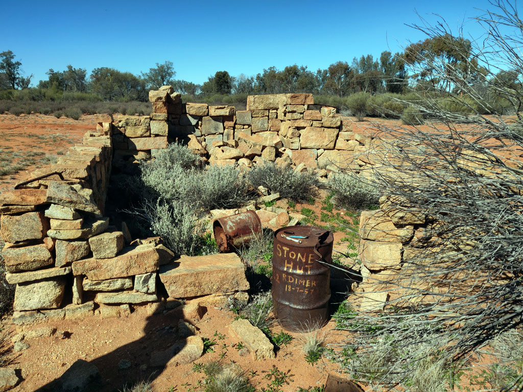
Onwards from Wolgling we popped into Reid's Hut on the
southern edge of another rock outcrop and got a few pictures. The
R.Dimer drum is still there, though it appears folk like to move it
around the hut area. 1957 would have been interesting to be out in
these areas, old gold mines and prospects would have been active and R.
Dimer would have been busy laying his dingo baits and chatting with
various folk. I'd still love to know the origin of the old hut since it
appears unchanged from when Lionel and I first came across it 25+ years
ago.
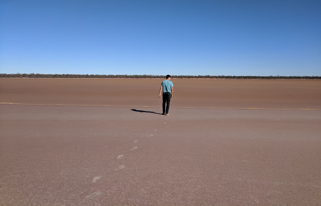
One doesn't need
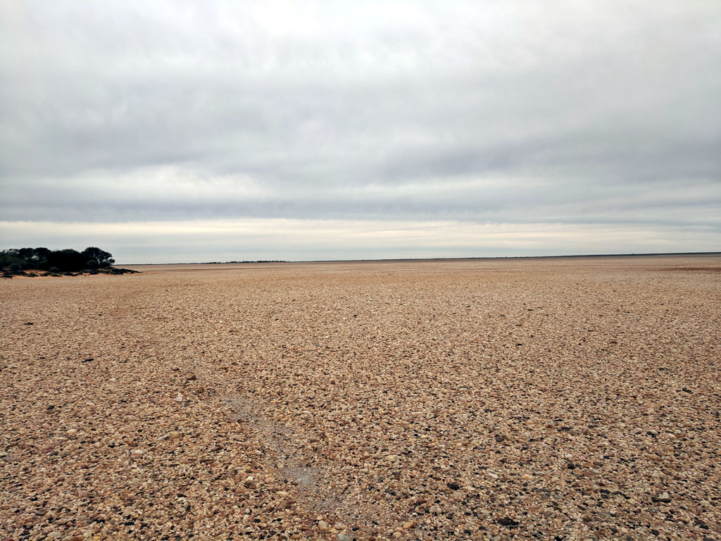
heavenly powers to walk on top of a lake, well at least in Australia :)
South of Johnson Rocks the track comes across a few clay pans/lakes and
Peter gets to wander out on one. Would be a great place to practice
flying a drone!
Then
onwards to Johnson Rocks
and disappointment awaits us. After years of finding great and clean
water waiting for us at Johnson Rocks, what we found instead was the
collapsed roof and thus polluted water from various animals using it as
a toilet. Very sad to see that damage and sincerely hope it was natural
and not some idiot deciding to heave a boulder onto the tank roof!
Could have also been a camel trying to get to the water - camels are
definitely overpopulating the bush areas. Anyhow, we had plenty of
water and decided to just camp nearby and give
the water a miss. Fortunately the next day when we reached Metzkes Find
we found an excellent supply of clean rain water.
I remember Lionel & I
finding a marking on the rocks by R.Dimer years ago. So, spent some
time wandering the rock outcrop looking for the old rock engraving and
finally found it on the southern most end of the rock outcrop
structure. It is near a small gnamma hole and shows visits in 1957
(presumably same period as the R.Dimer mark on the bin at Reids Hut)
and again in 1977. Lionel & I first came through here in the
mid 80's, so not that long after the last engraving.
I
had planned to head to Metzkes Find from a northerly track that joined
the Diemals-Evaston road just a little east of Johnson Rocks.
Within a couple of hundred metres we came across a sign by MacAuthur
Minerals (bunch of clowns that need a good kick in the nether region,
refer to my writeup of mining scoundrels http://www.george4wd.taskled.com/bullshit.html) . The sign stated the road was
closed due to active mining activity. TOTAL BULLSHIT, the wallies
haven't been in the area for years and I'm not sure what gives them the
right to close a road that was there years before the twits even
thought of sending contractors in for drilling. Anyhow, I hold these
kind of companies (shysters is probably a more accurate definition) in
contempt and am irate that a) they think they can close a road and b)
don't remove their bullshit once they've left. We continued up the
track and regretted not ripping the sign out of the ground.
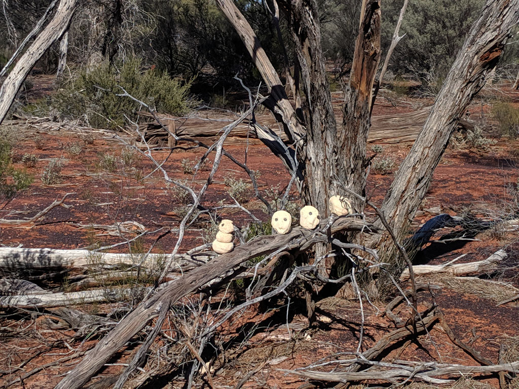
Further
on we found some side tracks (from drilling exploration) so figured to
drive down one for a bit to check out their holes. On heading back out
we spotted these heads. Look to be made from the clay like compound
drilled up in the core samples. I'm guessing one of the guys in the
crew must have been 'artistic' and/or bored and decided to fashion
these works of art out of the clay and add some eyes and leave them for
future art lovers to find :) At least a more productive conclusion to
MacArthur 'exploration'.
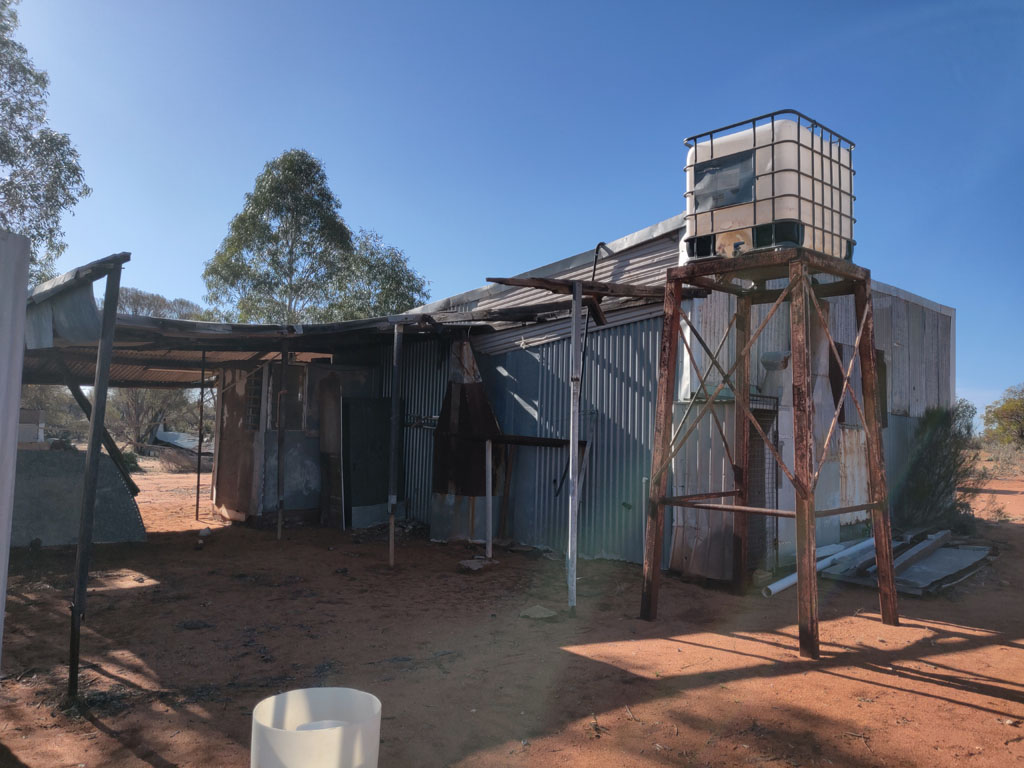
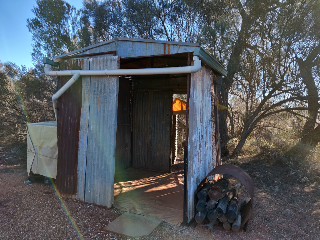
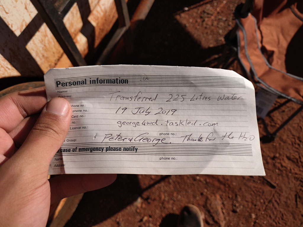
On
reaching our camp spot at Metzkes Find we discovered that someone has
performed some upgrades to the old shed and have fixed the roof and
added gutters to direct rain water into a 1000 litre plastic cube. The
cube was full and we were set for a layover day. Time for
showers and topping up our water bladder and bottles etc. There was
still an empty 200 litre blue drum and a smaller 25 litre drum in the
'storage' shed, so we moved them into the main shed and used our whale
pump to transfer water to fill those containers. Now at least when it
rains again the cube can refill and there's an additional 225 litres in
the other two containers. We left a note of our deed.
Once
camp was made, time to get dinner going. We reused the old cooking fire
area for our meal. Later we put up some tin sheets to block the wind
from our heating fire since a bit of a breeze cranked up after sunset.
The
note we left in a glass jar (with a candle in it) hanging in the shed.
We had our shower in the shed (hung the shower bag from the rafters)
since the floor is covered with plastic canvas, so a nice non-muddy
area to stand on.
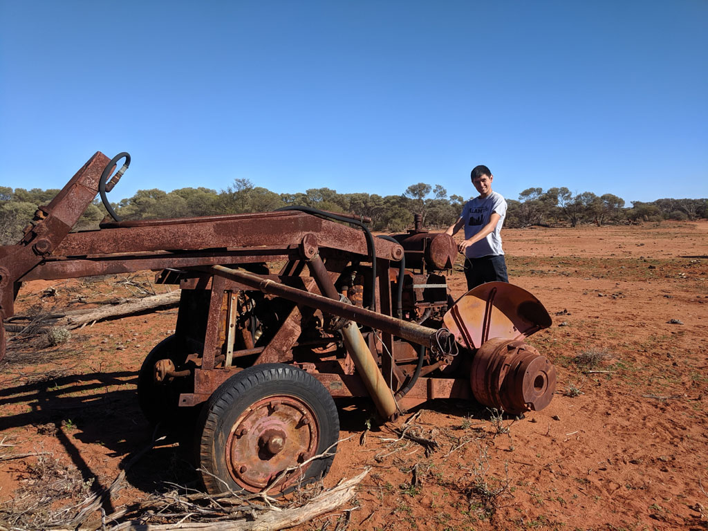
On leaving Metzkes
Find we picked up a new track/road that heading in a mostly northly
direction to Ranford Bore and then out to the main road via Perrinvale
Outcamp. There appears to be a new and active Sandalwood Cutting camp just
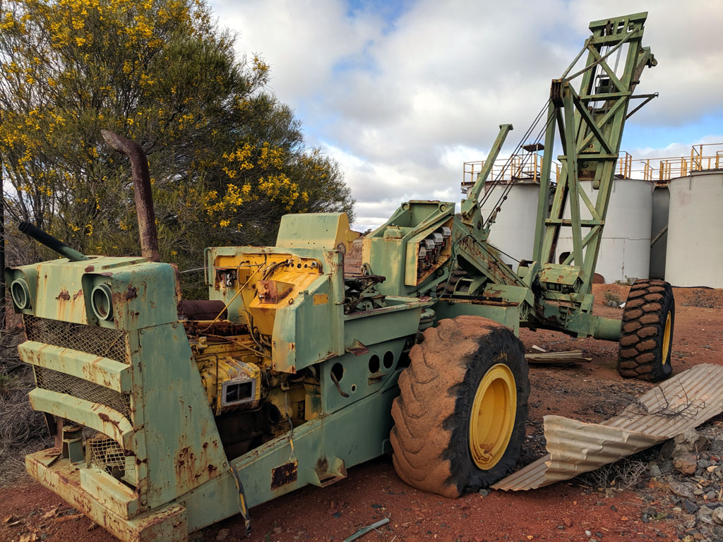
west of the Outcamp. At Ranford Bore a few old relics lay around
including this old tractor. Might need more than a couple of new
tyres/wheels though.
We took the
Perrinvale Road to the east with the plan to get to Leonora for our
first fuel up and to pick up a few fresh veges and a bit of fresh meat.
From the Perrinvale Road we got onto the Leonora - Mt Ida Road. We
visited the old Mt Ida Battery and found lots of treasures to check
out, old vehicles and ruins remain.
After
popping into Leonora we headed east towards Laverton but then took the
road south to Kookynie to visit Niagara Dam. Lionel and I first came
across Niagara dam in 1980. It is now a very 'touristy' place, some
toilets, even a RV 'dump station', upgraded roads in and around the
dam. Not quite the spectacle of discovery, but still something neat to
see, especially for Peter. The dam was pretty dry with only some
smallish puddles near the dam wall and gates.
From niagara we
headed back to Kookynie and then the road to head towards Yundamindera.
But there's an area that Lionel & I came across in 1996 that I
wanted to revisit. It's a mine (or a few mines) that are at a top of a
hill. The mines appear to not have been for gold but maybe gypsum
(there's a well named gypsum well north of us), certainly a lot of
white powdery
material seems to be prevalent there and gravel versus the more common
greenstone. At the top of the 'plateau' we actually had cell connection
(maybe to Leonora some 60km line of site distant or some closer mine?).
So a chance to send some messages out and even enough data to do a
whatsapp phone call or two back to the US. Peter standing on a small
rock to get that little more altitude for a line of sight connection :)
It was certainly a marginal spot and we could lose the signal by just
moving a few feet this way or that way.
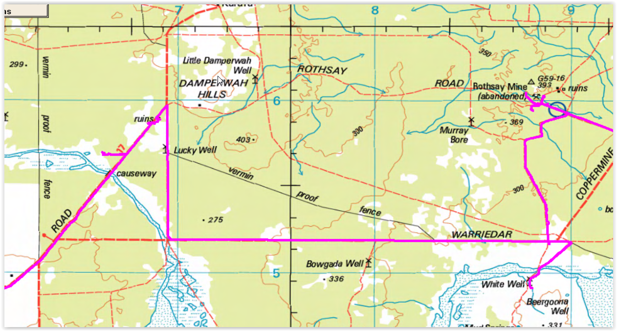
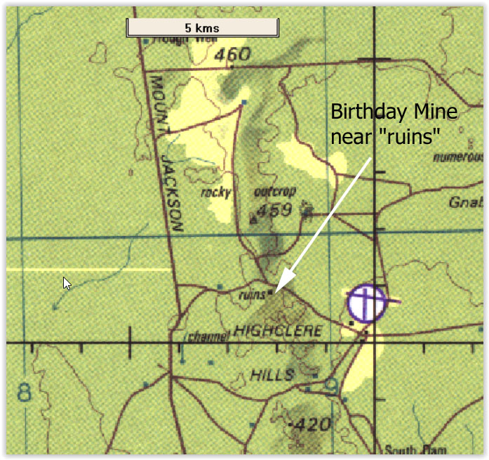
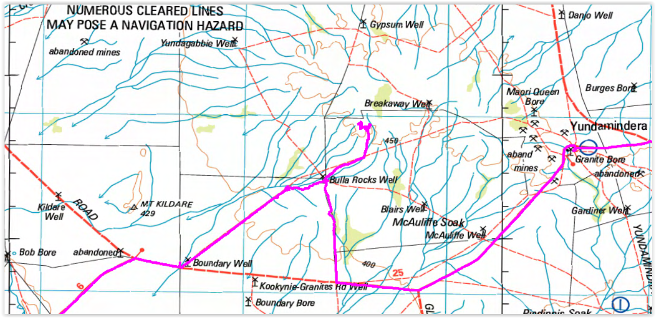
Here's
the location of the mine on the hill. It is as the end of the track in
the breakaways south of Gypsum Well. We also had a bit of an adventure
locating the track after Bulla Rocks (a few km west of Bulla Rocks
Well). The entire track from boundary well is getting old and not used.
When it reaches the water courses and a pool of water near the outcrop
the track basically fizzles out due to misuse, so a bit of cross
country driving was necessary to get to the well and good tracks again.
From there we went up to the breakaways and to the old mines and shed.
Do note that many of the tracks marked in the map below either never
existed or have total disappeared over time. I had cached most of the
areas we were going as bing aerial maps into BackCountry Navigator
(running both on our android phones and also our android navigating
tablet). The aerial maps allow us to zoom in and 'see' whether a track
really exists and often shows new roads/tracks (due to more recent
mining activity/exploration).
The old shed near one
of the mine shafts on top of the breakaways is still there and somewhat hanging
together. We saw our original 1996 and 2003 dates (Scolaro/Sanders) and
Peter added our new 2019 visit using some charcoal from old fires on
the ground near the shed remains. Maybe we'll add new dates in the
future...

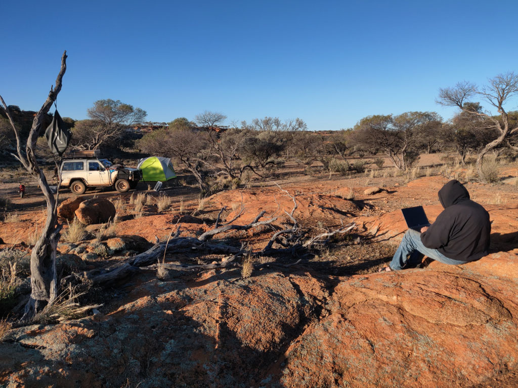
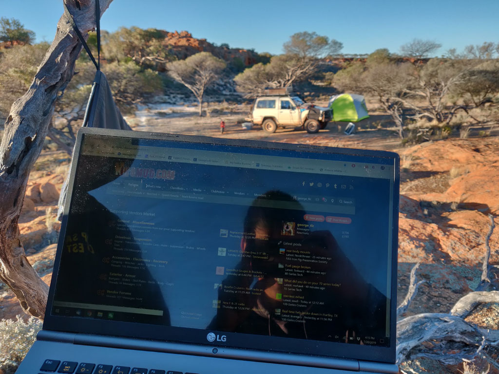
Now this is nerding
at it's best. We're camped and all comfortable and I realize we have
cell connection. So go to the top of the outcrop next to our camp and
it has a view towards Leonora (assuming that's our cell tower) and I
put my phone into a bag and hang it from a dead tree branch (you can
see it on the far left of the picture) and set it as a hotspot. Then
out comes my laptop, connect to the hotspot and I'm posting the fact on
a land cruiser forum in the US (www.ih8mud.com). Nerds unite :)
Logged into my ih8mud account and ready to post. Laptop right next to my 'hotspot in a bag'. Dearie me, must stop being a nerd!
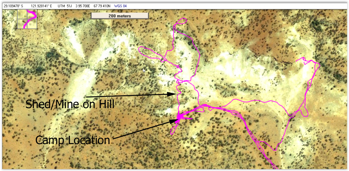
The following shows
the precise lat/long of the shed that is near the mine on the hill. I've
also marked where we camped. The tracklogs show a combination of the
vehicle log files and also my minibike and on foot excursions since my
android phone was logging (via back ground oziexplorer) my every
location for the entire trip. Obviously if I left the phone with the
vehicle or at camp then it would log that location versus mine...
Though more often than not the phone was with me since I was using it
as a personal GPS. Additionally Peter had his phone running as a GPS
and we had a tablet mounted on the dash for general navigation. Finally
we had a GPS BT standalone tracker that could be paired with the laptop
(also running oziexplorer) if needed. I think we had sufficient backups.
Leaving
the mine on the hill area we headed south back to the Yundamindera road
and drove into the old woolshed location. Nothing much left of it
except the foundations, old concrete pad and old water tank relics.
Back in 1981 when Lionel and I first drove through here the woolshed was
in great condition and the roads/tracks were more 'station' quality.
Now with more recent and current big mining activity (the big hole in
the ground variety) many of the old roads are highway wide and many new
roads and haulroads cut through the area.
We continued on
through Linden and then picked up the old track that leads us to Moon
Rock from where we could head down to Elora and Lake Minigwal.
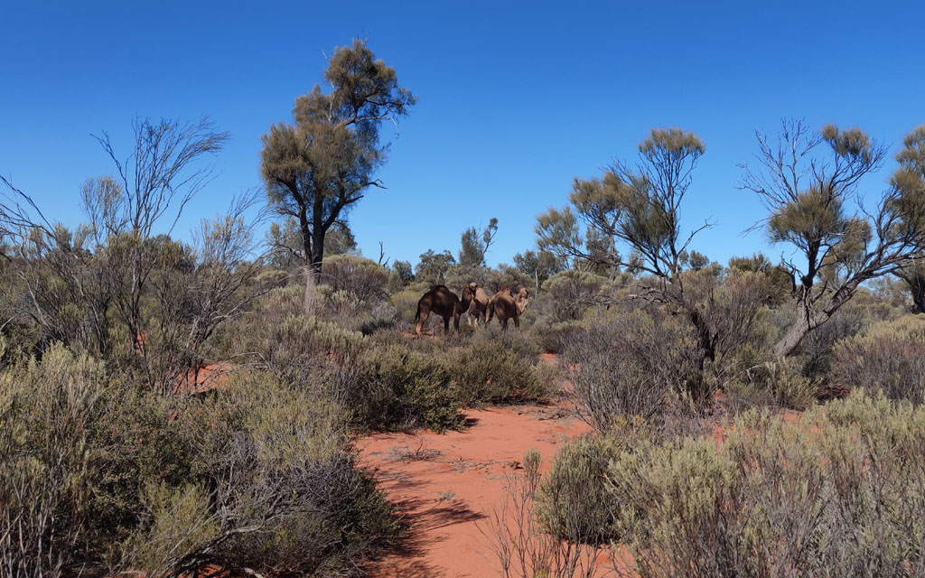
Driving
on the track towards Moon Rock we saw our first camels for this trip.
We'd seen the foot pad prints, but now we got to see the actual camels.
Peter got out and walked towards them and then started jumping up and
down like a kangaroo and the camels stared without a clue of what the
heck they were looking at. Very amusing to see them staring and
mesmerized by this bizarre creature.
Old tank
at Moon Rock, we found the well near to the tank, but no sign of an old
mill. We saw quite a few active rabbit warrens around the outcrop. The
track south of moon rock is getting more and more overgrown since it
appears the main traffic now heads down via a parallel track a few km
to the east. We took the old track.
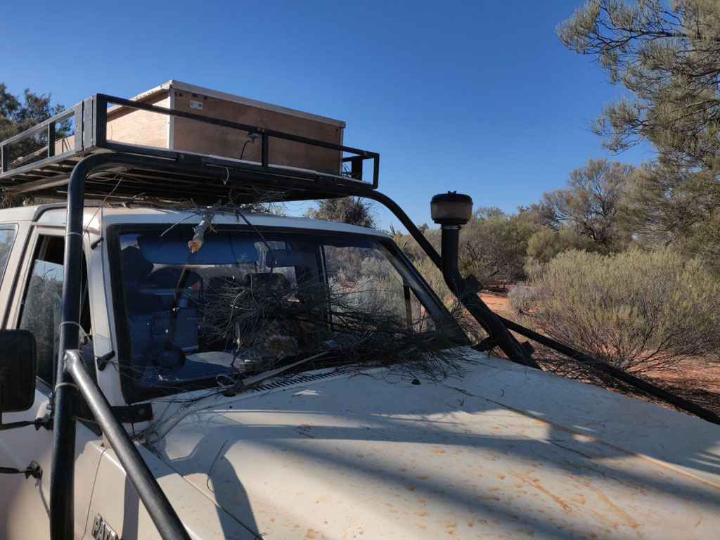
The
old track means a lot of scrub/branches scrapping onto the nissan front
area. The barwork as always helping to deflect the foliage and protect
the fenders and A pillars. Here's some collected kindling when we
stopped to clear the bigger stick from the roof and to remove some of
the buildup that was hindering visibility out of the windshield.
We
continued on after Moon Rock, past an outcrop and then to Elora. The
old homestead continues to decompose slowly. We camped just a few
hundred metres to the east of Elora and the track at a rock outcrop
since it was a nice clear area to set up the tent and make our fires.
The
floor is essentially all that remains of the old homestead. I also
noticed that on the new oz maps that Elora is no longer named and
instead just marked as Ruins. Why does oz mapping like to remove names
and features from maps? It's really quite stupid of them.
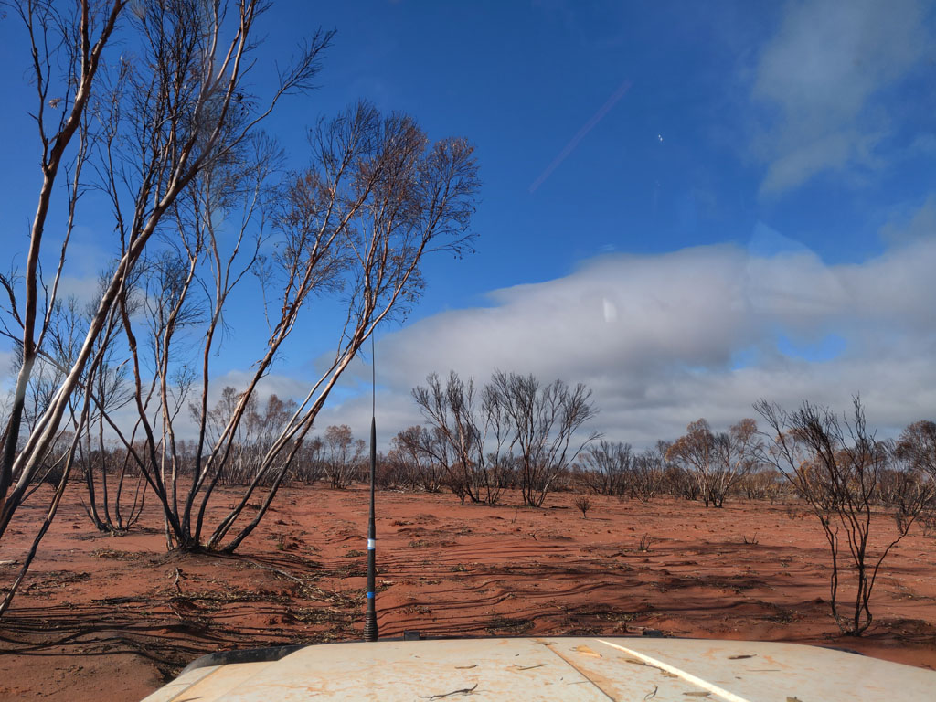
Quite
a few km of bush way past Elora have had a relatively recent fire go
through (within the past 5 years) and there's quite a bit of fallen and
burnt brush to navigate around. Of course one has to be careful since
the ground is now littered with burnt stump remains just waiting to
impale a tyre or two, so careful negotiating of the path is necessary.
Picture below shows the track going through the burnt area, but this
section is remarkably clear, unfortunately some areas are quite bad
with fallen/burnt wood. It is quite remarkable how far you can see
through the burnt areas with all the low scrub gone, you realize just
how flat and non-descript these areas are without the flora.
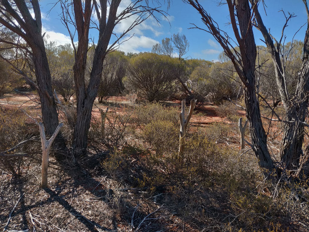
The
area around Elora was definitely harvested by Sandalwood cutters many
decades ago. From previous information, Elora itself was very active in
Sandalwood cutting. You can find the old camps pretty easily along many
of the tracks in the bush, just look for an unnatural clearing and then
check the area and you'll often find these Y shaped timbers in the
ground. Here you can see four of them and you can imagine a team of at
least 4 cutters all busy removing bark from harvested Sandalwood 'tree'
(really more a big shrub). The cutters of old would lay the branch in
the Y and then use an adze or similar tool to remove the bark. Often
you can find piles of old bark in the camps where they have been moved
from the work area.
Modern Sandalwood harvesting has now
progressed to mechanization and tracked machines crash through the
scrub and on finding a tree the operator uses the machine to rip it out
of the ground roots and all. Nothing "tread lightly" about the process
and their contracts cover 1000's of square kilometres and all this
sponsored and approved by the FPC (government forestry commission) who
'own' the land. The token 'regrowth' is to throw a handful of seeds
into the ripped out tree hole and dream that the seeds will take root
into a donor root - Sandalwood is a parasite. Of course since the
machine ripped out the Sandalwood roots and all (including the roots of
the donor) I'm not sure what roots are left there. Anyhow, it's not
like the FPC really cares about regrowth which will easily take 20+
years.
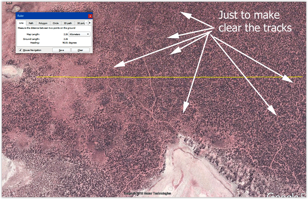
Here's
a google earth aerial capture of just one small area, east of Lake
Barlee, showing the "tread lightly" results of the FPC harvesting
contractors. You can see these 'patterns' of destruction over 1000's of
square kilometres throughout the goldfields. Basically as you zoom into a
Sandalwood harvested area you will see what looks like 'capillaries' -
these are the tracks of destruction from the harvesting equipment. They
are everywhere in these areas. Once you know what to look for you can
spot the "tread UNlightly" tracks easily and realize the enormous
areas that have been harvested already - wholesale mechanized process.
Some of these harvesting contracts are several years in duration as a
contract team will work through an entire area systematically, an area
that can be several thousand square kilometres.
As 4wders we get
blamed for not treading lightly but compared to the government, we are
total angels! Of course these are bush areas and the average aussie
tourist would never visit here unlike the coastal strip of oz, so it's
all invisible to the general public. Then for good measure you can
throw in all the large mining pits that are abandoned with their
tailing dumps and toxic water, also with our government's stamp of
approval. Oz continues to be a primary industry based nation - not a
sustainable path to the future.
We
wound our way through the burnt out area and then back to decent track
(widened and cleared at this point since some drill exploration
equipment had been through). So, easy driving and we continued east
along the southern edge of Lake Minigwal. Our intention to make it to
Thelma's tank to refill our water bladder and other water storage and
more importantly enjoy another shower.
Parked at the tank and
solar panel deployed and catching some amps from the sun. You can see
quite a bit of cable piled near the solar panel. This gives me plenty
of reach to find sunlight even if the 4wd is parked in the shade.'
The
tank is full to the brim and we have plenty of water for all our needs.
So much that we even did some washing since we had a lay over day here.
Even though there were a bunch of clouds out this day, the next was
sunny. Temperatures were typically in the 18 - 23C range during the day,
perfect weather to be out bush.
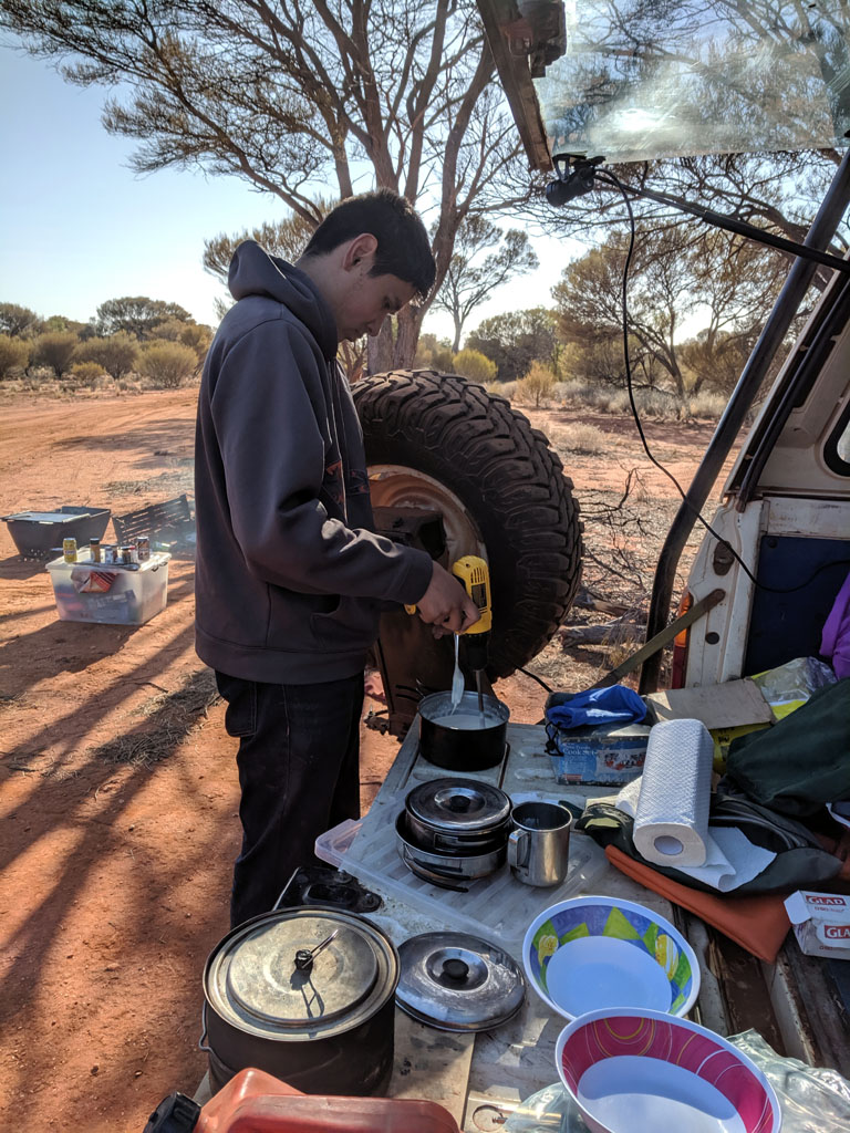
Since
we weren't moving this day we decided to make pancakes. With the fridge
we have fresh eggs and of course have flour and baking powder, so all
the basic ingredients on hand. Now on to the mixing. Well, since I have
a 12V cordless drill (that I run with a cord from the vehicle aux
battery) I fished around and found an appropriate sized allen key to
use as a beater. Here Peter is blending the mix, much easier than doing
it with a fork.
Camp
in the late afternoon and we've collected some of the junk from the shed area
behind the tank to build a wind break for our heating fire. The wind
break also helps to retain and direct the heat to where we were going
to sit during the evening. Even the kitchen sink is there :) We used a
small metal fire pit and put our steel bbq plate on it for doing our
cooking. We always make a large fire for lighting and heat and a
smaller secondary fire to do our cooking on.
Peter
is using a rope/strap to tie pieces of wood up and tow them to our camp
area using the Z50. Easier to find good fire wood a little from camp
since much of the close supply has already been used up over the years.
There was a dead tree in front of where the 4wd is parked and that we
'toppled' over with prudent use of the winch since we didn't bring a
chainsaw with us. You can see the felled tree/wood in the picture above
in front of the 4wd and just to the left of the open passenger side
door.
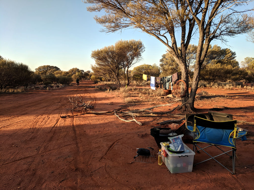
You
can see our washing hung up to dry, so civilised. It's nearly all dry
since we're in the late afternoon and we did our washing in the
morning. Quite an impressive amount of red was washed out of the
clothes and several 'rinse' cycles were necessary in our washing bucket.
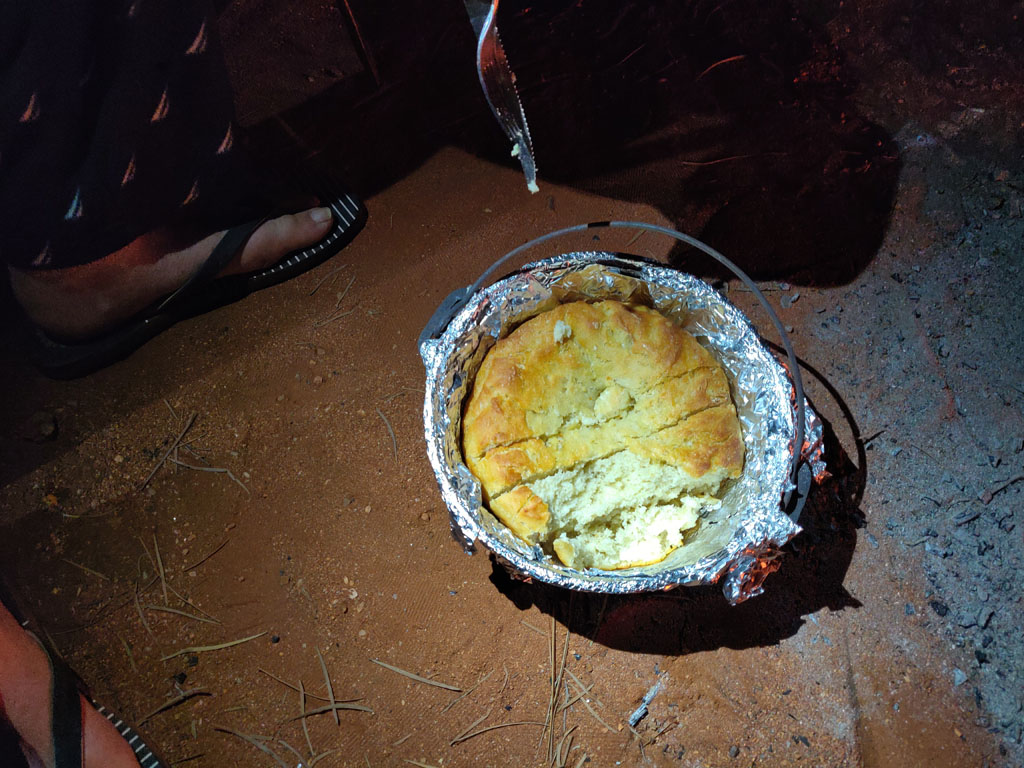
Since
we had a lay over day we figured it would be a good opportunity to make
some fresh bread. We had brought yeast sachets along with the plan for
bread and so late afternoon we started the process of mixing
ingredients and kneading the dough. I make the dough in a large ziplock
and that keeps the sticky mess/dough nicely sealed away. A couple of
risings and into the camp oven with lots of coals. Took quite a while,
but the final result was decent. The smell of freshly baked bread
is sure in get the hunger pangs going. Strawberry jam for me and
Raspberry jam for Peter and we had a good feed. I used the onboard 12V
air compressor with an air hose and blow gun to clean all the coals and
ash from the top of the camp oven and on removing the lid, used it
again to blow any remaining ash off the aluminium top. I like to use
aluminium to line the camp oven since it makes clean up super quick and
also helps to keep ash off the bread or cake being baked.
After
departing Thelma's Tank we headed east to go around the eastern edge of
the Lake Minigwal (saw quite a few camels) and then followed the
northern shore (westerly). We found a good track (mining no doubt) that our aerial
photography confirmed would take us up to the Stella Range and
Lightfoot Lake. I've never popped in to see that area as we've always
followed the track along the northern edge of Lake Minigwal and visited
the Surprise Granites instead and then headed north. Anyhow, seemed
like a good opportunity to visit a different area and explore. On
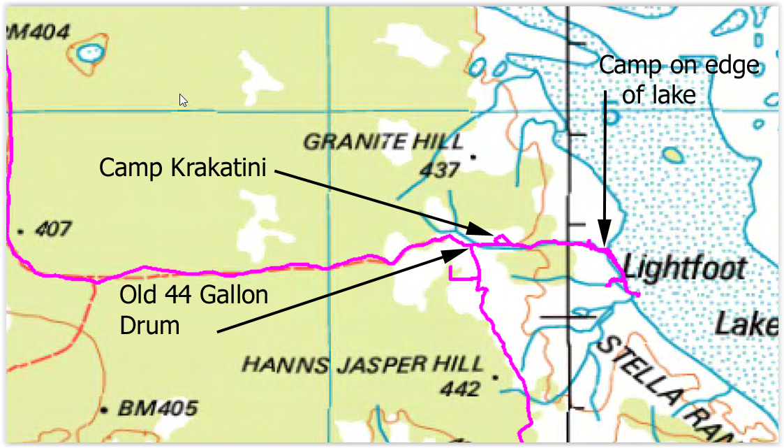
hitting what was sharp corner we noticed a rusted out old 44
gallon drum and spotted a fairly rundown track that headed east, so we
went that way hoping it would take us to the edge of Lightfoot Lake,
which it did and we camped the night. Nice place to camp being flat and
cleared of rocks/spinifex. The track took us to a rock outcrop on the
edge of the lake and dissipated so we just continued on and found some
tyre marks and to edge we arrived.
Nice
area to camp with clean dirt and wide clear area. This is actually a
water course (one of many) that feed into the lake that can be seen on
the right side of the picture. Peter did some exploring of the lake
edge with the Z50 and even I went for some rides. The middle gets
muddy as do some of the areas where water courses feed into the lake,
but most of the edge is easy to drive on. Quite a cloudy afternoon and
we had similar next morning before the sky cleared. Not a drop of rain
hit us. We're just got the first fire going and soon will get the bbq plate
out and start dinner. I doubt too many folk drive down this track to
the lake edge, maybe a couple or so per year.
I
rode the Z50 south from where we were camped and found the surface of
the lake covered in small rocks, quite different to the claypan type
surface near our campsite. Made it easier to ride since it provided a
bit more traction. I have no idea why this area was littered with rocks
compared to the area north, the feeder water courses all looked similar
and more dirt than rock.
Now, I must mention that
along the track we noticed a little post and a tiny red reflector.
Being boggled by the post/reflector we continued on easterly not
spotting an old track going north off our track.
Next day on
leaving the lake edge and heading back west on the track I got onto a
northerly track by mistake but figured we may as well see where it goes
and it led to a small rock outcrop that had a bit of height to it. So,
out of the 4wd and we climb to the top of the outcrop and look around.
We're doing a 360 panorama and see something shining a little in the
bush behind where the 4wd is stopped. Hmm - looks like a roof, hmm a
rainwater tank perhaps??
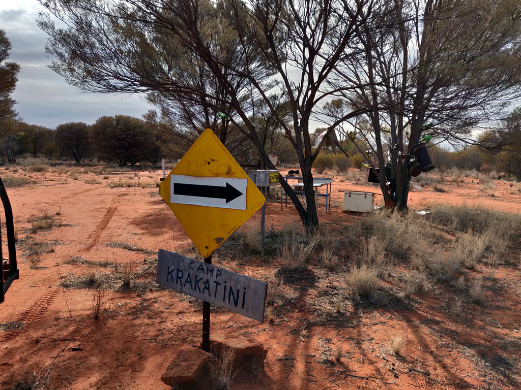
And so we hop in the 4wd, drive further
on the track that loops southerly and we drive into Camp Krakatini.
Amazing, nice rain water tank (says the tank was erected in 2007)
Z
 The
The
Camp
Krakatini in its full glory below. Compulsory junk collection, but also
a nice sink, cutting table and cooking stuff (in the cooler). There's a
great box with visitor log book that we happily added our names and
date of visit. Appears most folk are out there thinning the camel/dingo
population. We can certainly do with eradication of the camels - they
are destroying the water holes out there (and even closer to Perth) and
compete with the native fauna for the small amount of surface water
that is available.
The
tanks. Well designed and erected with wires to help the structure
survive winds and storms. Both the main tank and the 200 litre drum
were full. I like how the main tank fills and overflows into the 200
litre tank that then overflows out when it is also filled to the brim.
We had just filled the day before at Thelma's Tank so had no need to
fill the bladder. We did top up a 1 gallon container we use for
cooking. We did give it a taste and of course it's perfect rain
water.
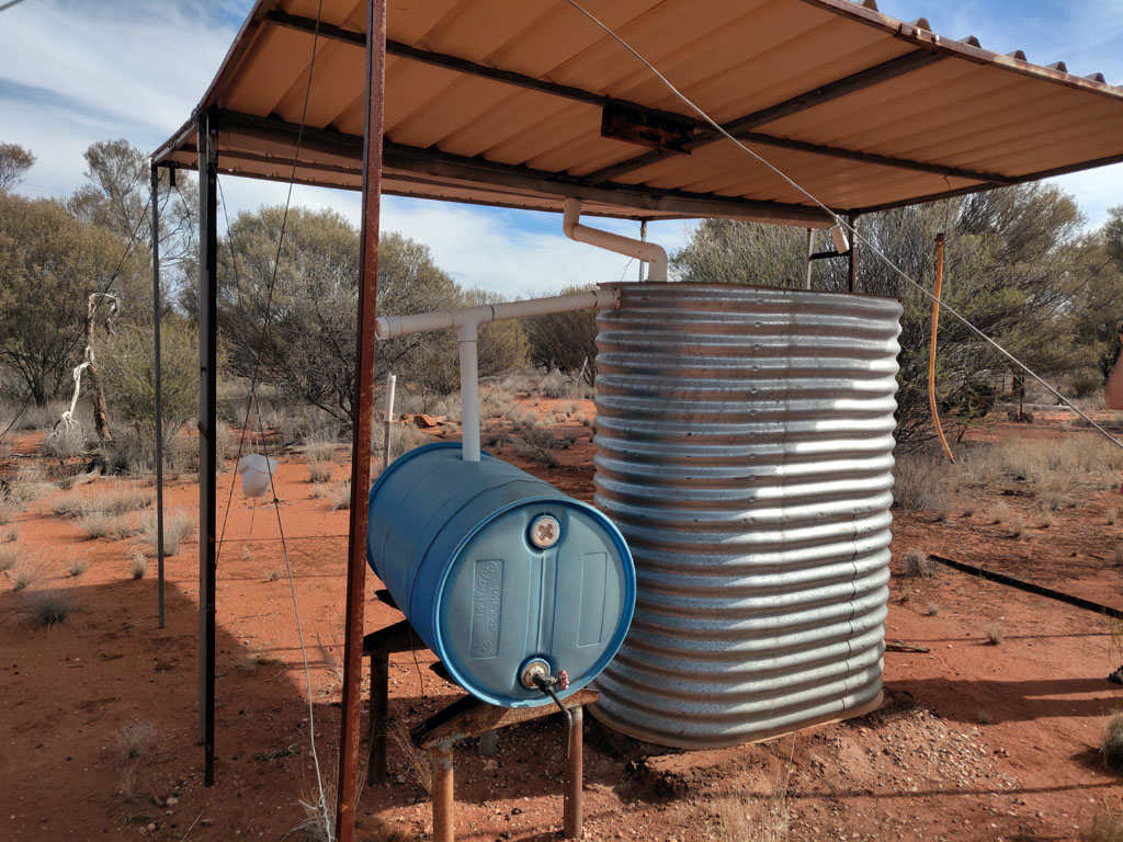
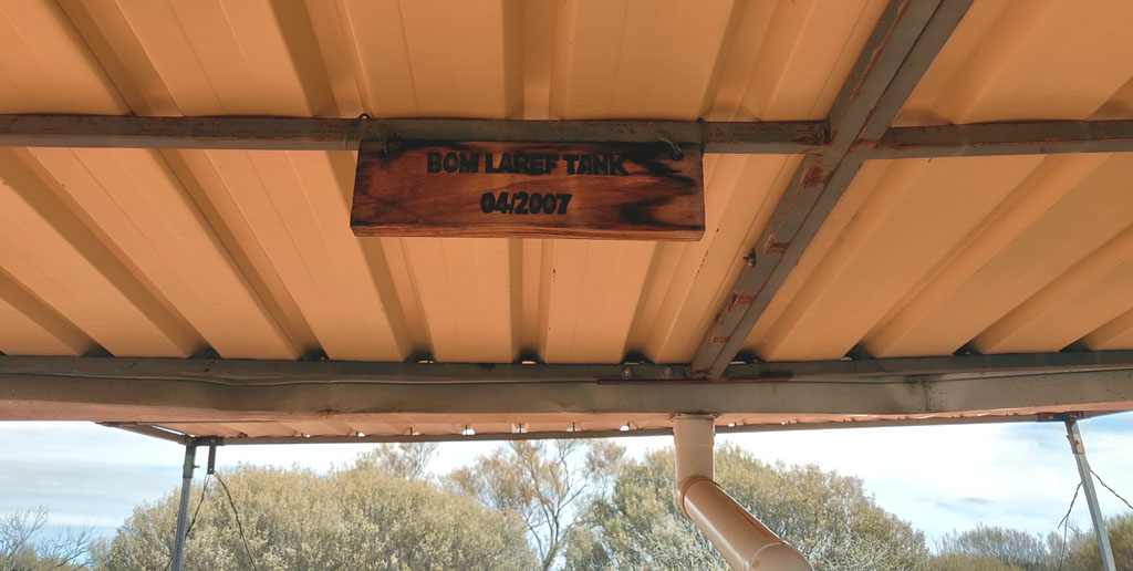
The
BOM LAREF Tank, installed April 2007. Now, if we just spend a minute
contemplating BOM LAREF and wondering what weird and foreign name this
is and then consider we are in Australia, the land of sarcastic clever
dicks, it is quite clear that this tank is actually named the FERAL MOB
tank :)
I'll give a big thumbs up to the fellas that installed
it and hope they don't mind a bit of publicity and marking its position
accurately on a map for other similarly minded folk to visit, use and
not abuse. Cheers guys!
And, yes, when we drove out we came to
the junction (that we had missed) with the post and red reflector. We
added several new bright pink marker tapes to make it obvious there is
a side track.
If
you know what oz bush should look like, then the little white square is
worth investigating, since it is clearly not 'natural'. That square is
the shining tin roof of the tank structure.
You can see the main
track heading west/east just below the tank and the small track leading
to the tank. The area to the right of the tank is the outcrop from
where we spotted the roof of the tank.
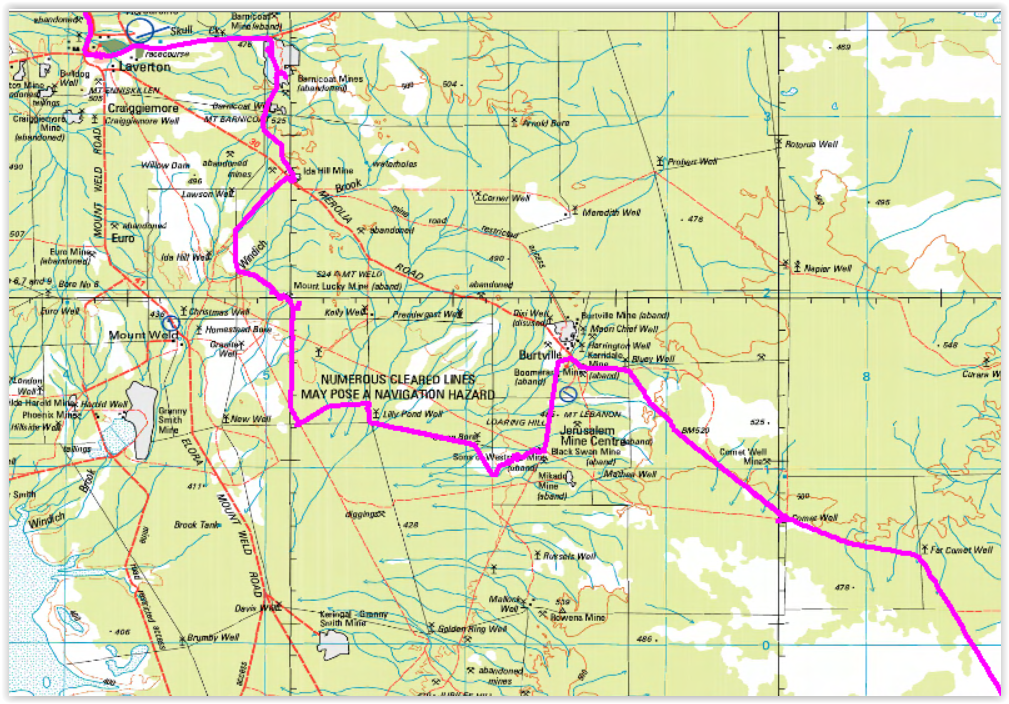
Lat/long of the tank is precisely: -29.402421, 123.237090 (WGS 84 Datum)
With
all the information I've provided including map capture, you should
have no excuse for not being able to drive right up to the tank if you
are so inclined to visit this rather remote area.
This
is the view looking North at the T junction. You can see the rusted 44
gallon drum sitting to the right, this is where the track heads east
all the way to Lightfoot Lake.
Oh, the Stella Range, well, it's quite disappointing and its name is definitely more than the range is worth.
At
this point we decided to head towards Laverton, about 150km away as the
tracks wind. We didn't take the most direct path, since after all we
were exploring new areas. First stop was a mining pit that I've seen
before (in 2014). This would give Peter a chance to drive to the bottom
of one. On the way to the mine, we saw a track heading west to some
hills, so we went to explore. We climbed a hill to see if there was any
cell reception, nada. Peter climbed an adjacent hill to see if he'd
have better luck there, but also nada. Of course we're a good 100km
line of sight from Laverton, so not too surprising we had no coverage.
We've
driven to the bottom of the pit. Last time Lionel & I visited was
in 2014. Nothing significant has changed now in 2019. I guess it may be
a few millennia before nature has a chance to erase the damage done by
mining. Certainly mining companies & the government don't give a
hoot.
We
continued north and decided to take some bypasses off the main road and
ended up in a somewhat isolated area and quite a few back roads. On
reaching the Burtville area we headed south and camped near the
Westralia Mine. Next day we continued on via back roads and some old
fence lines. Some tracks were close to non-existent, so some fun
navigating using aerial mapping information running on our navigation
tablet. An interesting area is around where you see we drive across the
Windich Brook. That area has some pretty steep creek crossings and 4wd
low range was necessary.
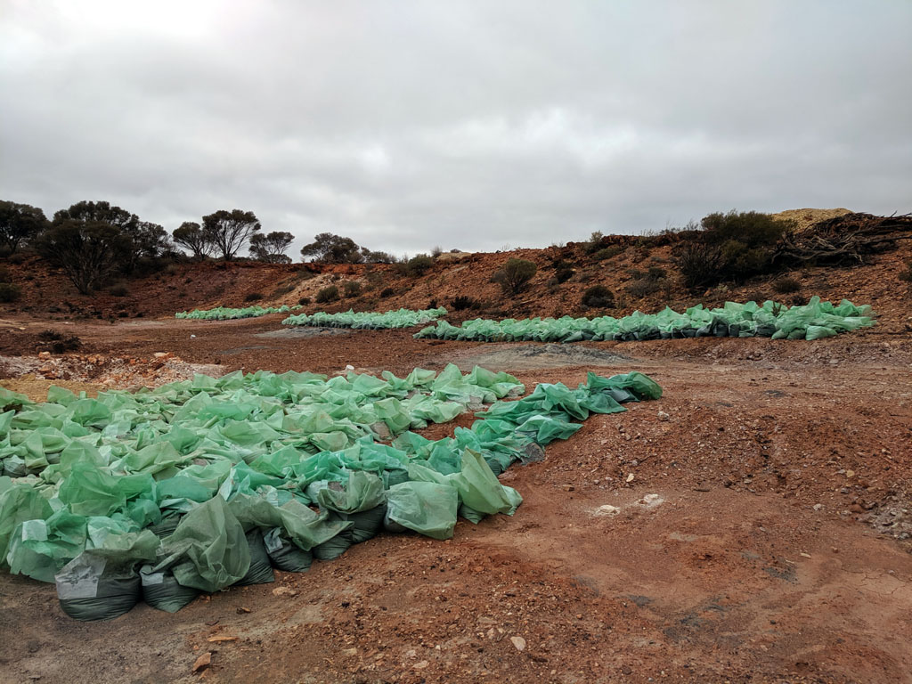
Of course we came across more mining
exploration and wow - look at all those plastic bags. I guess plastic
bags are only banned in town. What a joke! Not only do we see 100's and
100's of plastic bags, but they have just been left to decompose in
the bush. Another sign of modern madness, we have cities banning evil
plastic bags since they take a long time to decompose in the landfill
and here we have plastic bags left all over the country side. This
sight is very common in the goldfields, again, it appears nobody cares,
neither mining companies or the government that oversees their
activities. These bags were found in the Windich Brook area as we investigated various old tracks.
We
saw an interesting hill (caves in the sides of the top), so drove cross
country to get closer and then climbed up to the caves. Mostly caves
that the local Kangaroos appear to enjoy. We did get a nice view
looking across the plain that makes up the Windich Brook area. The
weather looks grim, but we never had any indication of rain and later
in the day it was sunny as usual.
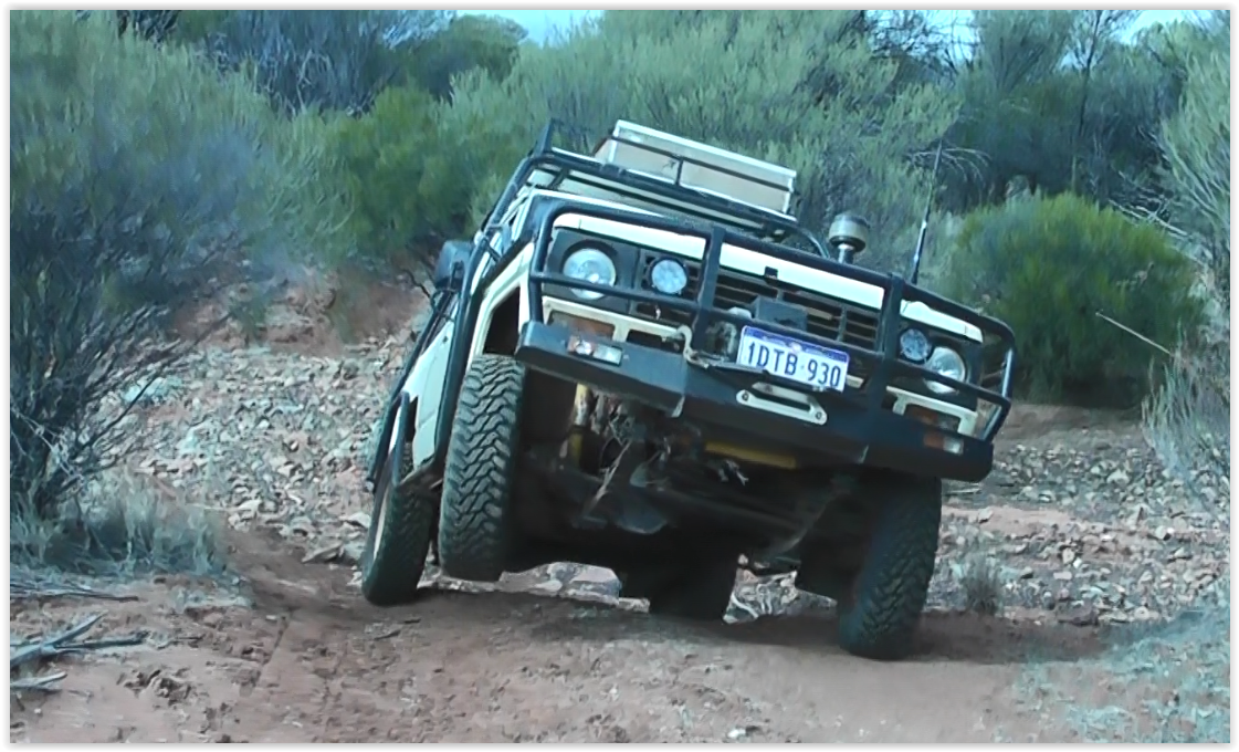
Screen
grab of video as the old nissan climbs up the bank of a steep creek
crossing. The nissan has ARB lockers front and rear, so this kind of
situation is a non-event from a traction perspective. Within the
vehicle I wasn't even aware of lifting a wheel... In the picture you
can see the drivers side park/indicator light on the roobar is somewhat
damaged, it was stabbed by a sharp tree branch several days earlier, the
only physical damage for the whole trip. A cheap set of Ebay LED units
will soon make it all well again and I'll be adding a piece of 3/16"
lexan in front of each light to make it bullet proof in the future.
After
checking out the area, we moved on and crossed the Merolia Rd (that
heads to Laverton) and went North to check out the Barnicoat Mines.
Large pit mines (of course) that have been left as they were and the
entire minesite placed on 'standby'.
Peter near the edge of one of the large 'holes'. You can also see that the clouds have dissipated quite a bit.
Another
large abandoned hole. The access down has been blocked, but it's easy
to see the size of the hole and of course the nice toxic water below. I
guess ground water contamination is not a problem or no one cares. Not
sure how the local fauna deals with the water, I guess no one cares
about them either.
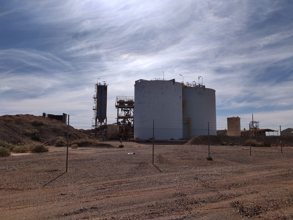
The
processing plant, equipment and housing is all fenced off and just
sitting. Presumably there is a dream to re-activate the mining activity
at some point.
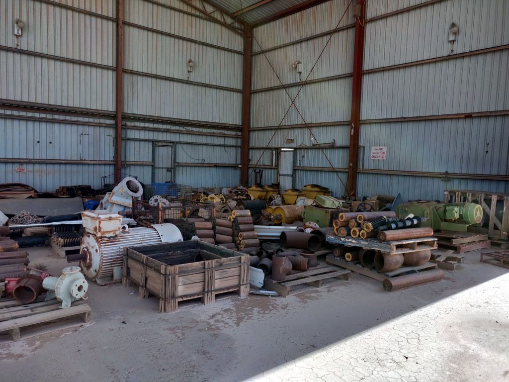
Part
of the minesite is a very large shed (some roof sheets have been ripped
off due to weather). The shed has a lot of (what was) new equipment, a
lot still tied down onto the pallets it was delivered on. I guess they
made enough money on what they extracted from the pits, that selling
off the equipment was not of concern. Not likely that the average
person would find a use for motors that are rated at 20kw+ :)
From
here it was just a few km to Laverton were we did a bit of grocery
shopping to top up some veggies and a few more meat patties/sausages
etc.
Our plan was to head to Wiluna but not via pavement. So, we
headed out of Laverton via the Erlistoun Road to Erlistoun and
then onto the Nambi Road. There's an interesting 'prohibited area' that
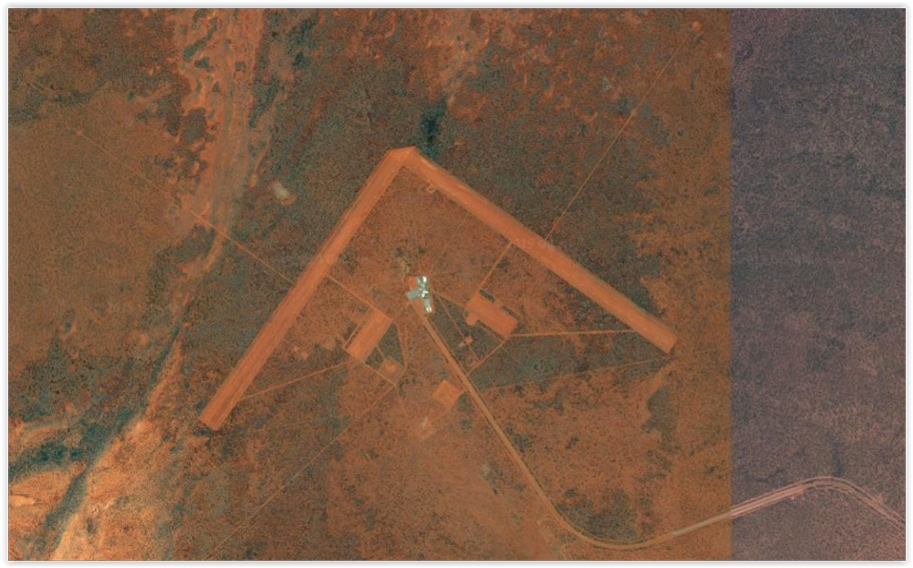
is just north/west of Erlistoun. Basically a large government over the
horizon radar system on a fenced off area about 10km x 7km in size with
some large phased antenna system. Clearly designed to 'see' over the
horizon (a long way) and out to sea both north and north west of
Australia. The system can probably see a seagull flying over Indonesia,
but of course never saw where the Malaysia Airways plane went... (yeah,
right...). https://en.wikipedia.org/wiki/Jindalee_Operational_Radar_Network
Aerial view of the phased antenna array. Each 'leg' of the V is about 3km in length.
We
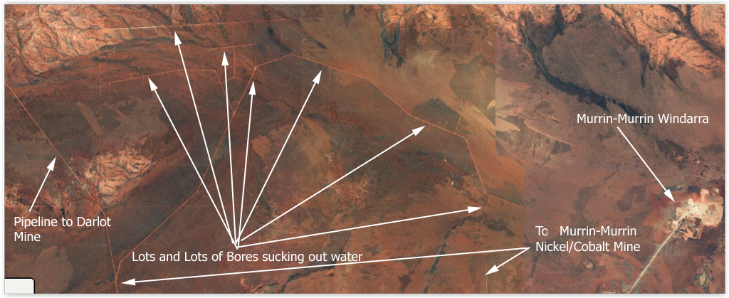
continue west on the Nambi Road that varies from a decent gravel road
to nearly track status. South of it is the large Roy-Valais Borefield
that is sucking an enormous amount of water that is piped (along with
power lines running along the pipeline road) all the way to the Darlot
open pit mine. There are also water pipelines from this field that feed
Murrin-Murrin Nicket/Cobalt mine. Of course the area is "No Entry and
Restricted" etc etc. Wonderful how they can just close off areas and
hide what is going on. The water is used as part of the gold
treatment/extraction process and they use a LOT of water. The scary
thing is that Nickel production water usage uses even more. So, in
addition to leaving huge pits, the mining companies are also sucking
the ground water table dry. But tourists along the coastal highways can
remain ignorant of these little details.
Screen capture of just
a SMALL area of the borefield. It extends southward more than the width
you see here. Just go onto google earth and zoom into this area to
understand the scope of the borefield. This borefield is over 20km wide
and at least 20km high. That is over 400 square kilometres of bores
actively pumping ground water to mines from aquifers that have taken
centuries/millennia to fill. From a few studies I've read through (that
are nearly 20 years old) the estimate then was that more ground water
was being pumped that was able to renew annually, so imagine now with
all the new mining activity and active bores. Not sustainable long
term, but then the water only needs to last until the mining is
complete, then future generations can inherit the mess that has been
bequeathed to them...
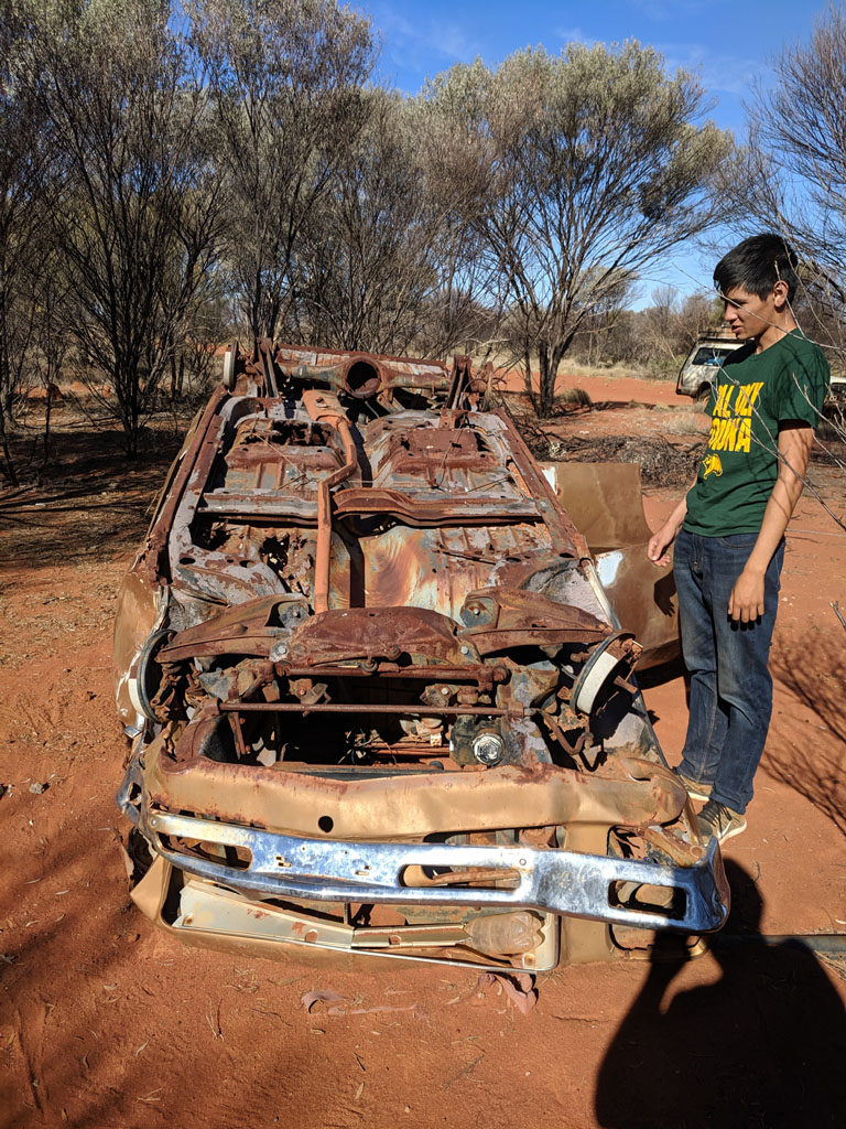
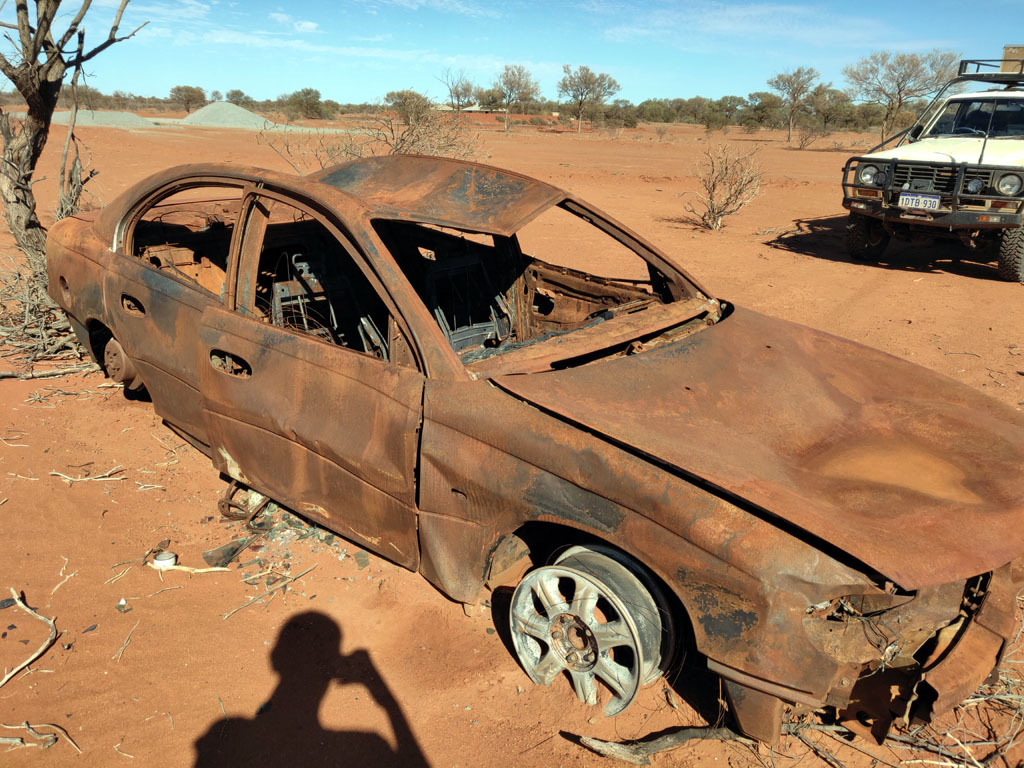
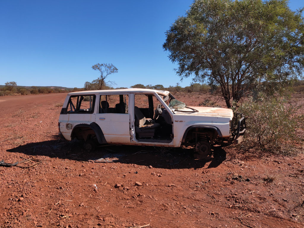
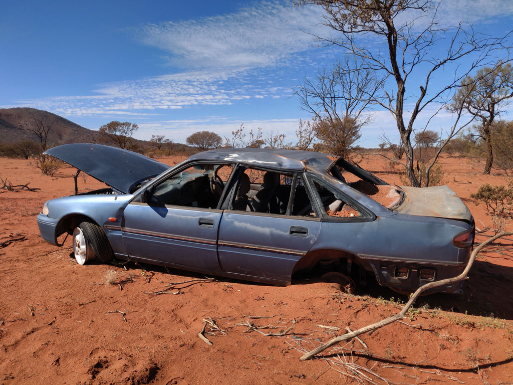
As
we head along the road we come across dead vehicles. One example, an
old dead holden. Missing a few bits and pieces. Not sure if those drum
brake shoes have asbestos? Peter is finding it amusing to observe how
many vehicles are just abandoned and gutted for parts.
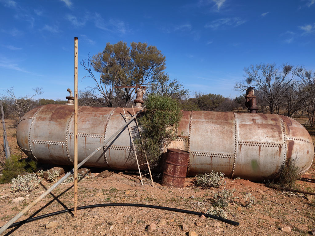
A
bit further along the road next to Dwyer Well we find this relic from
the past. 1/2" thick steel plate all riveted together as a large
pressure vessel. It's about 6 feet tall. Hard to imagine why it was
left here, there's no mine nearby. It would weigh a considerable
amount, so not like someone just had it on a trailer and decided to
pull over and dump it.
Onwards
we go and take a turn in the north direction on the Nambi-Bandya
Road. We reach a small mining area (with some no prospecting/metal
detecting signs) and decide to pull off the road and find a spot to
camp as it is getting late in the afternoon. We are just south of
Melrose Homestead and on the west side of the road. There are some old
mine shafts and a few old treasures. We find a spot a bit off the road and
make camp. We hear quite a bit of noise in the distance (Darlot mine is
operational). Next morning after a bit of breakfast I see a troopie
driving around and finally it heads to where we are camped. Turns out
the driver is Larry and has the prospecting lease and is initially
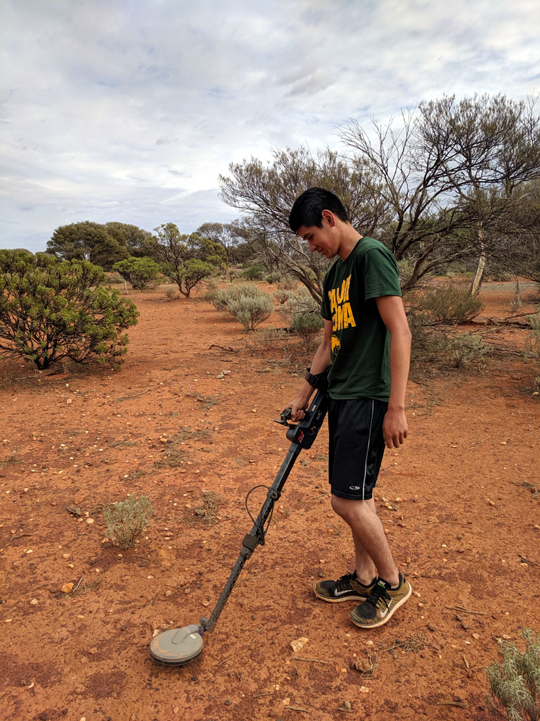
worried we are metal detecting/stealing his gold :)
After a bit
of a chat and realizing we aren't thieves and just father & son on
a camping/exploring trip, Larry becomes friendly. We end up chatting
for near on 4 hours. He even gave Peter a bit of a lesson on metal
detecting techniques and lent him a metal detector to try out. We
learned a bit of history of the area and how the Darlot mine is
operating and the state of the Melrose homestead. It was an educational
discussion with a bit of the behind the scenes stuff exposed. We also
discussed mining water usage and availability and how nearby wells are
drying up. Summary is that I have not changed my opinion of big mining
and how it interacts with government officials - needless to
say for their own mutual and future benefit. A small number of
'important' people making huge amounts of money.
Peter looking for gold and finding nails and bits of old tins...
While
chatting with Larry he recommended and internal road to get us up to
Wiluna versus heading west to the pavement. So, we continued in a
mostly northerly direction and our first stop to check out some old
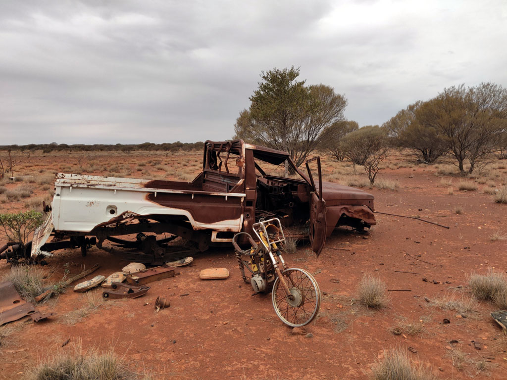
treasures was abandoned Yandal homestead. A bunch of old vehicles and
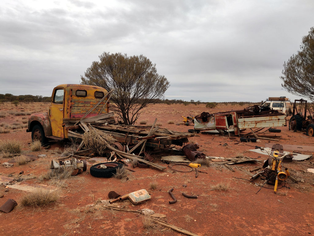
motorbikes from days gone by.
A
bit more junk at the Yandal dump. They seem to have standardised on one
motorbike model, so I'm sure they gutted from one to fix another.
Always a wonder to me when someone finally decides to quit a homestead
and the process of just picking up some valuables and then walking out
and leaving everything else to just rust away. So many memories that
are just left out there with no attempt to at least bury all the junk.
We
continued north on the road and as late afternoon approached we started
looking for a spot to camp. An older track veered east off the main
road and so we headed through the Corboy New Find Mine area, nothing
remarkable. So, continuing east and we drive onto a wide haul road but
clearly no longer in use since there were no recent tyre marks on it.
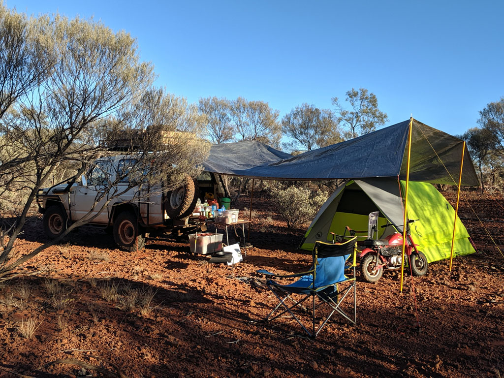
We crossed it and found a spot to camp near a hill and just above a dry
creek. Clouds indicated that we may have a sprinkle of rain so we
proactively put up our tarpaulin using a few extendable poles. We
erected the tent opening under the tarp side and built our cooking fire
just on the edge. As we got ready to start cooking dinner it did indeed
start to sprinkle and continue for a hour or two. Not enough to do more
than collect a few litres of water for us and barely dampen the dust on
the ground.
The next morning we were greeted with a cloudless sky and nothing to indicate that it had been a cloudy and wet evening.
Next
morning we returned to the old haul road and headed north until we came
across a good station road heading west and we took that to get back to
the main road. Continuing north we reach the Wongawol Road and headed
west to Wiluna. Reaching Wiluna we drove through the town (hardly a
metropolis), it is the last fuel/town prior to heading up the Canning
Stock route or east to get to the Gunbarrel and other desert tracks. We
didn't need fuel or supplies, so departed and headed west towards
Meekatharra on the so called Goldfields Highway. This 'highway' has
patches of bitumen and gravel and the government seems to enjoy wasting
money at each gravel to bitumen transition with signs announcing their
'roads to recovery' project. Nuts!
Not far out from Wiluna and
we come across a younger sibling to our old MQ patrol, a GQ. On popping
the hood, the front of the injection pump had been disassembled, not
sure if someone needed some of the parts or indicative of some engine
failure. The engine, drivetrain, front/rear axles were still intact.
Along
the 'Highway' we took a detour to check out the Kimberly Range. Some
interesting terrain and a very open plain that made for some easy
driving, but some interesting navigating since there were so many
tracks leading all over the place. This open plain continued for many
kilometres - quite a pleasure to drive through versus some of the tight
and overgrown tracks we had been on.
After
our detour we returned onto the Highway and continued on. Again time to
find a camp spot and we saw an intriguing set of breakaways and a gate
along the fence line. So, opened the gate and drove through and found a
gravel pit in the breakaways and a perfect nice wide space to make
camp. With the vehicle parked and engine off we heard what sounded like
a tiny air leak. A bit of inspection and we determined that the rear
driver's side tyre had a leak from the valve stem area. So, we slipped
the jack under and removed the wheel and installed the spare. Broke
down the split rim on an old tarp I carry for such purposes.
Interestingly
we could not find any indication of the cause of the puncture in the
tyre. All we found was the tiniest of holes in the tube and even when
matching up the tube position within the tyre (we had marked the tyre's
alignment versus the valve stem hole), we couldn't find anything in the
tyre (inside or out). So, cleaned up the tube and put a cold vulcanized
patch on and re-installed the tube into the tyre and reassembled the
wheel/rim.
I can only assume that the tube puncture was due to
some small piece of debris caught between the tyre and tube that wore a
hole over many many miles. Anyhow an easy repair and Peter got some
experience in how to break down and reinstall a split rim..
Next
morning we returned to the highway and came across a vehicle heading
towards us with 2 ladies waving madly at us to stop. By the time we
slowed down we had gone past them so did a u-turn and pulled up along
side. Turns out they were two european lady
tourists in a rental 2wd
camper inquiring if this road would get them to Esperance and how much
further was the gravel... Updated them that it was patches of gravel
and bitumen and the road was ok if taken with some caution (mainly due
to road tyres). Told them they would reach Wiluna and from there head
down to Leonora/Menzies/Kalgoorlie and continue south. We could only
confirm that the road from Leonora down to Esperance was paved, and
that 'likely' the road from Wiluna to Leonora was probably sealed. You
would have thought if this was of a concern they should have checked at
Meekatharra before committing to this road. Anyhow, I'm sure it would be
an adventure for them and not like there isn't quite a bit of traffic
to provide assistance if needed.
On
reaching Meekatharra we fueled up and then had to make a decision which
way to head. I suggested we head towards Carnavon to explore some
different terrain and an area with rivers (real rivers, versus dry
creeks etc). So, Peter agreed and off we went. Got onto the
Carnavon-Meekatharra road and headed towards the Murchison River. I was
hoping we would find a nice pool on the river, which we did.
Firstly
we took a detour off the main road to visit the Big Ben mine. Was
marked on the map and so we followed the track down to the old mine.
Big Ben and his mates must have liked beer, a LOT!
They also may have like eggs, since we're guessing this may have been a chicken coup.
The
mine shaft goes down quite a ways, so the mine was certainly something
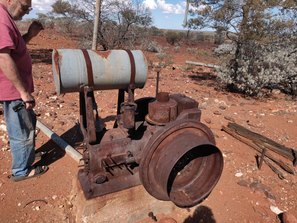
that operated for quite some time. An old engine is one of the few
pieces of equipment still in place, looks like it had a large belt on
the flywheel to run something.
Then
back to the main road after a bit of exploration around the nearby
abandoned mines. Our plan to find a good campsite as we crossed the Ord
River (not the one up north...). The Ord merges into the Murchison. We
continued westerly and the road crossed the Bedaburra Creek and saw a
track on our maps that headed south and in theory would take us down to
the Murchison River. So, we took the track and headed to Mount Taylor
Well. From there we examined the map and compared it to the aerial
photography we had to verify which tracks actually existed and headed
in the direction we were interested in. We did find a possible track
and followed it, no recent traffic on it and it headed in the right
direction.
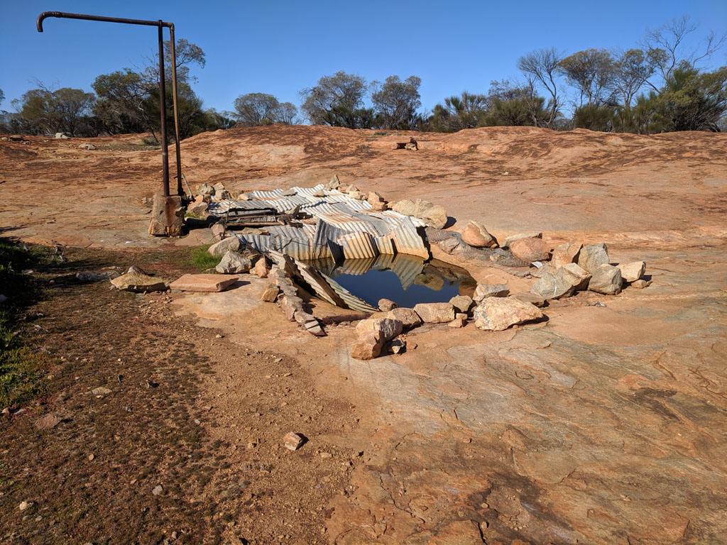
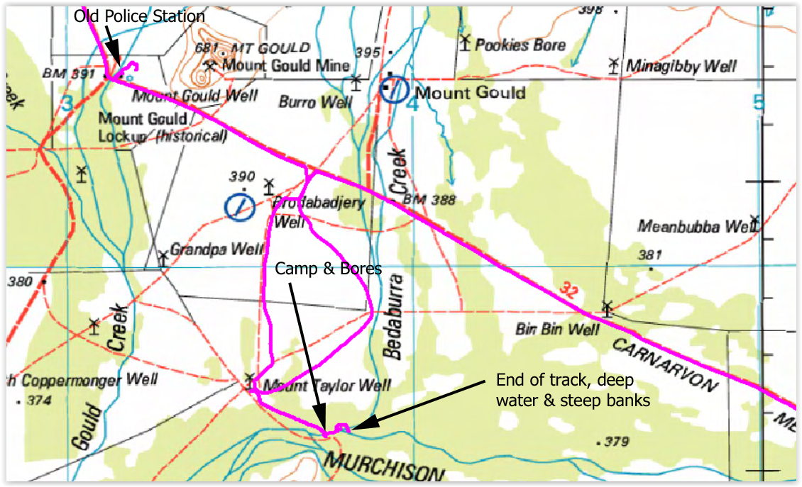
We continued on and then came across two pipes in the
ground that of course require closer examination. On opening the lids
(not locked) we found water depth plumb bobs in each. We removed one of
the plumb bobs and the water level appeared to be maybe 10' or so down.
Perfect to slip our whalepump down the plastic internal pipe and we had
plenty of hose and power cable to easily reach 20'. So, dropped the
pump down and plugged into one of the anderson powerpole outlets in the
engine bay and pumped out a bucket of water to test. Water was perfect,
just a small hint of 'bore' water and it was quite warm. The pipe goes
down at least 50' so it is reaching a warm aquifer - perfect for having
showers.
Map showing the location of the bores. Also the track end. The police lockup is a 'relic' and we got to it the next day.
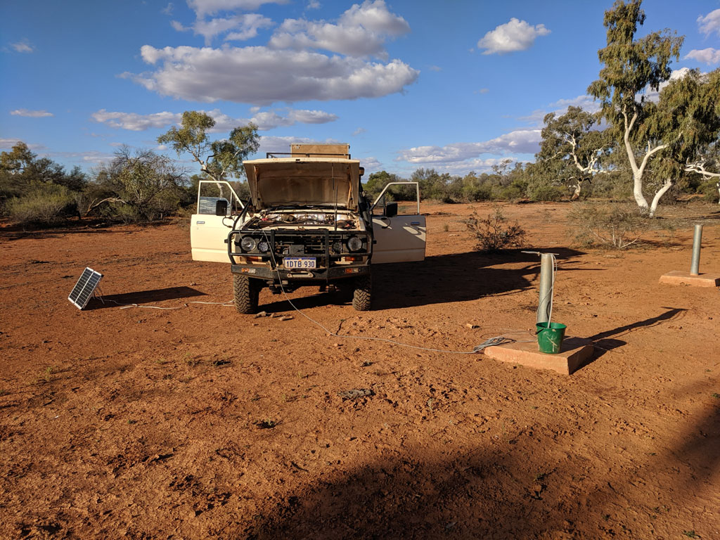
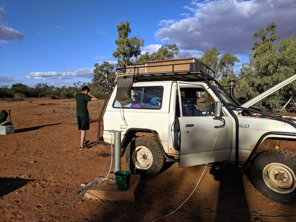
We
moved the nissan so that we could stand on the concrete of the bore
pipe to not get muddy feet. Shower is filled and the water is already
warm as mentioned above. It's quite a luxury to have near unlimited
water while camped and a great opportunity for a shower and to top up
our water supply.
Presumably the bores are occasionally checked,
not sure how often and by whom. The track in is hardly trafficked and
not the easiest to locate. Quite possibly this was some master plan to
monitor the river levels and then abandoned as a useless exercise.
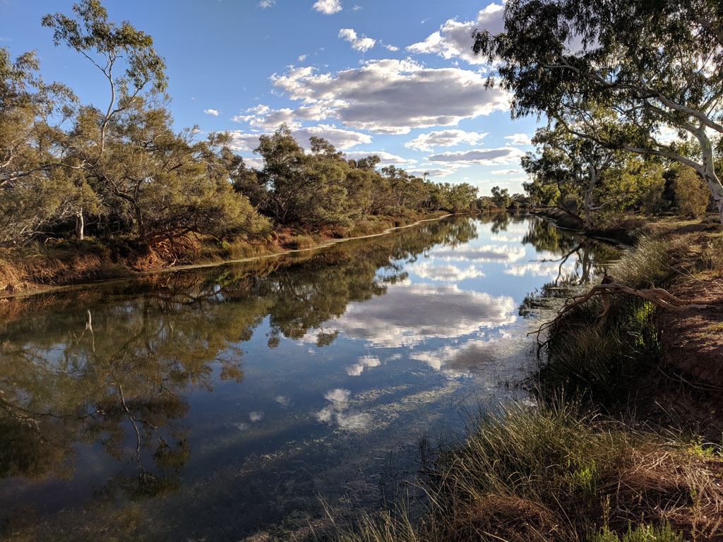
About
100 yards from where we were camped runs one of the branches of the
Murchison and there's a wonderful looking pool that is full of water.
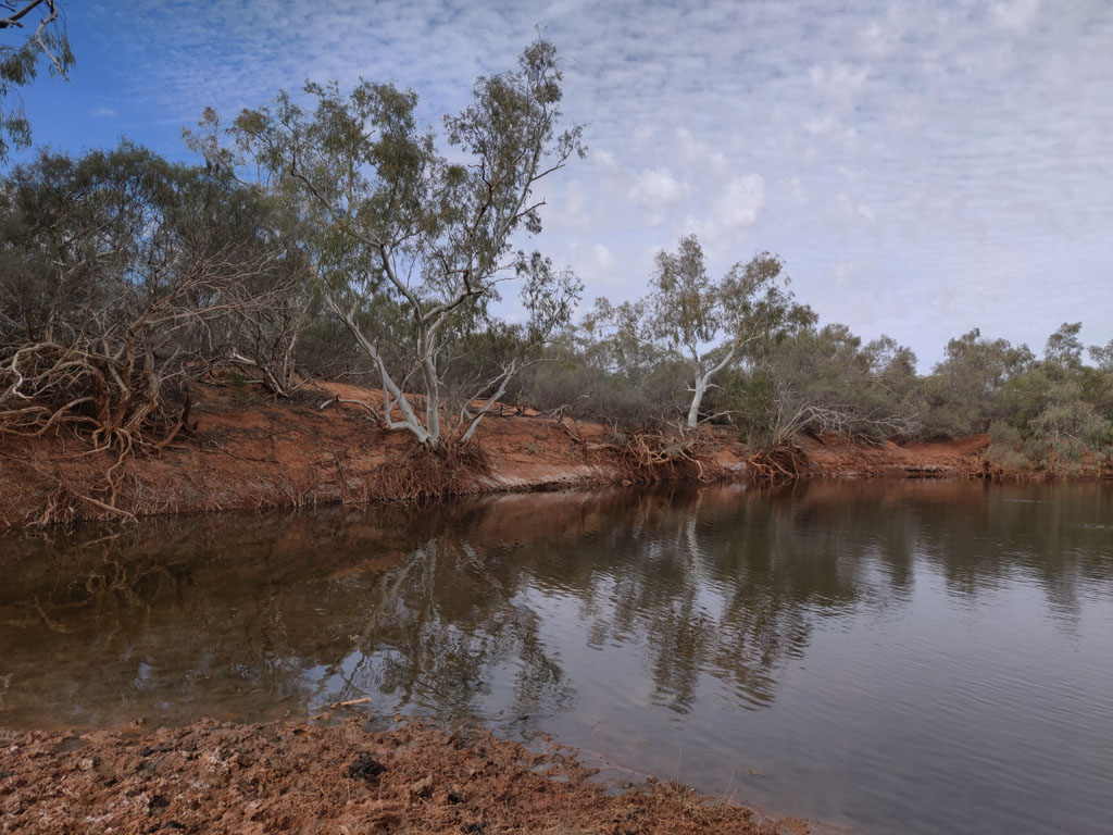
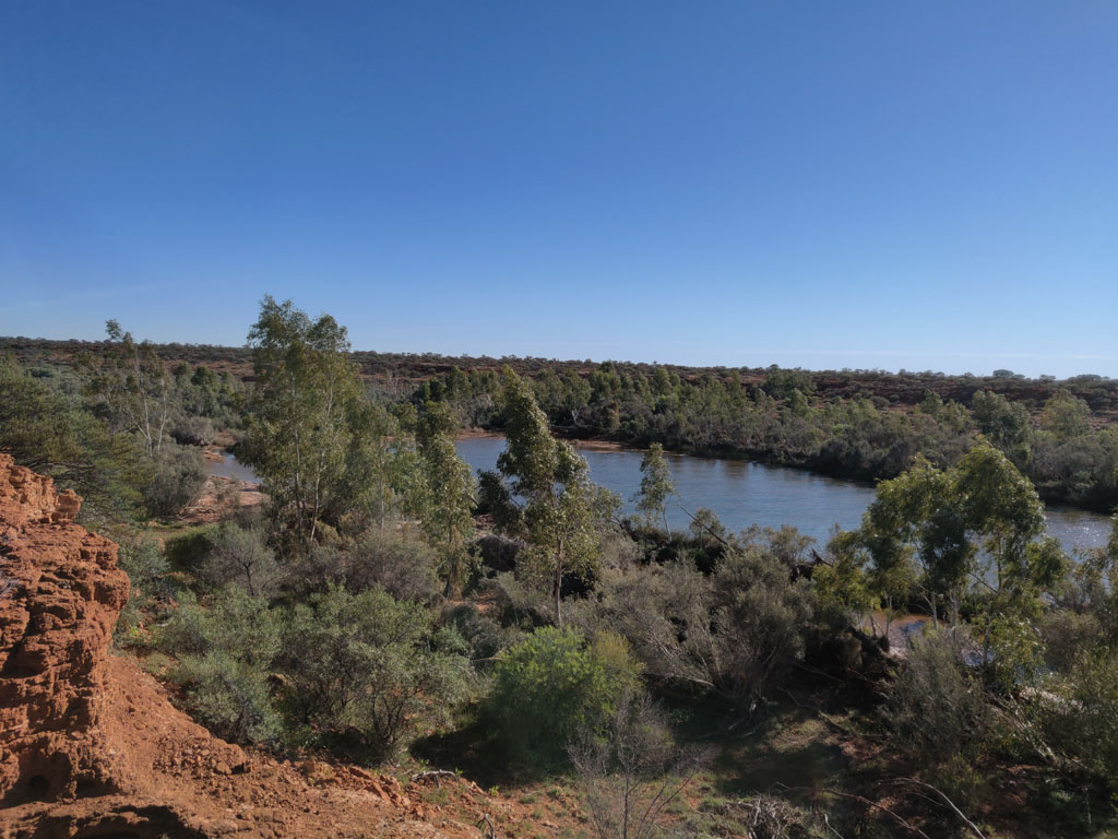
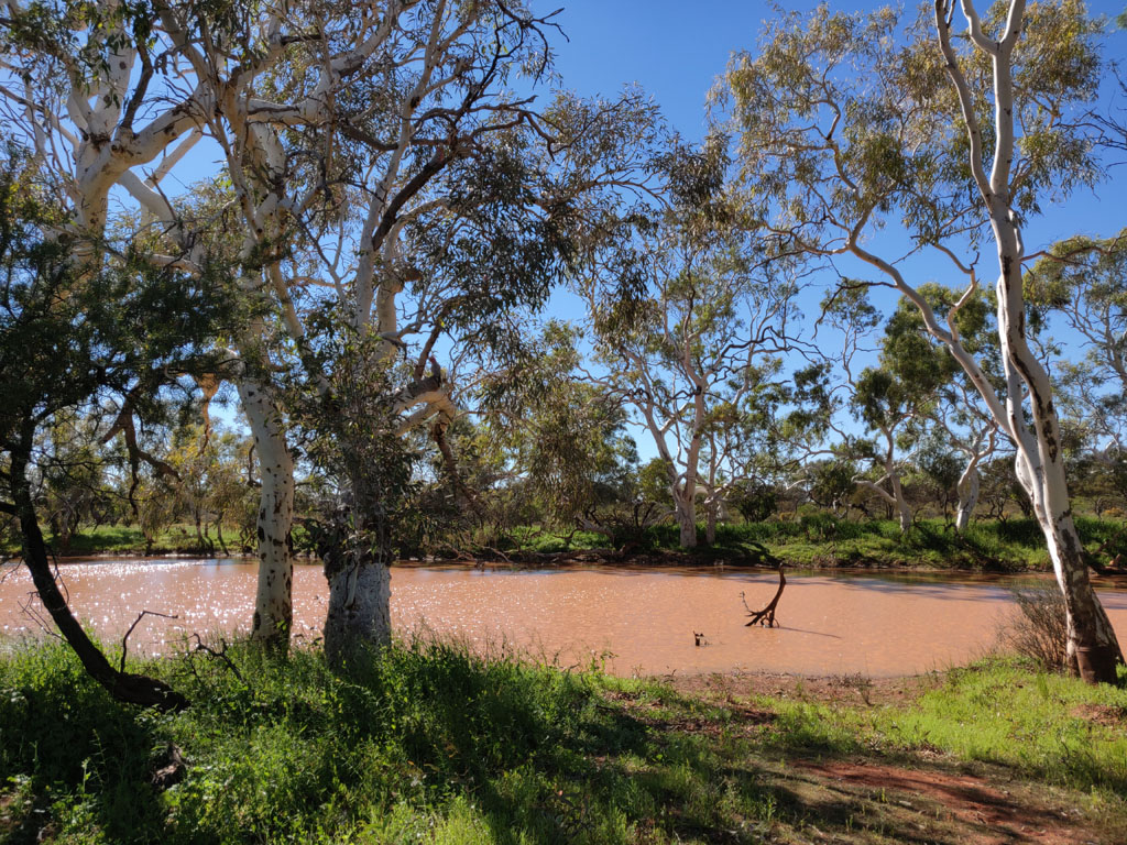
Quite a beautiful sight and very peaceful.
Our original plan was
to cross the river since there's a track shown on the maps, but clearly
the track doesn't exist (we followed it to the river and found a very
steep bank that drops into deep water and an equally steep bank on the
other side). Track has not been used for years since we had a bit of
work to push through lots of undergrowth to reach the river's edge. Oh
well, still a great camp spot and we would continue on towards Carnavon
on the main road the next day.
And
so the next day we head back up to the main road and continue west.
Right before Gould Creek we saw a few old buildings so pulled off the
road to check them. They are an old police station and lockup. The
signs say it was built and manned around 1888. Supposedly to arrest
people (and mostly the local aborigines) that were killing/eating the
sheep. At least it was near a decent creek and there's a well next to
the police station. Of course these buildings have been renovated and
repaired.
There are
a few tracks that follow the creek northwards and we drove up a bit to
check things out. A couple of dead Camrys to be found, here's the first
one, burnt out, the other was in better condition.
Mt
Gould in the background with active mining around the top of the hill.
The other Camry, still has the motor etc intact. The back seat is full
of dirt, so not sure if this was flooded out and then washed or dragged
out of the creek or someone was transporting dirt when it broke down :)
From
Mt Gould we continued on the main road in a mostly northly directly and
reached the Gascoyne and drove across it and then back again. We then
got onto the Dalgety Downs road and headed westerly with the Gascoyne
just to the north of us. We continued on with the thought to find a
track to lead us up to a river and maybe a nice pool to check out.
Our
plan came to fruition when we saw what looked like a reasonable track
heading north. The track actually deteriorated and certainly the track
on the map did not exist and we ended up following some old wheel marks
and then just heading cross country. Lots of water courses have cut
channels through the area near the river. We eventually parked the
vehicle and hiked to the pool. I've become very skeptical of tracks
that are shown crossing major rivers, maybe there was an original track
or a fenceline decades ago, but they are non-existent when you actually
visit the area on foot or in a vehicle. Fortunately we had aerial maps
to verify track existence or not.
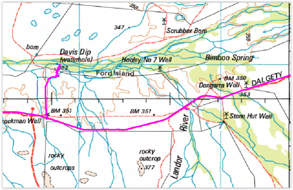
Here's a bit of the tracklog
showing how we reached the Davis Dip waterhole. Of course most of these
stations are running cattle now and the pools are polluted with
considerable cow dung.
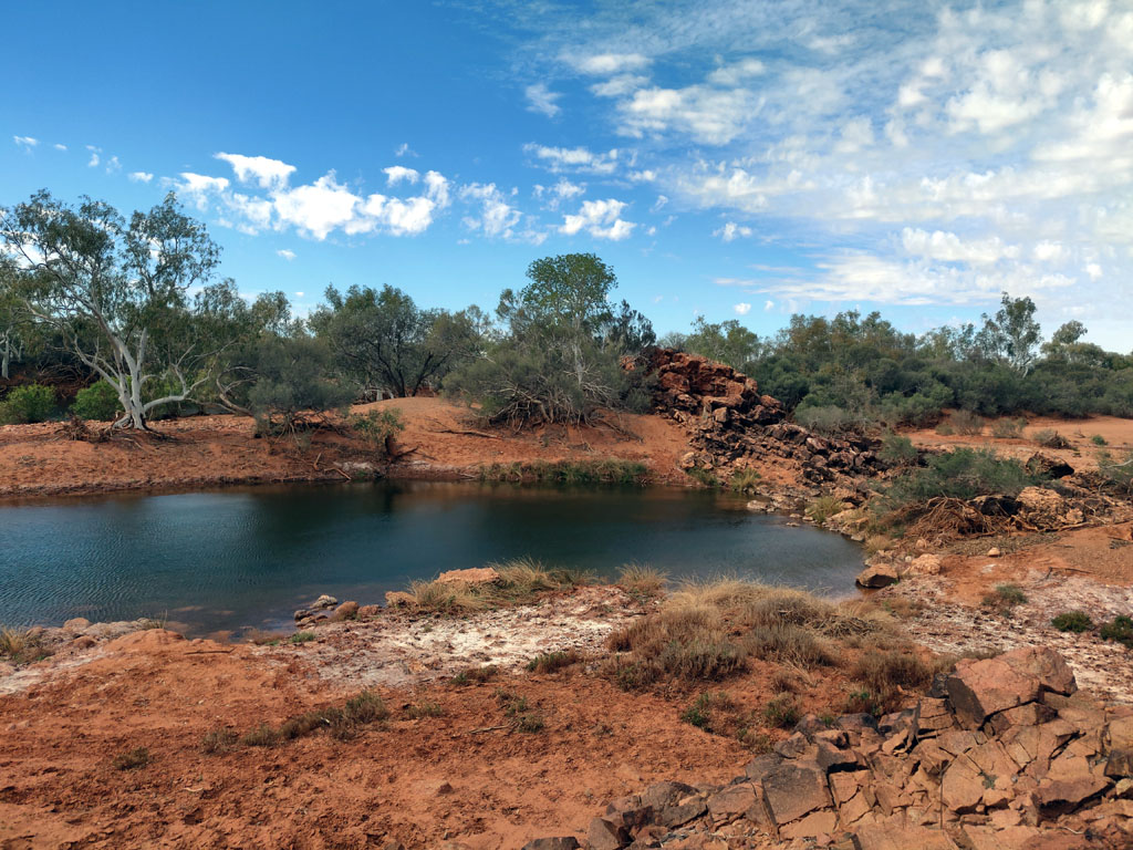
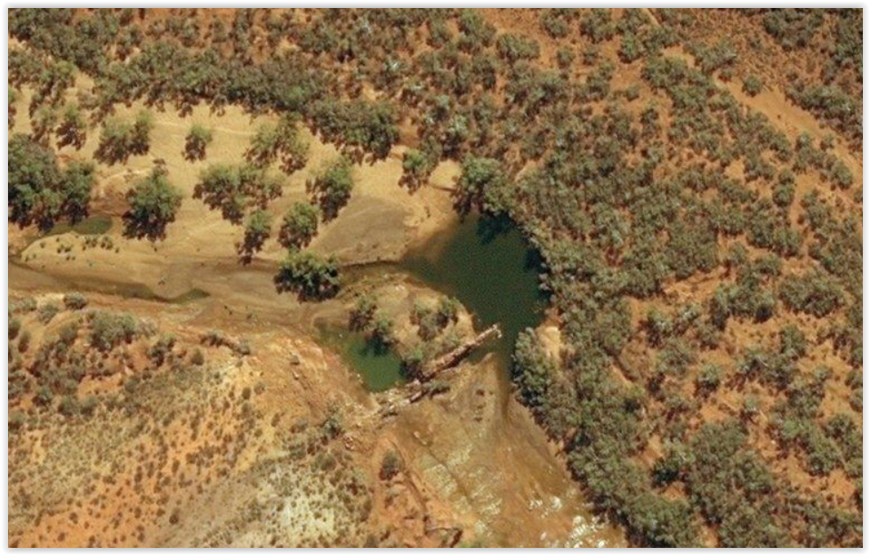
The
Gascoyne River and Davis Dip. You can see all the cattle feet imprints
on the edge of the water. Given the number of cattle that walk around
the pool, it's hardly a place for a dip.
The
pool forms near a natural cut in the river path. A fairly large rock
wall (that has been eroded in the main path) forms a bit of a cut that
the river has to flow through. In the wet season when the river is
flowing with some force it must form a bit of a water fall/rapids to
get through the cut.
This
is a bing aerial view of the water pool and also you can see the rock
barrier that the river has had to cut its way through over the aeons.
This spot was about a 700 metre walk from where we had parked the
nissan. What looks like tracks are cattle tracks as they head to and
from the water hole following the same path. This aerial view is the
resolution we had available while running Back Country Navigator on our
android devices. Makes finding and navigating so much easier than
trying to rely on oz topo maps that are horribly outdated and
inaccurate.
We
returned to the main road and continued west towards Dalgety Downs and
when we reached the homestead we headed south on the Mullewa Road. I'd
already visited the Kennedy Ranges some 25+ years ago and other than
the interesting aspect of having a sand dune on top of a range it
didn't strike me as anything worth a significant detour.
So,
south we headed without a real trip plan in place yet. We have plenty
of fuel (having filled at Meekatharra) so no reason to not just wing it.
Crossed
a creek (Daurie Creek) and saw a track leading to Coor-De-Wandy just
off the main road, so popped in to look. Another abandoned homestead or
outcamp. Had a cement bath tub though :)
The creek along side the ruins was dry and sand filled. Would be pretty when actually running.
Back
to the Mullewa road and head south again. It was time to look for a
camp spot, we pulled in to check Bilung Pool and there were a couple of
4wds towing caravans so we moved on to look for a more private
spot. A few km further south we came across Walarrie Pool and there was
a track running along its southern edge. So, in we pulled and set up
camp for the night. Nice view from the lookout.
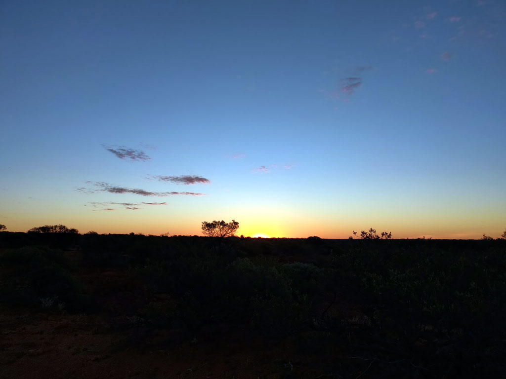
Sunset and a good opportunity to have snapped a picture.
Next
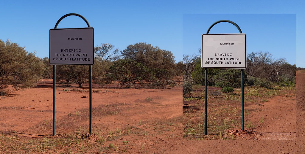
morning we continued south on the Mullewa road and crossed the 26th
parallel. Years ago vehicle insurance policies changed the coverage
when you headed north over the 26th. Not sure if that same silliness
still exists. Anyhow, a picture showing the view going south and north.
We
continue heading south and realize we're going to run out of bush
before we run out of vacation time... So, we chatted a bit about
options and checked the map and came up with a plan to visit the Yalgoo
goldfields area.
This required finding a road to head east. Just
a few km south of where we camped we came across the Beringarra Byro
Road and that looked like a perfect way to head. Very good gravel road
that would allow us to make good time.
We
hadn't gone far and saw an abandoned structure marked Mardagee on the
map above. So, we headed in to check it out. Appears they were old
shearing sheds, quarters for the shearers and the mess hall. Just one of
several buildings in the picture below.
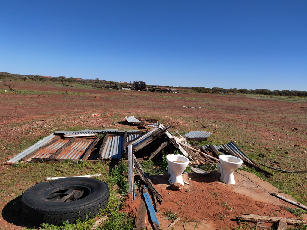
Toilets with a view...
A
nice pool of water behind the ruins on the Yarra Creek. Looks like
there's been some recent rain through the area to muddy up the water.
About
30km further along the road we spotted a dead vehicle. With nothing
better to do we drove over to it to check it out. An old Holden FC
still surviving out in the bush. The chrome is still in impressive
condition. A brake shoe is sitting on the front fender, wouldn't be any
doubt that's an old asbestos lined shoe.
Back
onto the main road and we continued east and drove past Beringarra
where the road took a south-west change of direction which took us past
the southern edge of Jack Hills. We decided to investigate the range
and found a track heading along the western edge. As we drove along we
crossed a haul road (paved). Hmm. So, we continue on the track a while
and then decide we don't need to drive into a working mine so head back
to the haul road and take it to get back to the main road, which at
this point is also paved.
So, clearly the main road had been
paved to become a public 'haul road'. The road was hardly in perfect
condition and we deduced that there was no more active hauling going on
(too many pot holes and damaged from when it did see trucks hauling
iron ore). On getting to cell/data access we did some quick google
searching and found the Jack Hills mine never reached 'stage 2' and had
been mothballed. Seems Mitsubishi spent a small fortune buying
something useless that they've been trying to unload for several years.
The mine was mothballed on June 2013, so 6 years that it has been
closed and mining stopped about 1 year before that. Of course there are
still signs on the main road warning to be careful of trucks hauling
trailers... easy to put signs up, too difficult to remove them when no
longer valid.
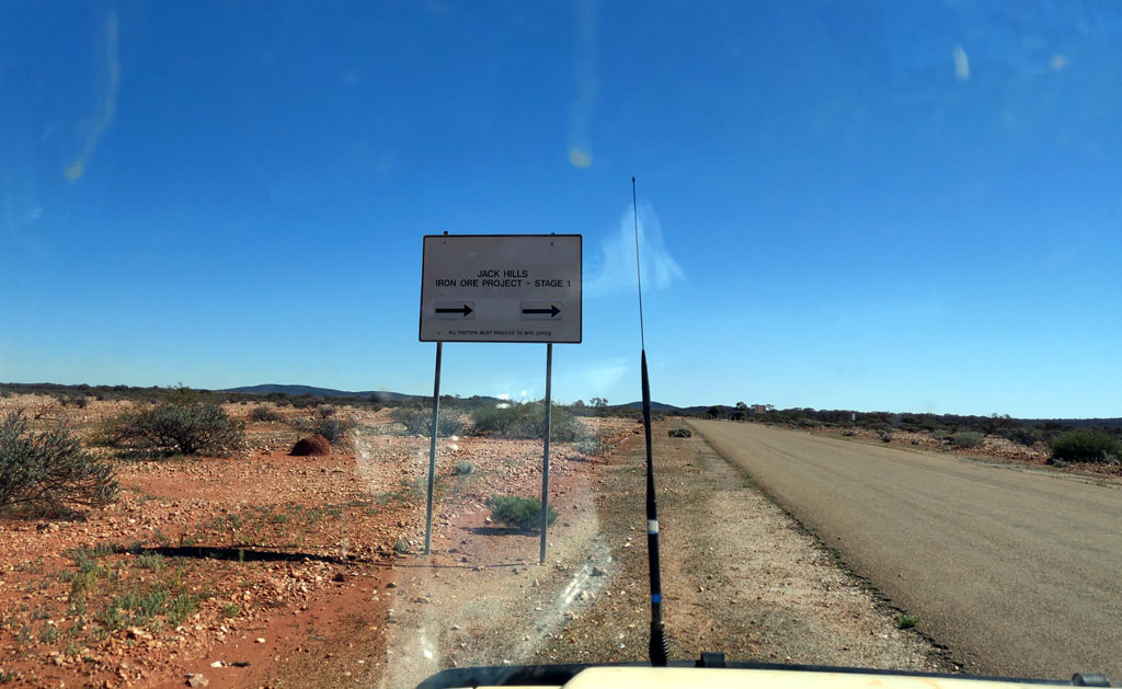
Here's the Stage 1 sign pointing to the mine.
Never got to stage 2, thankfully. Last thing we need is more of our
hills defaced for the sake of short term profits. I never understood
the profitability of hauling iron ore with trucks and obviously once
iron prices took a downwards dip the bean counters also decided
there was no profit in the madness.
Anyhow,
we had a mostly paved road that allowed us to cover good distance. We had to dodge plenty of pot holes - sometimes a good gravel
road would be better.
We've come about 100km from first hitting
the paved 'haul'/public road and are crossing through the gap that is a
cut through the Weld Range. You can see from the picture that the paved
part of the road is now covered with gravel to fill in many of the pot
holes. Over the years I'm sure the road will revert back to fully
gravel.
We continued towards Cue, but that wasn't our destination. I planned to visit Walga Rock and the Big Bell mining area.
On
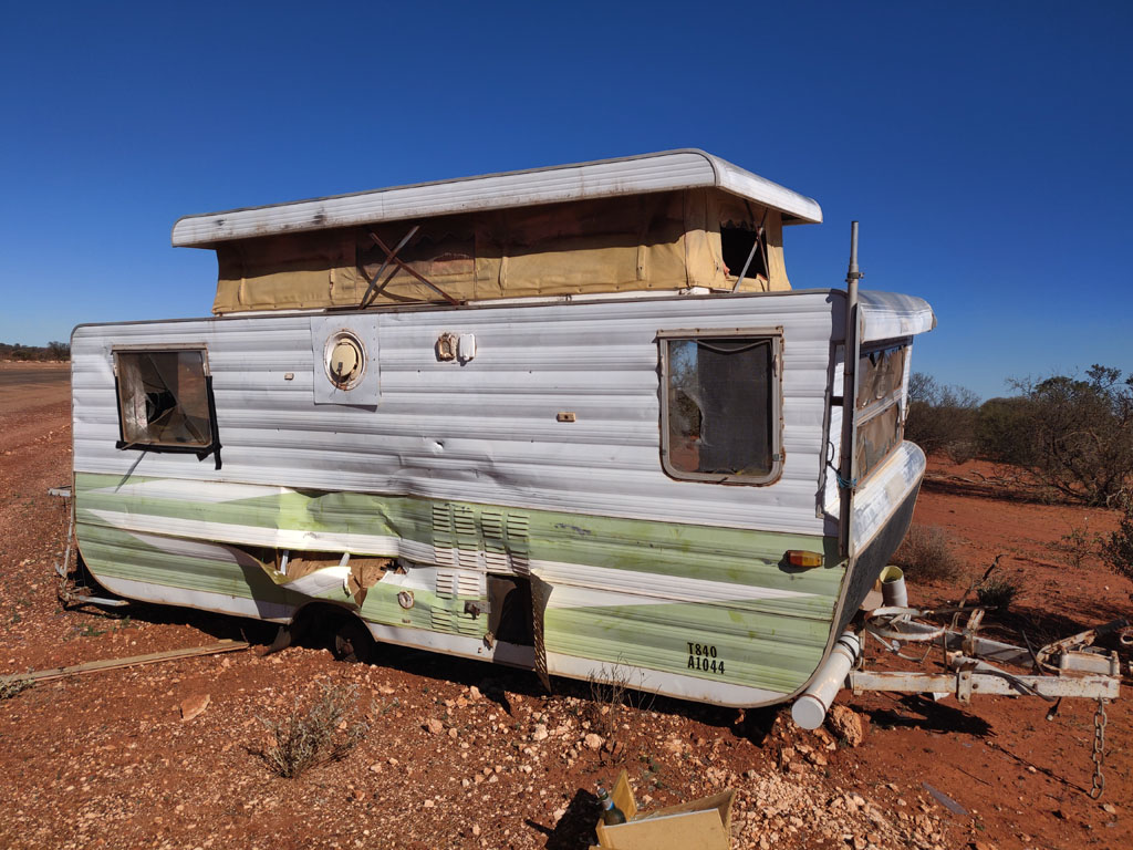
the way we found an abandoned and damaged caravan on the side of the
road. Looks like a major wheel failure, likely a wheel bearing that
siezed.
Further
south we reached the road that would take us down to Big Bell. On the
way down we saw a small mining area to the east of the road and so
drove there to check it out.
A very heavy duty caravan was sitting there and was presumably the living quarters for folk working the prospects.
Some
of the old treasures at the mining area. The wall thickness of the
boiler is over 1" thick, amazing the stuff that they hauled into the
bush in the old days. The vehicle is an old mini station wagon, not
quite the bush vehicle one would expect to find out here.
We
reached Big Bell and stopped at the old pub. The "pub with no beer"
graffiti from many years ago (nearly 40...) is gone. All fenced off now
to make it "safe" for the tourists.
Near
it is an active big pit mine. There was active watering of the road
going on for dust reduction which was doing a good job of turning the
surface into mud. We drove through the old townsite, that is now all
marked with plaques and the original roads (or where they may have
existed) have been 'restored'. There was a vehicle or two camped in the
townsite - no idea what kind of a nut would camp there and then go for
a crap exactly where? We drove on towards Walga.
So, we get to
Walga rock and find that the loonies have fenced the whole rock off. No
camping signs have been erected and warning signs that it is dangerous
to climb the rock. The mind boggles.
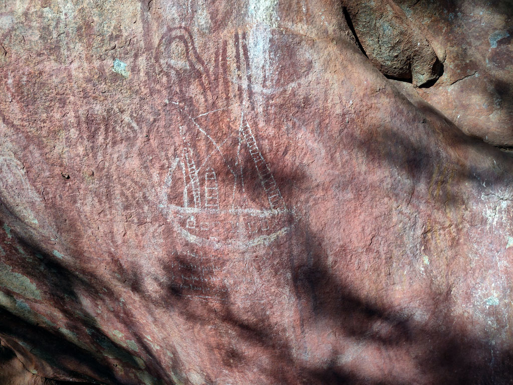
The
overhang area is where there is some aboriginal art. There is also a
ship, now I'd suggest that the likelihood that the ship is authentic
aboriginal art is ZERO. At least the more rudimentary art is
authentic and there's quite a lot of it.
So
Walga is not a spot to camp near, time to move on. As we head down the
road two large american pickups each towing a fancy 'offroad'
caravan, both zooming along at high speed towards us, clearly in a rush
to the next camp spot in their 'off road' adventure. They'll be sad
when they get to Walga, no camping... Maybe they can camp at Big Bell
with the other nuts :)
We see a nice large outcrop (Woolgerong)
a few km off the road to the north-east. Checking the map and aerial
and we can see a well just a bit further down the road and what appears
to be a bit of a track, so decide to see if we can get to the outcrop.
We overshot the well since what we thought was a track was a water
course, so went back to the well turn off. Following the track leading
off from the well, we head north and follow a very old fenceline. The
track along it is reasonable until we get to a deep creek cut, so need
to clear a bit of a path through some scrub to drive across the creek
where it is flat. Succeed and continue on and get back to the fenceline
track. Once alongside the outcrop we leave the track and find ourselves
a nice camp spot right at the base of the outcrop. The plan is a
layover day and to climb up the outcrop the next day and check out the
view and surrounds.
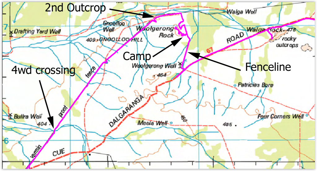
The map snippet below shows the path we took
to Woolgerong. The 'wandering' to the north-west of the Camp is from
walking up and around on the rock outcrop. Since I had my phone with
me, oziexplorer was logging every footstep I took...
We
have camped in a nice little clearing right alongside the rock and sun
is setting. Getting ready to light the fires for cooking and to keep
warm at night. Both nights we were there some donkeys in the distance
would start up their hee-hawing to serenade us.
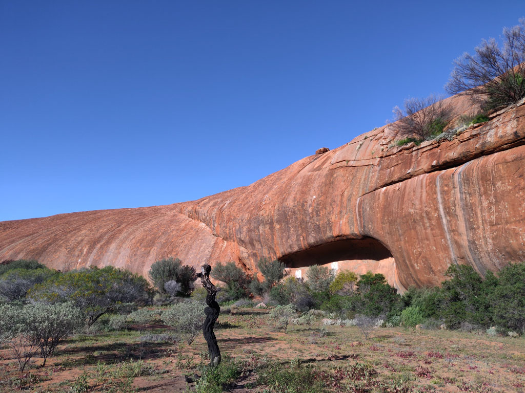
On
top of the outcrop, it is taller than Walga and we have the
place to ourselves. We have cell/data access from the top, presumably
from Cue (about 50km line of sight from Woolgerong), so an opportunity
to send a few pictures, messages and even make a whatsapp call or two
back to the US. We certainly have some altitude to make it line of
sight. We spent 30 mins or so at the top, there is also a cairn at the
highest spot. There is quite a swift easterly blowing so we sit a
little below the peak on the west side to get out of the cool breeze.
The
view to the north-east and we can see the other outcrop (marked on the
map snippet above). The track we were planning to follow along the old
vermin proof fence would take use past this other outcrop. That would
be tomorrow's exit plan and at least we could get an idea of the bush
would we be driving though. At this stage we didn't know if this was a
'new' vermin proof fence (complete with stupid warning signs) or an old
relic from the past.
The
outcrop we're on has some quite steep faces, some that it would be very
difficult to walk. The face that we camped next to allowed us to walk
up contours and that was easier than a full vertical assault. The great
thing with these outcrops is that they offer very high traction with
rubber soled shoes, so it is quite impressive the slope that one can
easily climb, coming down can be a bit disconcerting since you are
faced continuously with the actual slope.
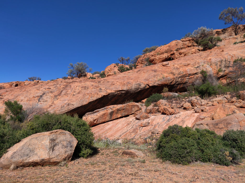
Heading
off the next morning towards the vermin proof fence and the second
outcrop we saw some undercut/cave on the north-east face of the
Woolgerong Rock so drove up to it to inspect. In doing so we drove over
some old fence wire that decide to tangle up around the passenger side
front wheel/brakes etc. So, a quick stop with cutters to remove the
fouling wire.
The caves on the side of the outcrop, quite deep
and would require some crab maneuvers to sneak in. A few dead
kangaroo remains could be seen from the openings.
We
continued on the old fenceline track and hit the vermin proof fence.
This little section is mostly intact, though you can see the fence
falling down and the track quite clear. Further on the fence is mostly
down and posts are all decomposed by termites. The track also
deteriorates in many places, especially across water courses, requiring
driving parallel to the track where it is less overgrown and now washed
out.
We visited the 2nd outcrop (you can see it just on the left
edge of the picture below. There's a bit of a flood plain on the
south/west side of the outcrop and it took a little searching to join
back into the vermin proof fence track. We ended up on the wrong side
of the fence once it started up again after the flood plain (fence was
washed away in that area). Since the fence is so run down it was easy
enough to find a spot to cross back onto the 'correct side'.
Looking
back towards Woolgerong Rock from the second outcrop. You can also see
Walga Rock in the back ground, just to the left of Woolgerong. I'd
imagine you could camp in this area for months and not have another
vehicle visit, even though we're only about 4km (line of sight)
from the main Walga road.
From
here we then continued down the vermin proof fence track. Here's a
screen capture of a dry creek crossing where the track had completely
vanished, though we did pick it up again after the crossing.
Once
back to the main Dalgaranga Road we continued south-east and saw on our
map that there were several mines to the west side of the road, so we
chose a track to head in. You can see the tracklog in the map snippet
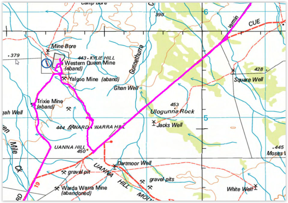
below. We headed up to the Yalgoo Mine and as can be seen from the
tracklog the track does wander around quite a bit since it has
deteriorated in many places and we just drove in the general direction
that the aerial maps indicated the track went.
When we reached
the boundary of the Western Queen Mine we observed that the gate locks
were open so we went in to investigate the mine area.
And
of course what greets us are two large pits. This is the first and
larger of the two pits. The road access is all the way down to the
water and so down we drove.
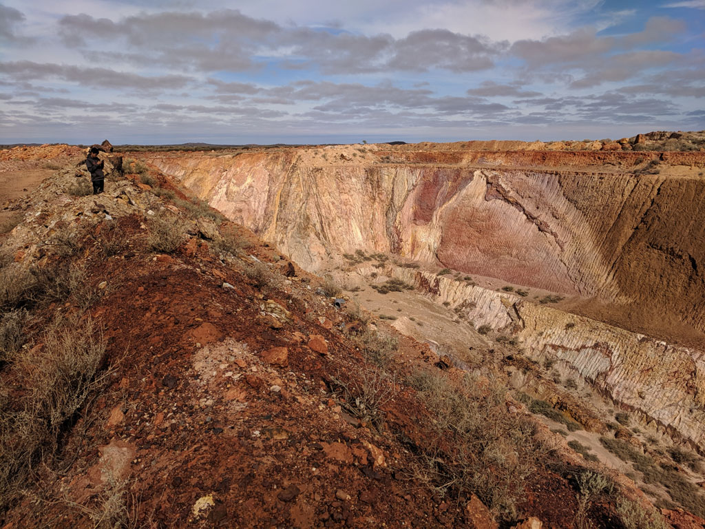
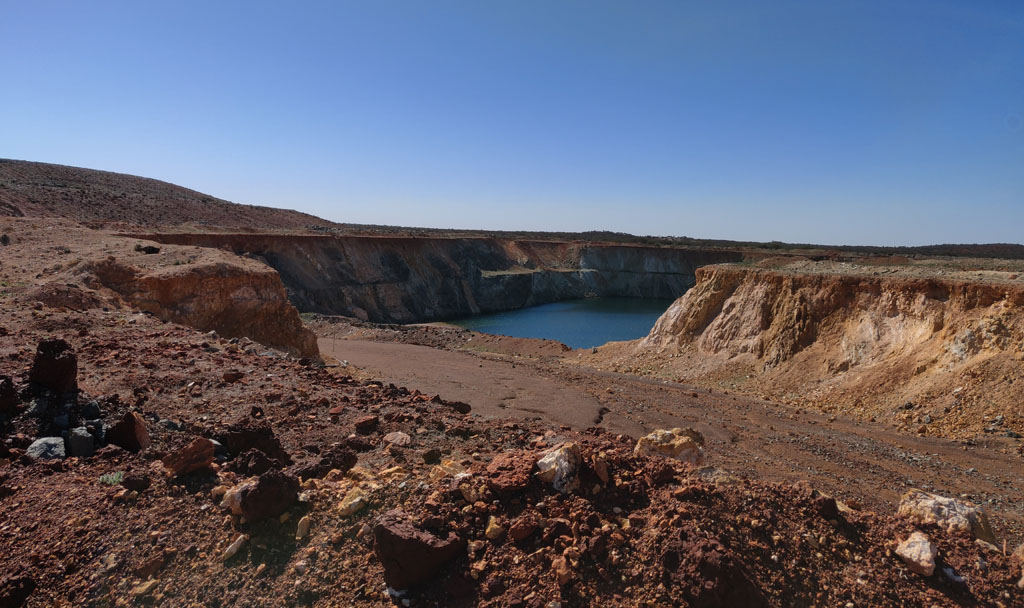
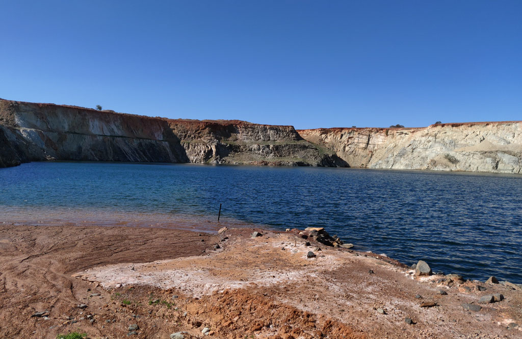
We've
driven down to the water's edge. Clearly the water is very deep and so
there's quite a lot of hole below the surface. It is an all too common
sight to find these water filled mining pits. Again, there is
often sulphide (sulphides are prevalent in the green stone common
to the gold bearing ore) in the mineralization and the water interacts
to form an acidic solution (dilute sulphuric acid). This acidic
solution then leaches heavy metals out of the mineralization and then
creating a toxic brew. Wonderful legacy that the mining industry is
leaving future Australians.
We
leave the pit mine area and follow other tracks back out to the main
road again. We continue on the Dalgaranga Road until we hit the Yalgoo
North Road and we turned due south on it. This would lead us down to
Yalgoo.
We saw a road in to the City of Melbourne Mine and we went in a bit but
noticed new activity so came back out and went south a bit and then
into the Revival Mine area. Here's a picture of some of the old mining
activity.
Most
of the mine shafts we saw in this area weren't the common vertical
holes, but instead slit shafts that were at somewhat of an angle. We
presumed that the gold followed angled ore bodies and the miners just chased after the rich veins. The picture below is
one of these slit shafts, though I can't believe that they thought a few
pieces of wood could protect them from mine collapse.
Continuing
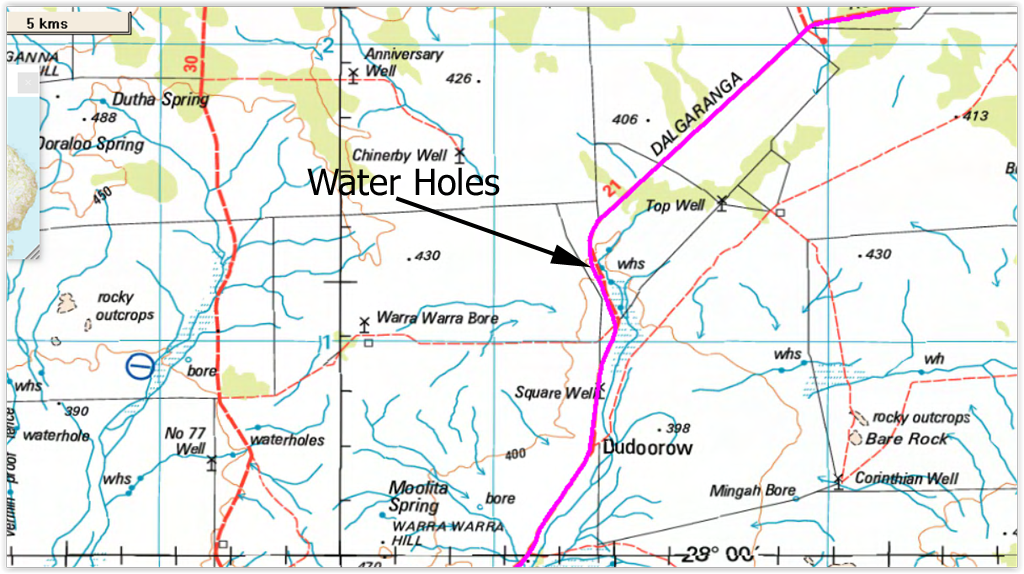
south on the Dalgaranga Road we found a creek with waterholes to our
east. The creek is running over rock sheets which allows the pools to
form. You can see the water holes marked on the map snippet below.
Unfortunately
the water is quite salty, so only useful for washing ones feet. You can
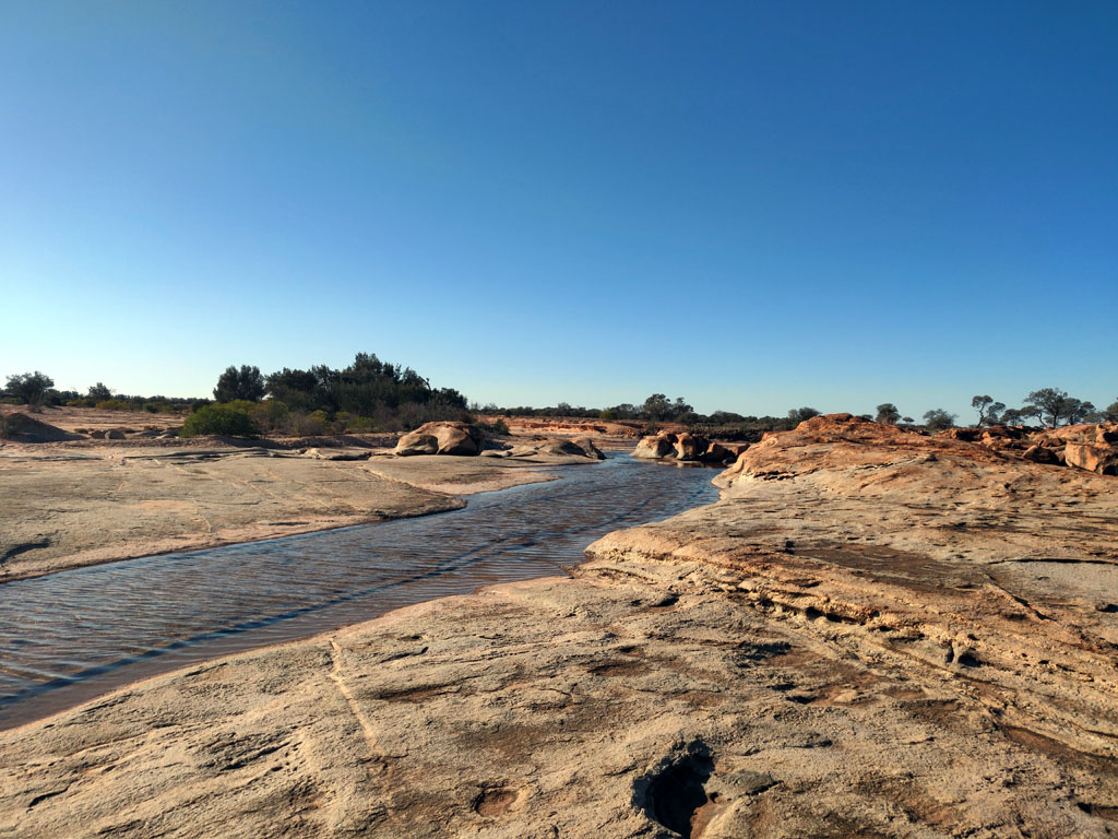
see from the picture below the rock sheets that the creek flows over.
It is an interesting sight.
Heading
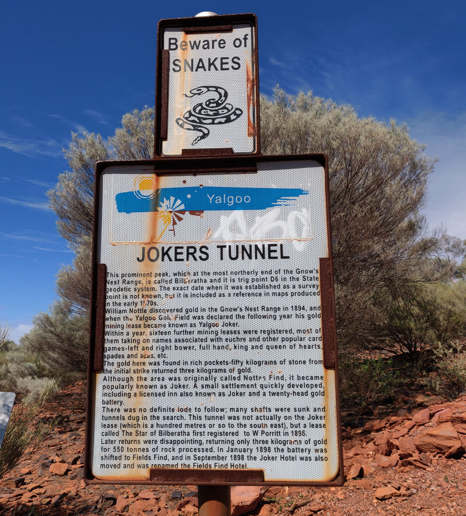
on we went through Yalgoo and then took the Yalgoo-Ninghan road.
Driving along we saw a tourist sign to Jokers Tunnel so figured we
should at least pop in and see what it was. Pretty interesting, seems
like they were looking for gold through a hill and made a tunnel
through it.
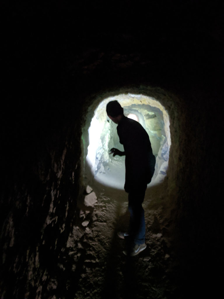
Peter
is leading the way and it starts reasonably high (he's over 6' tall)
and the going is easy, ground is dusty and we kick up dust as we
proceed.
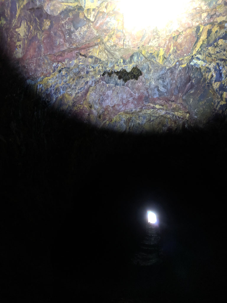
Then
we here the occasional bat, so I look to the ceiling of the tunnel and
we spot individual and groups of bats clinging to the rocks. Here's a
little group of them hanging together. They are quite tiny with wings
folded, well less than 2" across. Our progress and lights got some
spooked and they would fly past us as they headed through the tunnel.
You can also see one of the tunnel openings.
As
we reached the other end of the tunnel, it got shorter and shorter. We
were on our haunches to fit through and we'd have to repeat
the exercise to go back through. You can see how short the other
entrance of the tunnel is. Maybe hobbits worked on this end...
Done
with checking out the Jokers tunnel and a little of the surrounding
area, we continued on south. Saw an old track on the maps that would
take use directly into Reids Ridge Mine area so in we went. Pretty
overgrown track but nothing worse than we had previously driven through
on this trip.
We finally hit a good track after a couple of km.
Came out to a small mine area with some treasures. The ore around the
mine looked more like they were after copper versus gold. We even had a
bit of cell/data access from the top of the hill behind us.
Seemed
like a good a spot as any to make camp. Peter later went for a bit of a
ride around the area on the Z50 and came across a more recent mine (now
abandoned), so that would be something to explore tomorrow on our way
out of this area.
This
is part of the mine shaft area a few dozen steps from where we camped.
Any older hopper is still sitting in its support framework.
Next
morning we headed out to visit the mine that Peter had located (Reids
Ridge Mine). As we drove along the track we went past a couple of guys
(in their high viz) that were doing some surveying work, presumably
getting ready to drill new holes and check the area out for another
bigger hole.
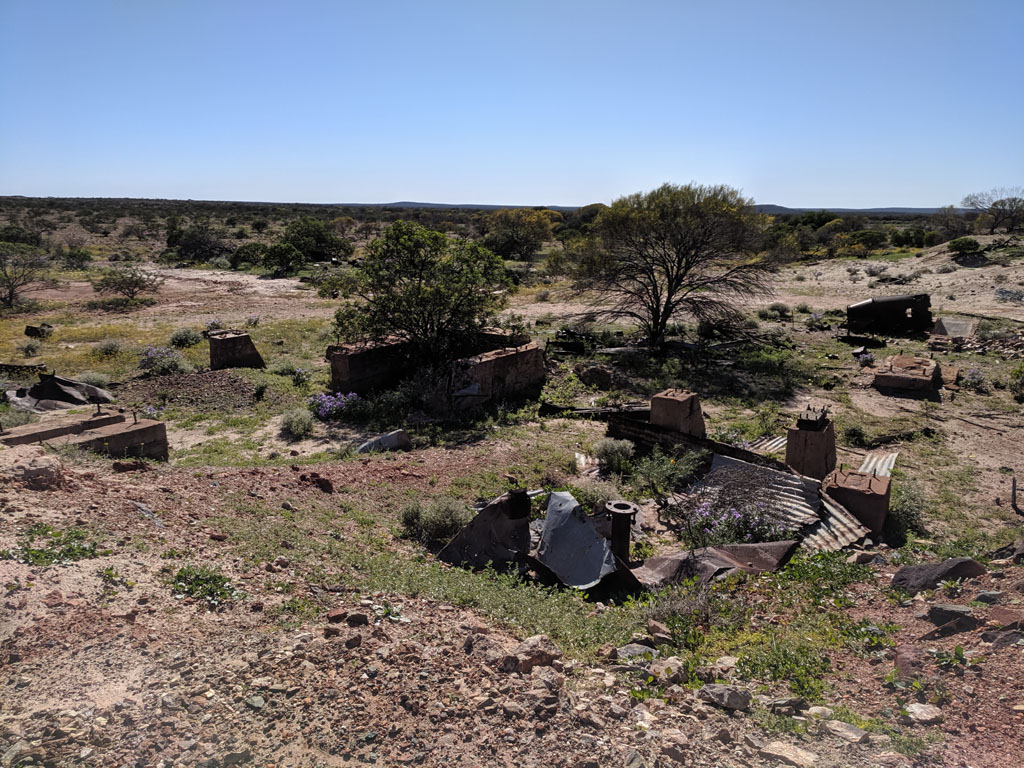
So, a few km further we come to Reids Ridge mine.
These fellows had spent some time and money here. Abandoned living
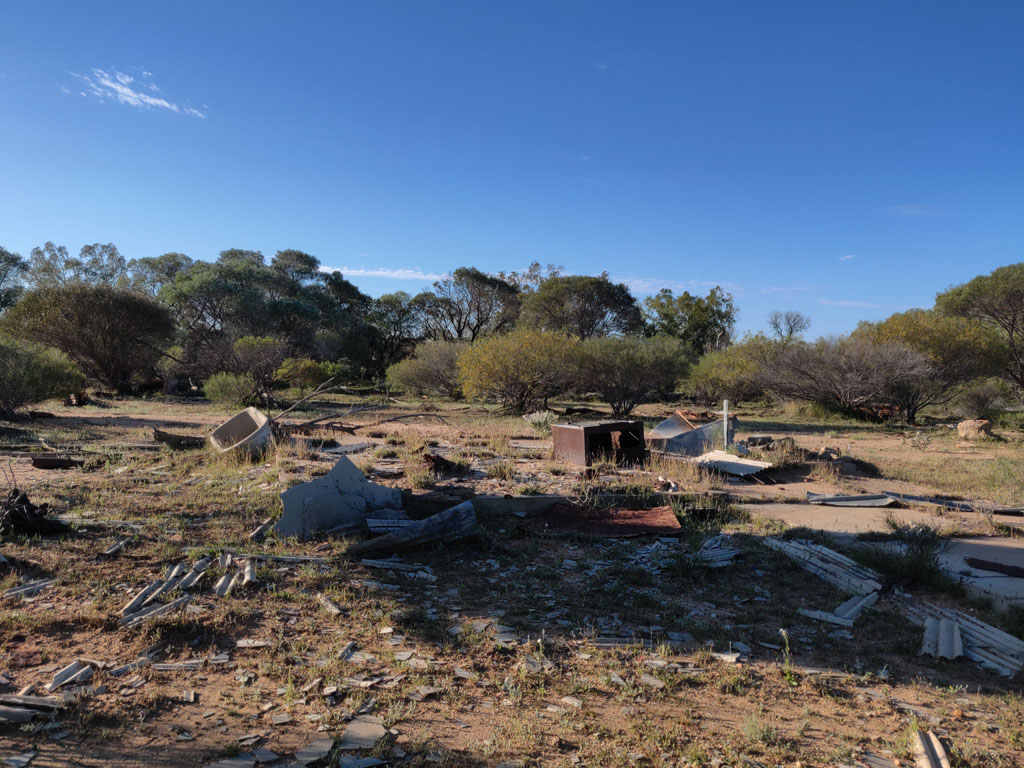
quarters, kitchen, office, bathrooms etc.
Workshop area, with lots of bits and pieces laying around. Lots of drums of sodium cyanide (empty).
Other
side of the workshop with the tailings dump in the background. Lots of
old fridges and washing machines just outside the camera view. Junk
everywhere.
Looks
like a truck died out there and they scavenged whatever they thought
would be useful. Axle assemblies are still there though. Big tanks in
the background for separating out the fines.
Another
piece of dead equipment. Parts of the motor have been disassembled.
Always boggling the junk and gear that just gets abandoned out in these
areas. Clearly once the money runs out they just abandon everything and
there's no need to clean up after themselves. Again, a great legacy
being left to future australians.
Peter
up on top of the tanks. The actual mine can be seen in the back
ground. The hydraulic winch is still there and connected to the large
bucket that would raise material from the various levels. The ladder
going down the shaft is mostly in ok condition, but we weren't planning
on risking life or limb. Even a large water tank (empty of course) on
the hill in the right side of the picture.
The tanks are fed
from a tumbling drum which was loaded with steel/iron balls to help
break up the material prior to the sifting process.
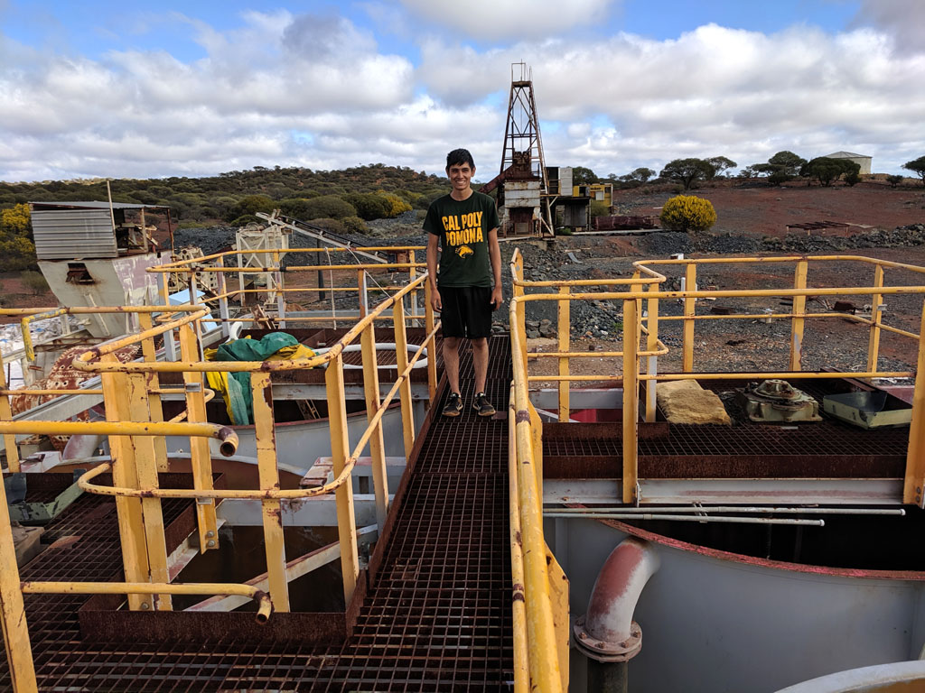
We
left the area and returned to the main road and took the Coppermine
Road heading west. We drove into the Rothsay Mine area and of course
there's new work going on. We ignored some signs and drove around a bit
to check the area out. There are some old ruins and of course the old
cemetery with dates in the 1890-1900's range.
On heading out our
maps showed a track on the other side of the airstrip, so we checked it
out. You can see the track we followed from just east of the
airstrip.
Turned out to be an old fenceline track that was fun to
follow. We stopped for a drink at the top of a hill and took this
picture. Good view of Mongers Lake in the distance.
Once
we reached the main road again we went east a bit to get to White Well.
We had to cross Mongers Lake and there's a decent crossing that is hard
packed.
Across
the lake and we found a creek that had been dammed. The creek is
next to White Well. Nice amount of water and we had showers. The dam
wall across the creek traps a considerable amount of water, all fresh.
You can see the hose end on the ground that we used to fill our shower.
We
had an empty plastic bottle and we used it as a 'float' to keep the
whale submersible pump from dragging on the bottom and sucking up silt.
The power cable is more than enough to reach to the vehicle 12V. With
only a couple of feet of head to pump the whale unit easily pushes out
3+ gallons per minute while drawing less than 2A.
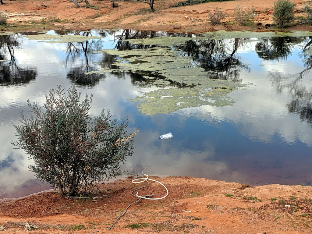
We
moved on to our last camp site for the trip. Heading north on a good
road past Lucky Well to some ruins. Turns out they aren't that old, but
were housing for some experimental arid plant growing folk. Not wanting
to camp next to the ruins we got onto the Rothsay road with the plan to
find somewhere to camp.
We came across a warning sign that the
road is 4wd only, I guess the local 'tourist board' figures they want
folk to think they are on an adventure. The road could be easily
traversed in a car, only if wet would it be a problem and then it would
be a problem for a 4wd too... Though the tyre marks show clearly that
someone stopped near the sign and then reversed out, must have got
scared.
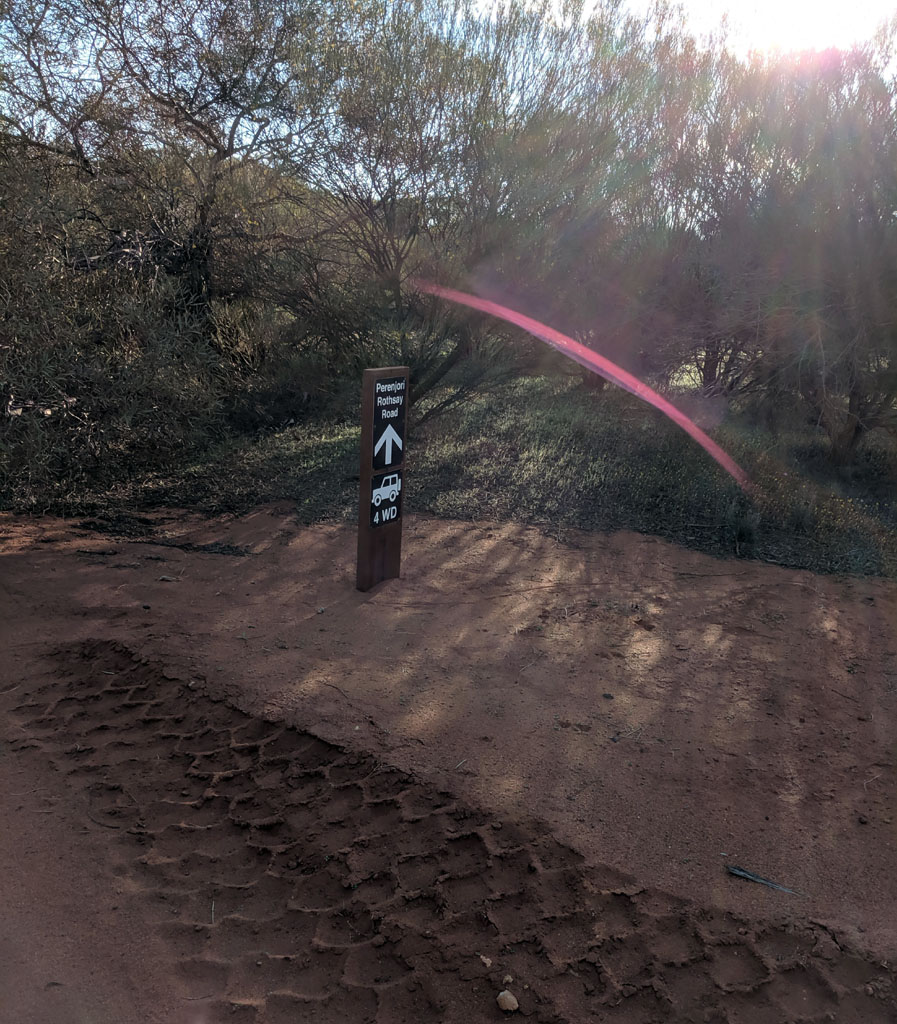
The
final camp site was along an old fence line heading east of the main
road (can't honestly call it a track). You can see where we headed west
a few km off the Rothsay Road to our camp. Next day we crossed the
causeway (good quality crossing) and then continued on to Perenjori to
put some much needed fuel into the tank. Our last fillup was at
Meekatharra some 1200+ km of driving behind us. Then to Wubin and back
to Perth.
Out last camp. Tent is up and we're getting ready to
collect more wood for our lighting and cooking fires for dinner. We
found a nice series of clearings that made for a great final campsite.
A
fantastic trip and we explored many areas. Peter agrees with me that
the best area to just get away from people and their signs is far to
the east, Lake Minigwal and areas around it.
The entire
trip (less Perth to Mt Manning and the final drive back on pavement) is
encapsulated in the screen captures below. The tracklog is "imprinted"
onto the topo map.
Mt Manning
via Johnson Rocks and then heading to Metzkes Find.
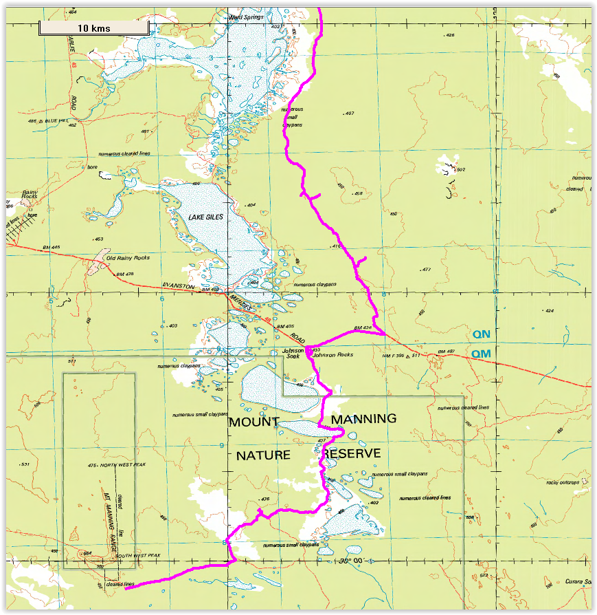
Metzkes Find through to Leonora (first
fuel up) and down to Kookynie to visit Niagara Dam and then back to
head further east.
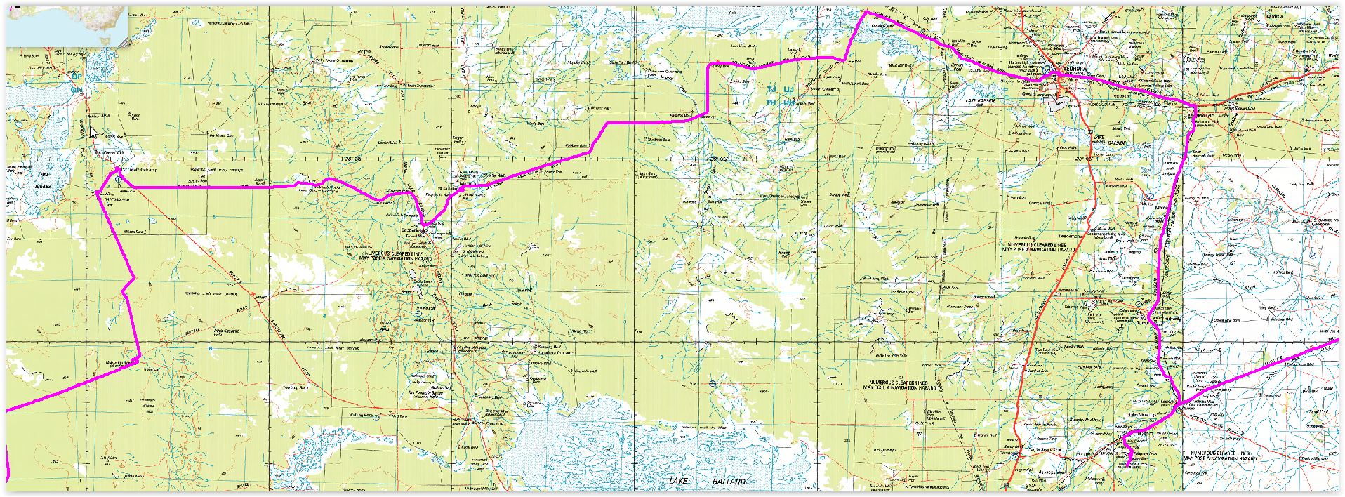
We took a detour before
heading to Yundamindera Wookshed (all gone) to an old area that is
quite interesting in terrain (mine on hill via some rock outcrops).
Then on through Yundamindera and then hooked onto the old track that
leads to Moon Rock and from there to the old Elora Homestead and along
the southern edge of Lake Minigwal. We investigated a newer track which
as we surmised lead to drill sample holes, the mining industry's never
ending goal to ship rocks overseas. Then camped at Thelmas Tank where
we had a nice shower and also topped up our water supply with great
tasting rain water. Then wrapped around the eastern edge of Lake
Minigwal and followed it east where we found a good track heading up to
the edge of the Stella Range (which is hardly stellar!) and camped on
the western edge of Lightfoot Lake where on our drive back to the main
track we discovered Camp Krakatini (with a well constructed rain water
tank). Then onwards north west towards Laverton.
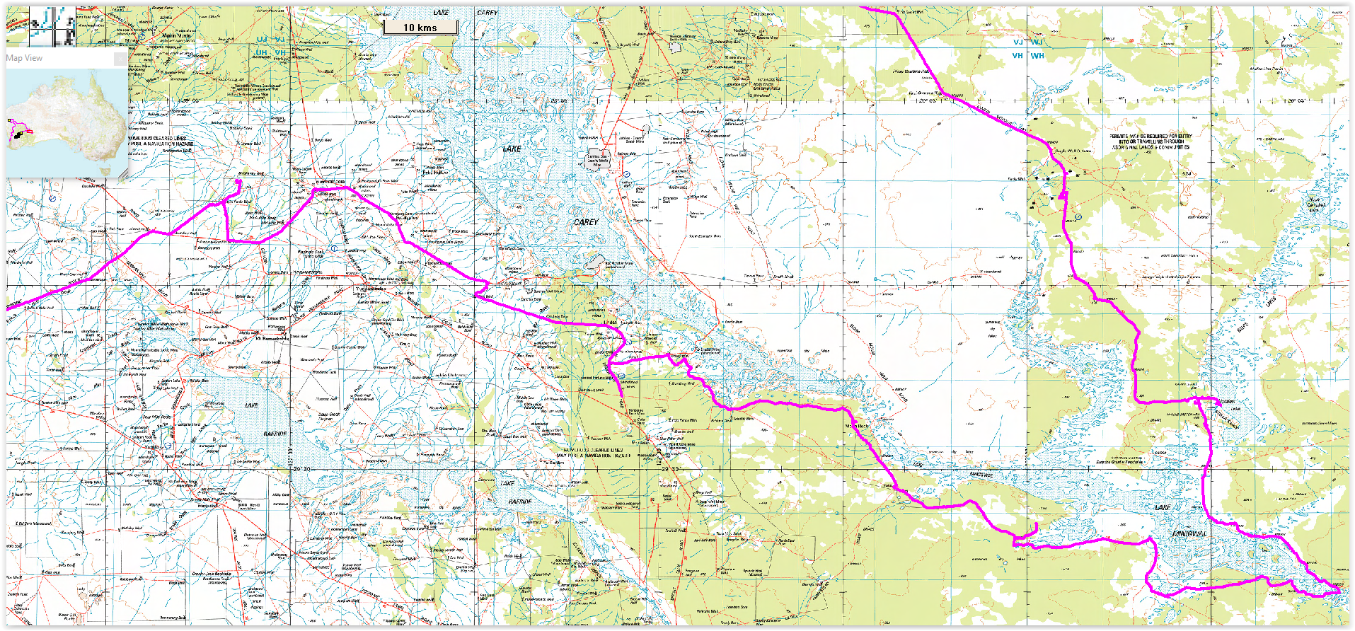
We headed to Laverton via some old
tracks, some very old and overgrown. Made for some interesting finds,
old mining areas and old station 'junk'. We fueled up at Laverton and
then took the Erlistoun and Nambi roads with our plan to head to Wiluna
via back roads.
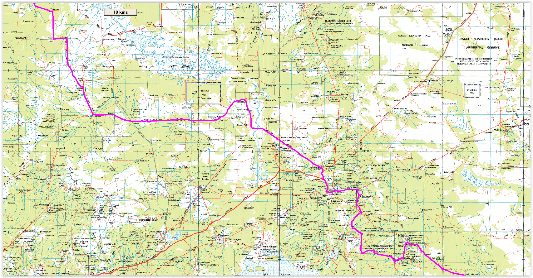
Onwards and towards
Wiluna. We camped just south of Melrose and the next morning got
detained by a local prospector that was worried we were stealing his
gold. After he realized we were just camping and out for a long father
& son adventure he calmed down and we ended up chatting for
near on 4 hours. Larry is an interesting chap and we learned from him
some metal detecting tricks and also quite a bit about the local gold
formations and his prospect. Discussions of just about all topics
ensued and we got some advice on what road we should take to reach
Wiluna that would keep us off bitumen and allow us to explore.
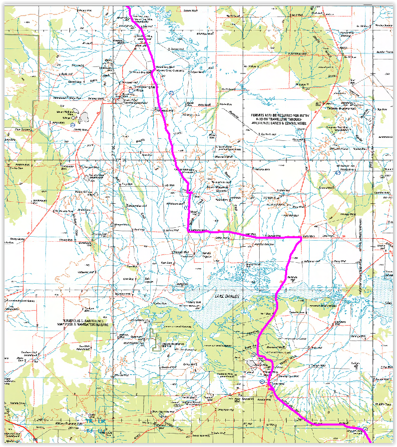
After departing Larry we
continued in a northerly direction and found a nice camp sit off the
main gravel road just east of the Corboy New Find Mine (not much of a
show) and crossed a disused haul road in the process. Next morning we
took the haul road north to a good station road to get us back on the
main gravel road and from there we hit Wiluna. Saw signs congratulating
us for crossing the Gunbarrel, not that we had :)
Drove through Wiluna and then headed towards Meekatharra but got
sidetracked investigating some back roads.
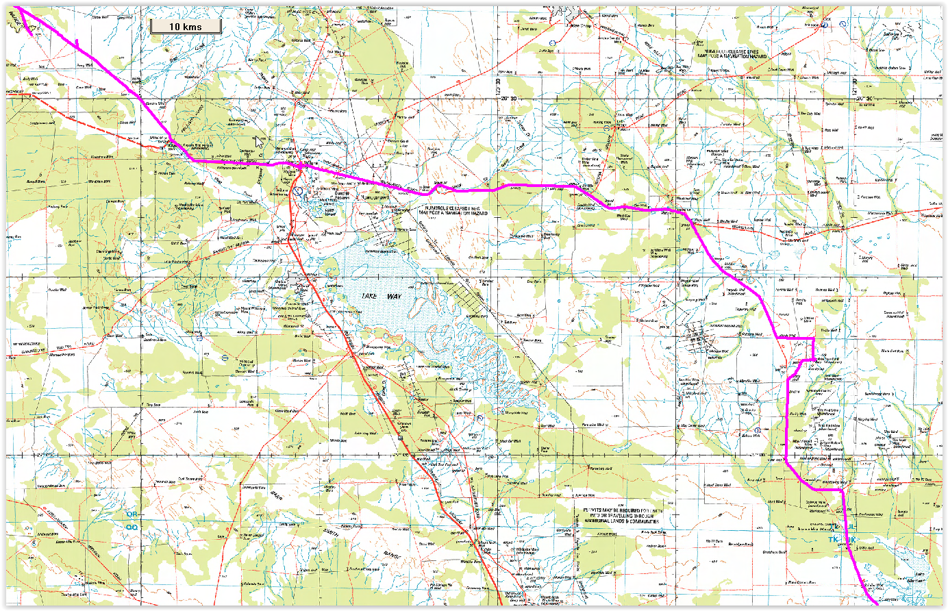
After
our detours we got back onto the main road and headed to Meekatharra. At Meekatharra we fueled up and then headed westerly
with the idea to hit the Murchison. This part of the trip, well, the
whole part after Laverton was really planned as we drove it... Visited
Big Ben Mine (old mining area where we decided that Big Ben and his
mates must have loved beer, a LOT!).
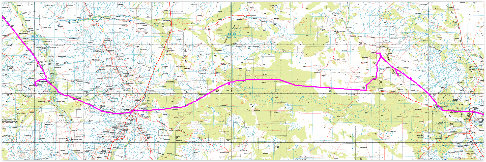
This map section covers
a fair bit of 'stuff'. We dound a great campsite (bore holes to pump
water from) right off the edge of the Murchison. Then we headed north,
crossed the Gascoyne and then back and then westerly. Found an old
(very old) track that headed to a pool (that required a bit of a hike)
and then back to the main road to head westerly and then hook onto the
Carnavon-Mullewa road. Camped near Walarrie Pool for a night.
Then headed south a since we still had several days of holiday decided
to head east to visit the Cue/Yalgoo area. Found that the road was all
paved (though disintegrating in places) from Jack Hills onwards.
Apparently there was a Stage 1 iron ore mine that never reached Stage
2. I still think it is daft to truck iron ore rocks and I guess that
economics also found it daft :). Anyway, we scored bitumen that made
the drive easier as we headed towards Cue.
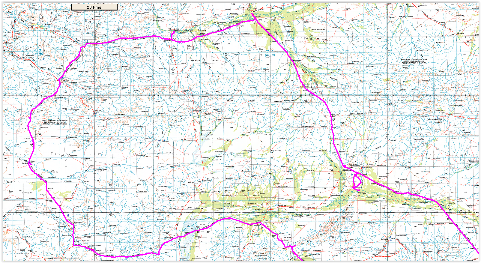
Nothing
exciting on this map, just driving and covering some distance.
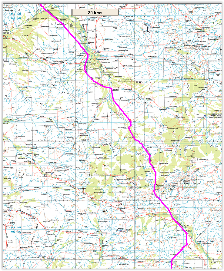
My
plan was never to actually reach Cue, but instead head to Walga Rock
via Big Bell. The local tourist board has clearly made Big Bell
something "to visit", though it really is no different (other than
fencing off the pub) that when Lionel and I first saw it some 39 years
ago. Of course there's the addition of a new mine site, i.e. another
big hole in the ground. Walga rock has changed, it's all fenced off to
protect it from the dingoes I guess. There's also no camping there. All
so modern... We instead drove down to an old well and picked up a
very old fence line and drove and camped at Woolgerong Rock (which is
taller than Walga - tee hee). Then took the track and hit the old
vermin proof fence (I can't think of any vermin, 2 legged, 4 legged,
wheeled, on foot, etc that couldn't walk across it). Followed the old
vermin proof fence track and it is an old track not for anyone worried
about scratching the duco. Back onto the main road. Visited the now
abandoned Western Queen Mine (via their unlocked gate) to discover a
few big holes in the ground with water and other 'stuff' mixed in. Then
on to Yalgoo.
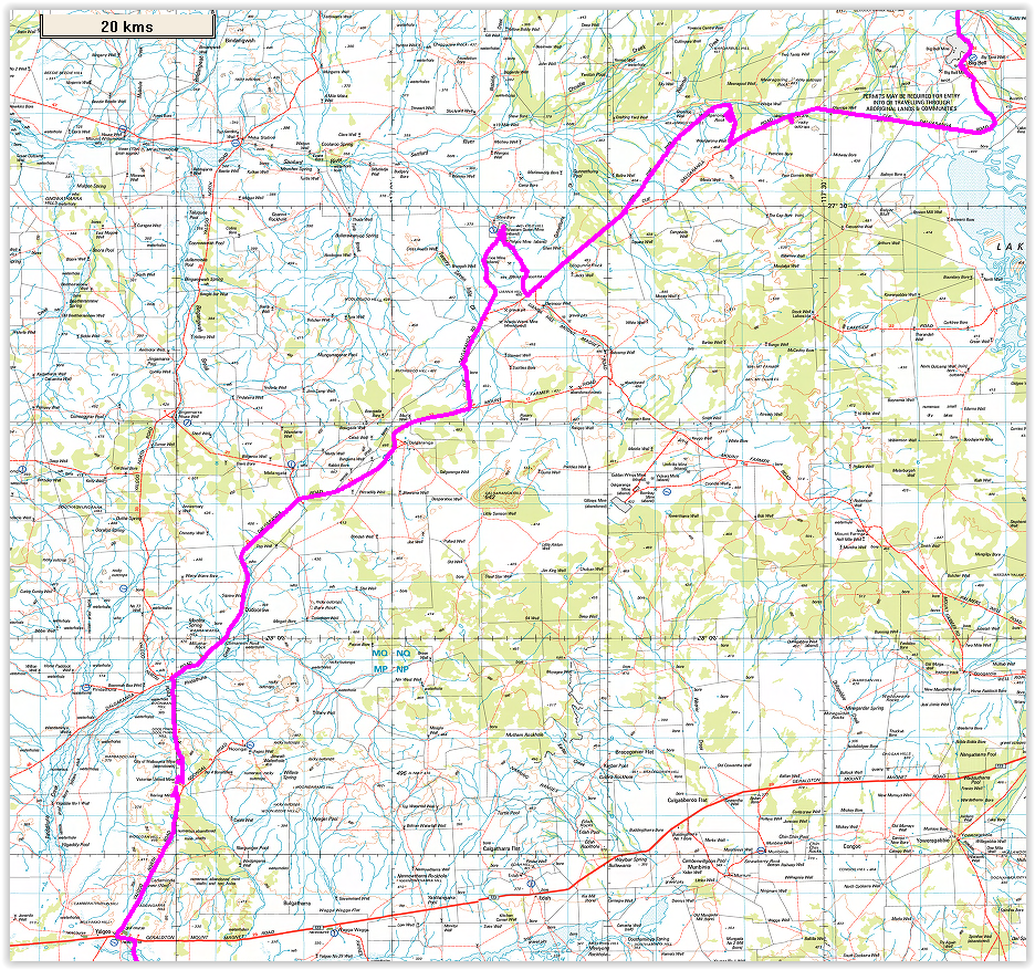
Heading south of Yalgoo we
stopped in to see the Jokers Tunnel and some of the surrounds and then
continued on. This is the final part of the trip and we camped near
Reids Ridge Mine and checked out the junk left after the mine finished.
It's interesting to see all the equipment, but on the other hand it is
very distressing to see that mining companies can just abandon all
their junk without any attempt to clean up after their mess. I guess as
long as the government and the mining companies are all pocketing $
it's all good. We then checked out a few tracks and visited the Rothsay
Mine area. Popped down to have a nice shower at a dammed section of a
creek near White Well. Highly recommended spot to get great fresh water
for showering etc. Then on to some old ruins on the Rothsay Rd where
there's a sign specifying it is 4WD (what a joke, could drive the
corolla down it). Found a nice spot off an old fence line to camp for
our final night. Next day out to the bitumen and home. Great Trip!