Trinity Wilderness Area 2021
December trip (6 days) and nice weather, just before the
storms (and snow) moved in the day after I headed back to town. Perfect
timing to have sunny days and reasonable day time temperatures.
Red Bluff and then onto HWY 36 to head west.
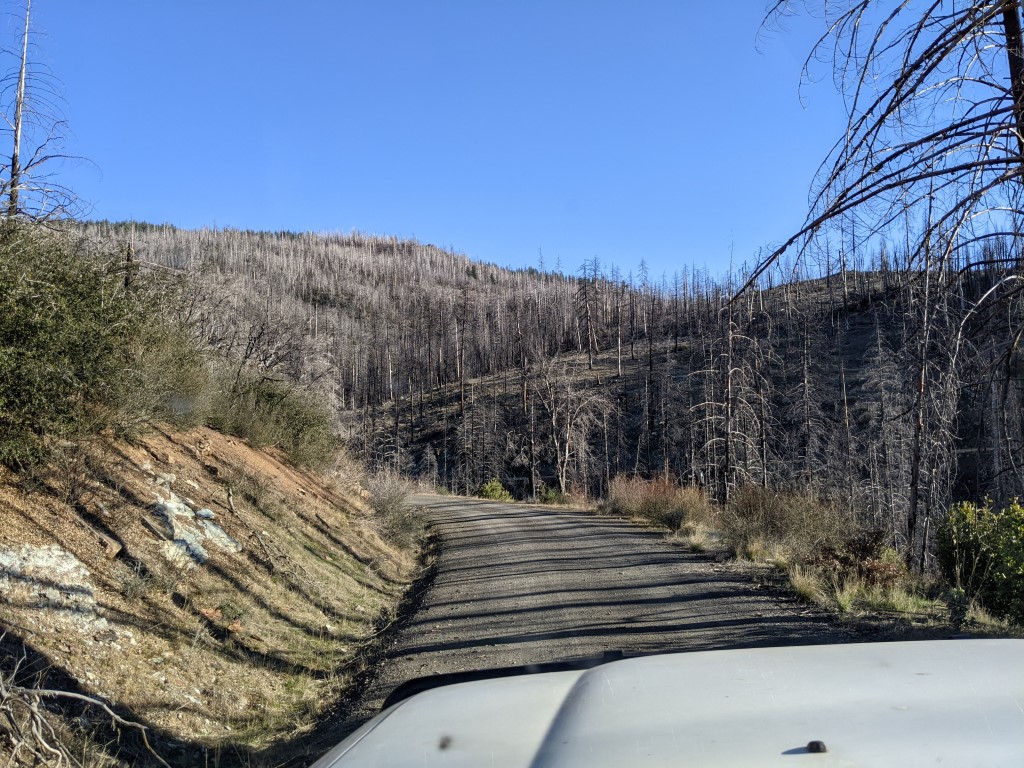
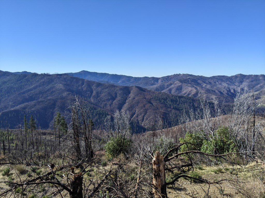
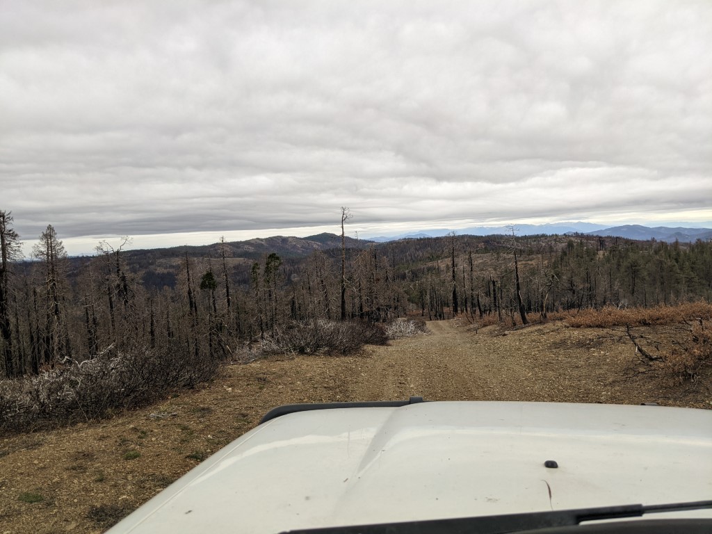
After getting off the main road, this was the view heading south on
Bramlet Road. Elevation is around 3800 feet. What can be seen is
some of the results of the large fires that swept through here earlier
this year (2021). Having visited this general area a few times over the
years, it was quite a shock to see the large burned areas and how much
of the forest undergrowth has been cleared away due to the fires.
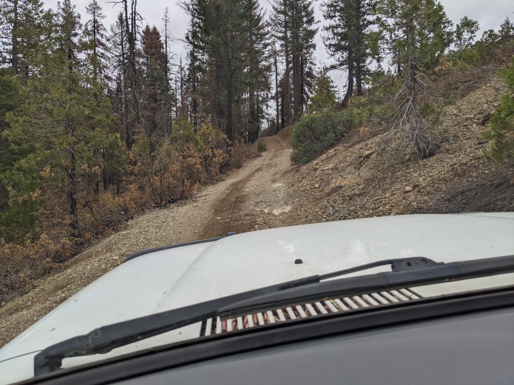
After getting off Bramlet Road I followed a forestry
road name Red Mountain Motorway. Always found the name amusing, since
it clearly isn't a motorway as such :). Without snow, it is an easy
forestry road to drive and provides some driving fun as you head in a
southerly direction. This was the road I took to the first night's
campsite near the top of Red Mountain (near 6000').
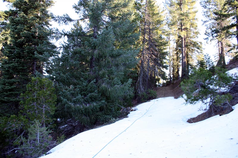
The following picture is essentially the same spot
but taken in 2009. A little different when not fire ravaged and with
some snow. The blue 'rope' is synthetic winch line that was pulled to
enable us to winch through the snow patch.
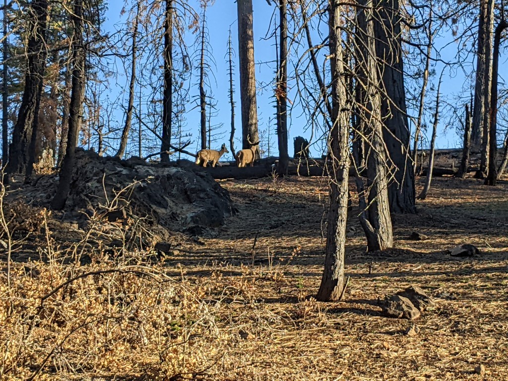
Further on I spotted some deer off to
the side of the road. Nice to see that they are still present even in
the burned areas. Without the undergrowth the forest looks very
different and is open and easy to traverse. You can to see why the
natives used fire as a tool to clear areas for hunting and easy access.
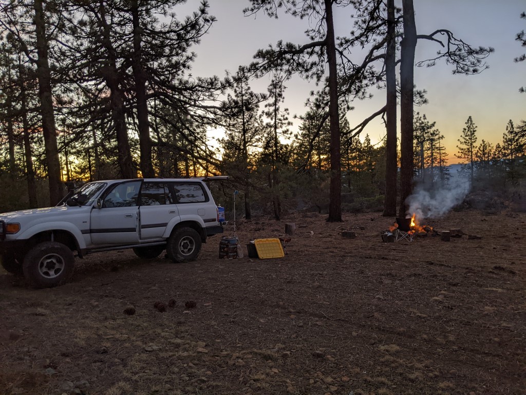
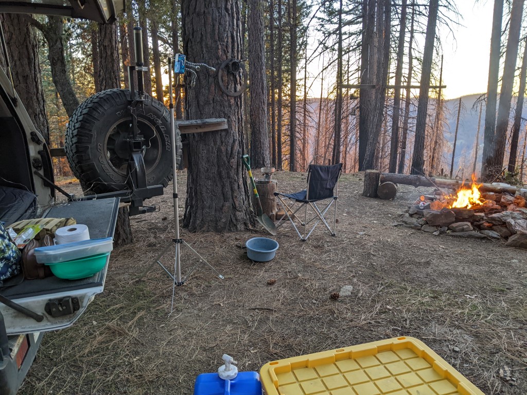
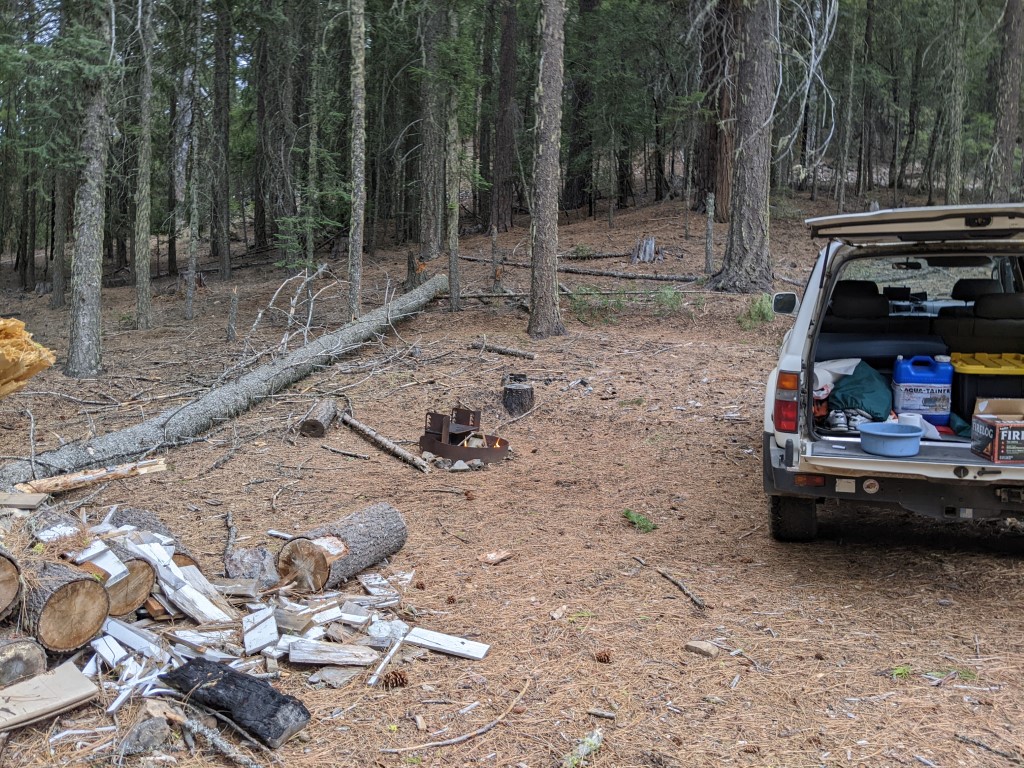
There's a nice clearing and a fire
ring just off the 'motorway'. Plenty of pre-cut wood as well making it
easy to get a fire going quickly.Since I was on this trip by myself, I
had decided to just sleep in the back of the 80. Just a thermarest,
sleeping bag and a couple of synthetic packable comforters as extra
insulation. Night temperatures were dropping into the high 30's / low
40's so having a fire going before sunset was always a good plan. Very
little wind, so at least one could enjoy the heat from the fire. Being
winter the sun was setting around 5pm, so cooking dinner was done early
and while that was happening I'd collect wood to feed the fire after
sunset. Most nights I'd be in bed by 7:30pm and then I'd spend some
time checking maps on my android tablet to plan the next days
adventures. Then a bit of light reading before nodding off to sleep.
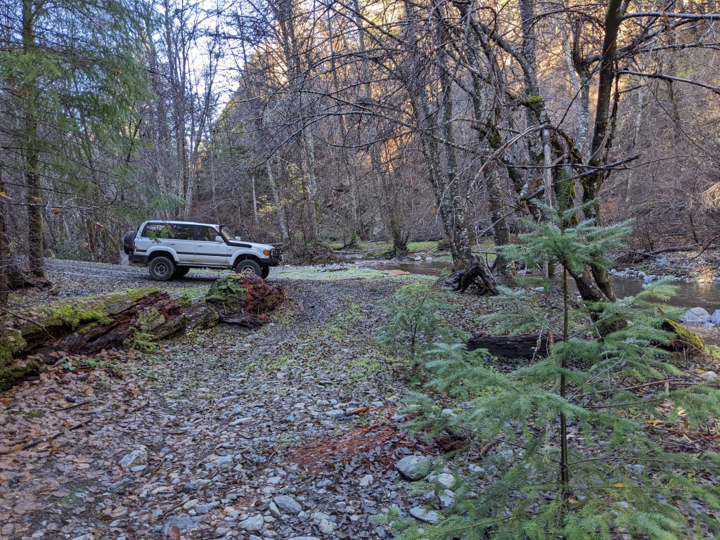
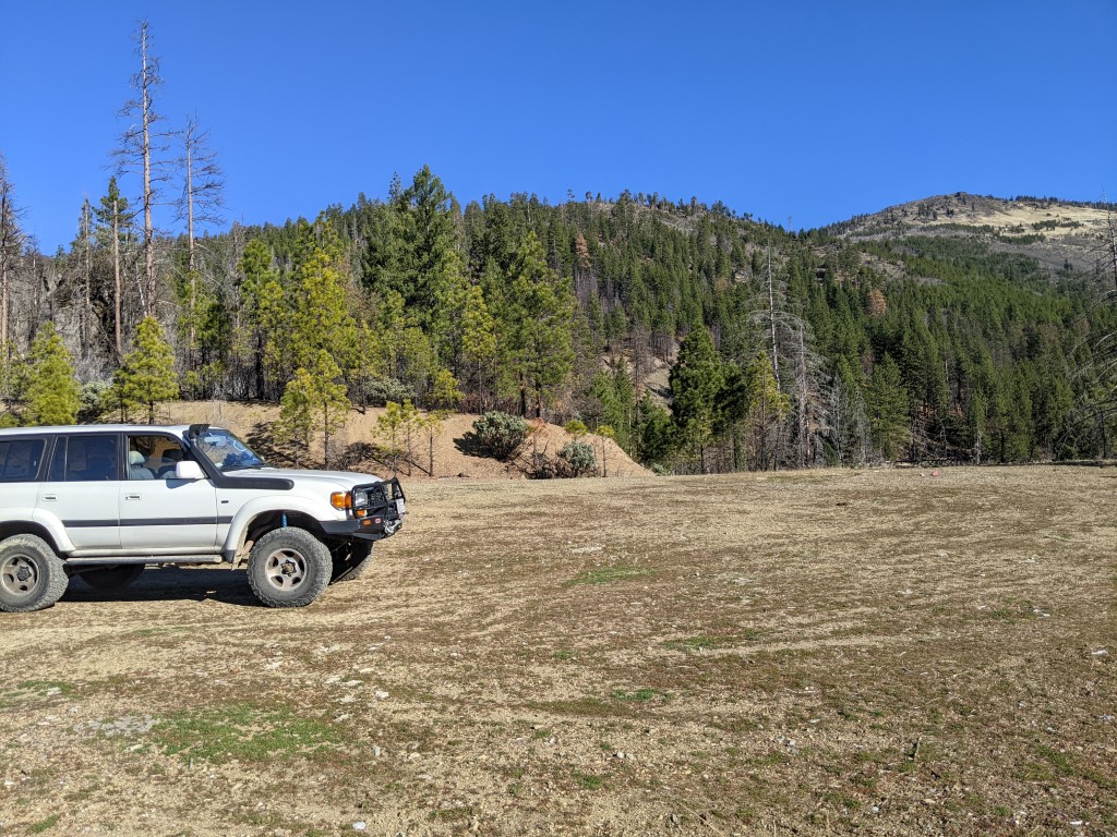
Next day was nice and sunny and time to explore
other connected forestry roads. Early morning and there's still fog
lifting in areas. Found this spot just off one of the roads, nice creek
and a clearing where one could camp. Pretty damp/wet though and it was
just the start of a new day, so not looking for a camp spot yet.
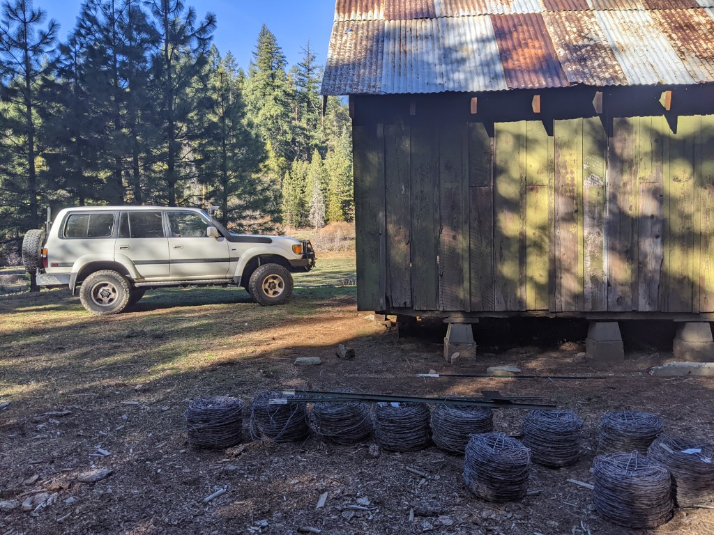
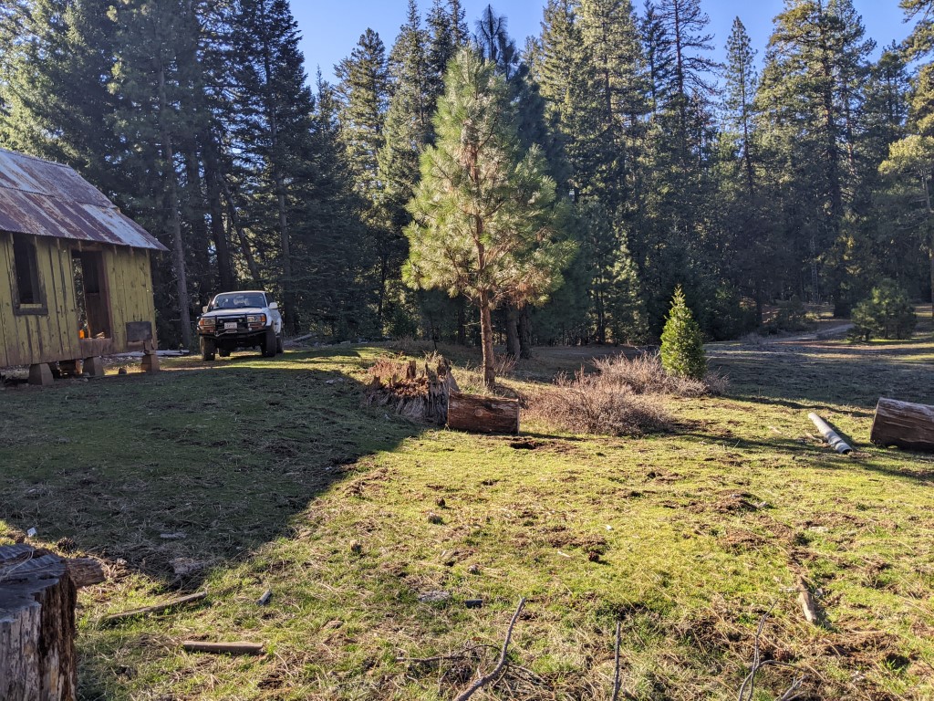
There's a place call White Rock (near an area on the
side of a hill with a large white rock). The location has an old cabin
that was presumably a forestry cabin from years gone by. It's next to a
nice meadow and also clearing with several old firerings and camp
tables. A few days later I returned to this location since it was going
to rain that evening and I figured if it started raining earlier than
having got my cooking done, I'd just camp next to the cabin and cook
inside where at least I'd be out of the rain. Lots of unused rolls of
barb wire if one is into that :)
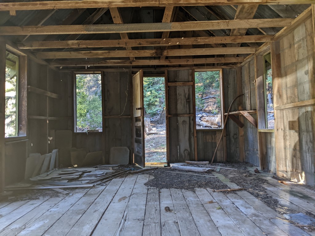
Picture
of inside the structure. Roof is still intact and it would only take a
few minutes with a broom to tidy things up. Would be windy though since
there aren't any functional windows. Some thick clear plastic sheet and
a staple gun would take care of that. Assuming you wanted to live here
a while :)
At least this area was not affected by the fires. A nice area to grab some lunch and soak in the fresh air.
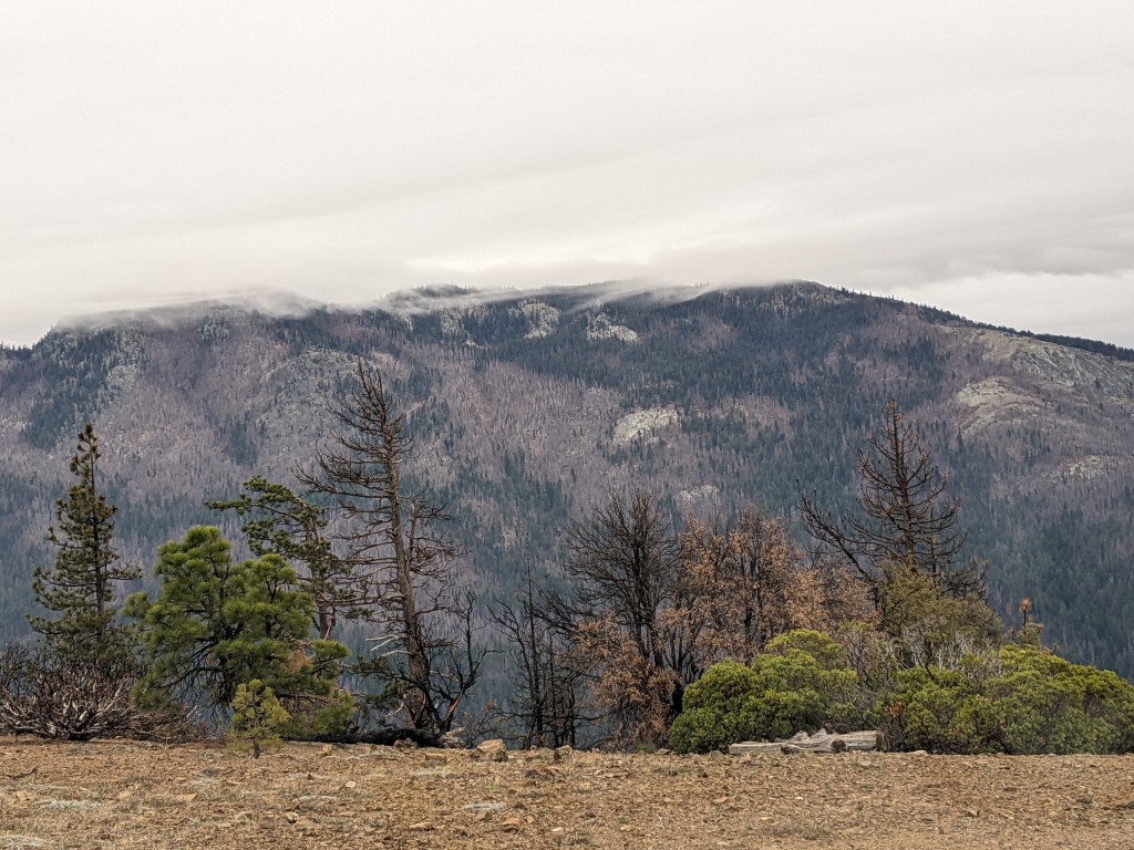
Every so often one of the roads would
head to the top of a ridge and you would be presented with views of the
rolling hills and tranquility of being in a less traveled area.
Beautiful sunny day to enjoy the view.
Hermit Rock in the background. Hard
to see behind trees. There was a nice spot to camp just a few hundred
yards from here. Had a rock lined fire ring and sufficient wood for a
decent fire.
Camp made and fire going. Sun setting
soon, so time to get food cooked and eaten while the sun is shining.
Nice view from this camp spot and again no wind blowing, adding to the
enjoyment of being near the fire. Nice cut logs around the camp and
handy to use as a table for the camp stove.
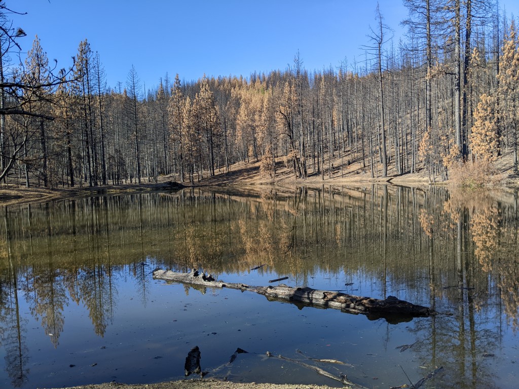
Another day and off exploring. This
sad looking lake is named Hell to Find lake and it certainly looks like hell after
the fires have done their work. The water is ash filled and
devoid of plants. On previous visits we would often see deer in the
water (it is relatively shallow) as they walked across and would pull
aquatic plants up to eat.
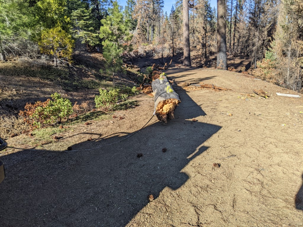
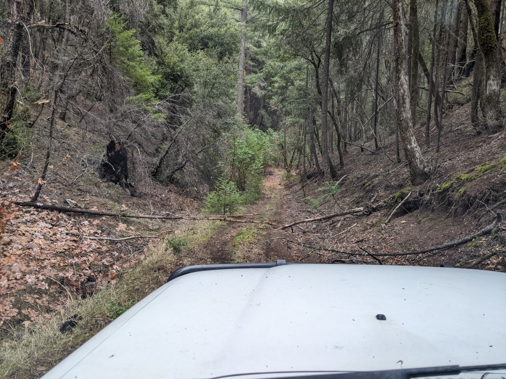
My plan was to camp at a creek I've
been at before. But on the way I was presented with this across the
road, around 2' in diameter. After a little checking, it seemed that
with the winch I should be able to rotate the tree out of the way.
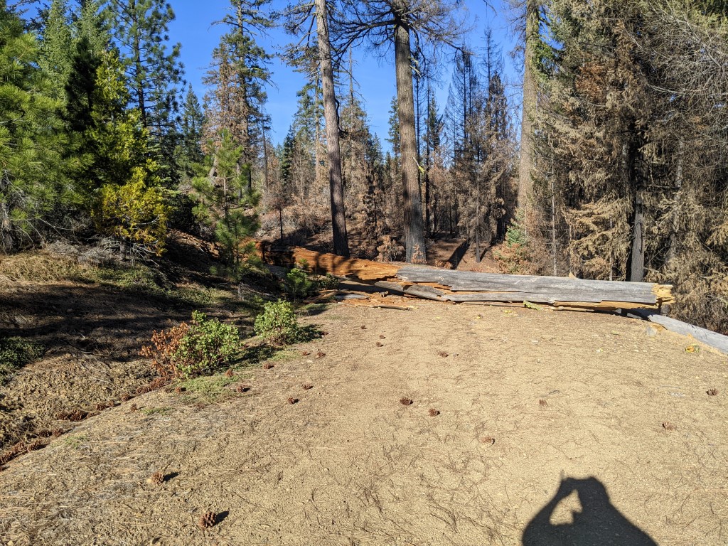
A few minutes later and the tree was no longer blocking the road and I was able to continue on to the next camp spot.
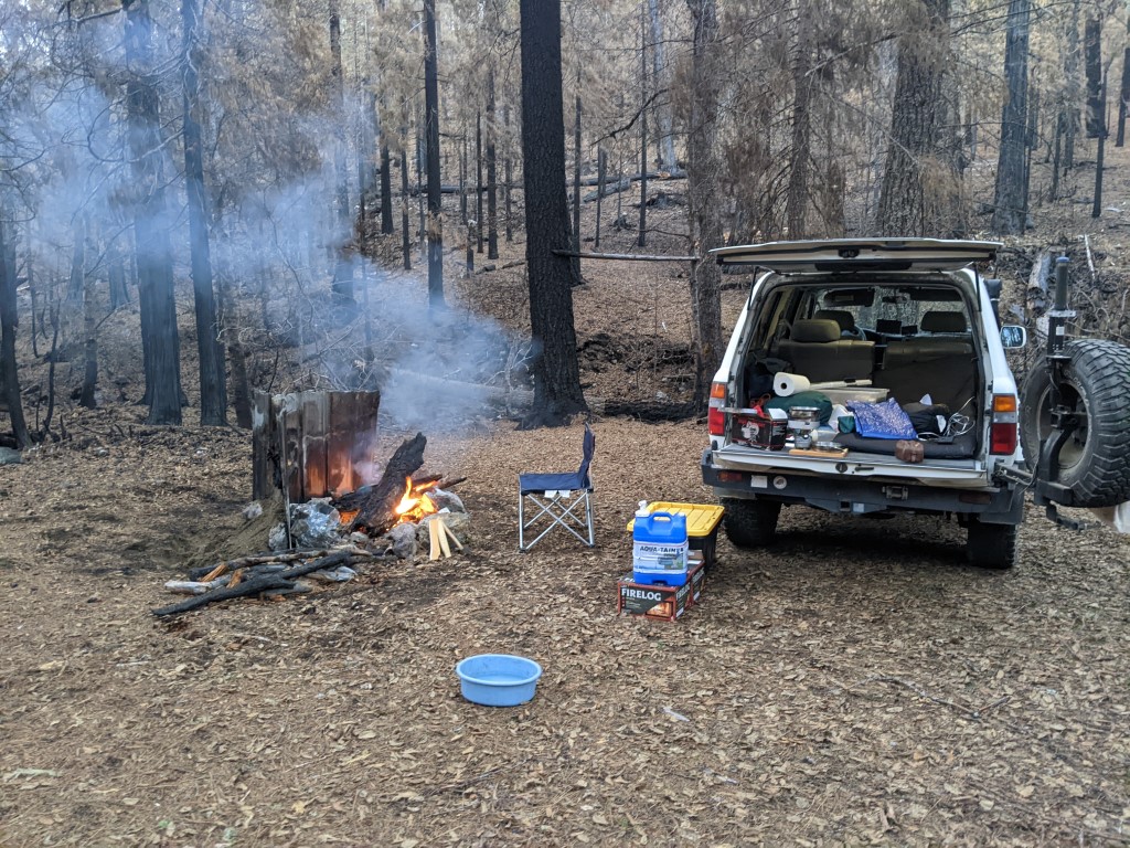
Camp made and fire going. I found a
few small sheets of tin and used them to make a back for the fire,
helps reflect more heat towards me. Was getting cold in this
little valley with the creek nearby, so having an efficient fire going
was a good thing. Making camp is so easy when you are on your own and
sleep in the back of the vehicle. Breaking camp to move is just as
quick, so it doesn't feel like a saga to move every day.
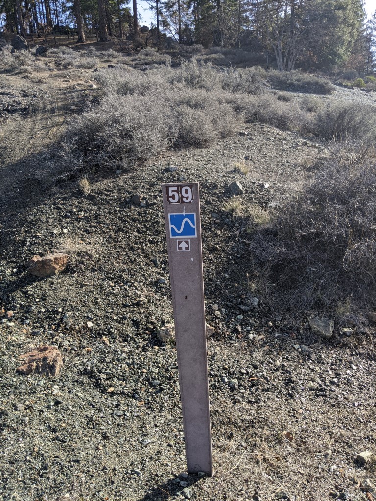
I had come across these blue wavy
lines on several roads that I traversed. Was trying to guess what they
meant. Water? Snake? Cosine wave? Bumpy water? So, took a picture to
remind me to google the sign when I got back to civilization to figure
out what the heck it means. Well.... turns out it is the forestry
service's track 'difficulty' marker and the blue with white wavy line
means a 'moderate' trail. They have 'easy', 'moderate' and 'difficult'
based on some nation wide scoring system. Sometimes I think they have
nothing better to do and it is just make work...
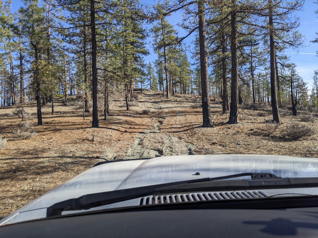
This
is part of the 'moderate' section. The 80 just drove through this and
some stuff before as if it was just a dirt road. Any vehicle with a
little ground clearance would eat it up, 2wd is all that is needed.
2nd last day and the weather clouded
up with rain predicted in the evening. This was the day to fuel up
while checking out a place called Natural Bridges near Hayfork. After
fueling up in Hayfork I headed south to Natural Bridges, but before
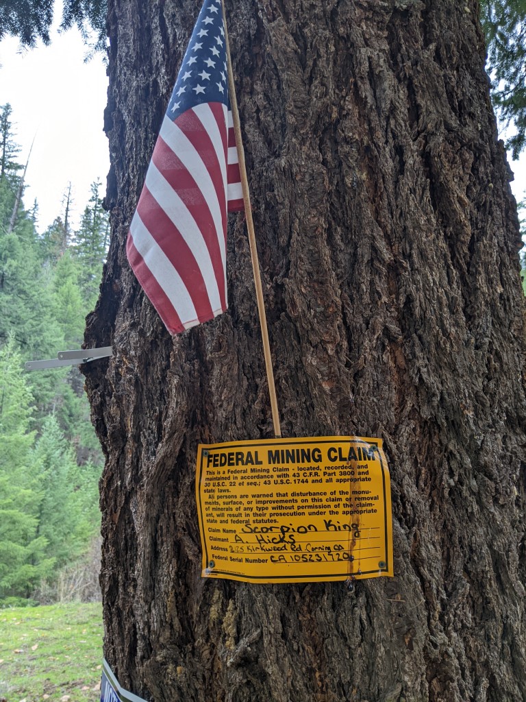
that I'd seen on the maps a place called Scorpion King Mine, figured
I'd pop in to see what kind of mine.
This is a tree at a clearing at the bottom of the track that leads up
to the mine area. Still not clear what the mine is and there's no sign
of anything active going on.
This is the mine and where the road
would lead to. There's more below the road level, down the hill, but it
looks similar. Looks like they were mining gravel... No recent activity
and of what there is, it looks to be at least 20 years ago
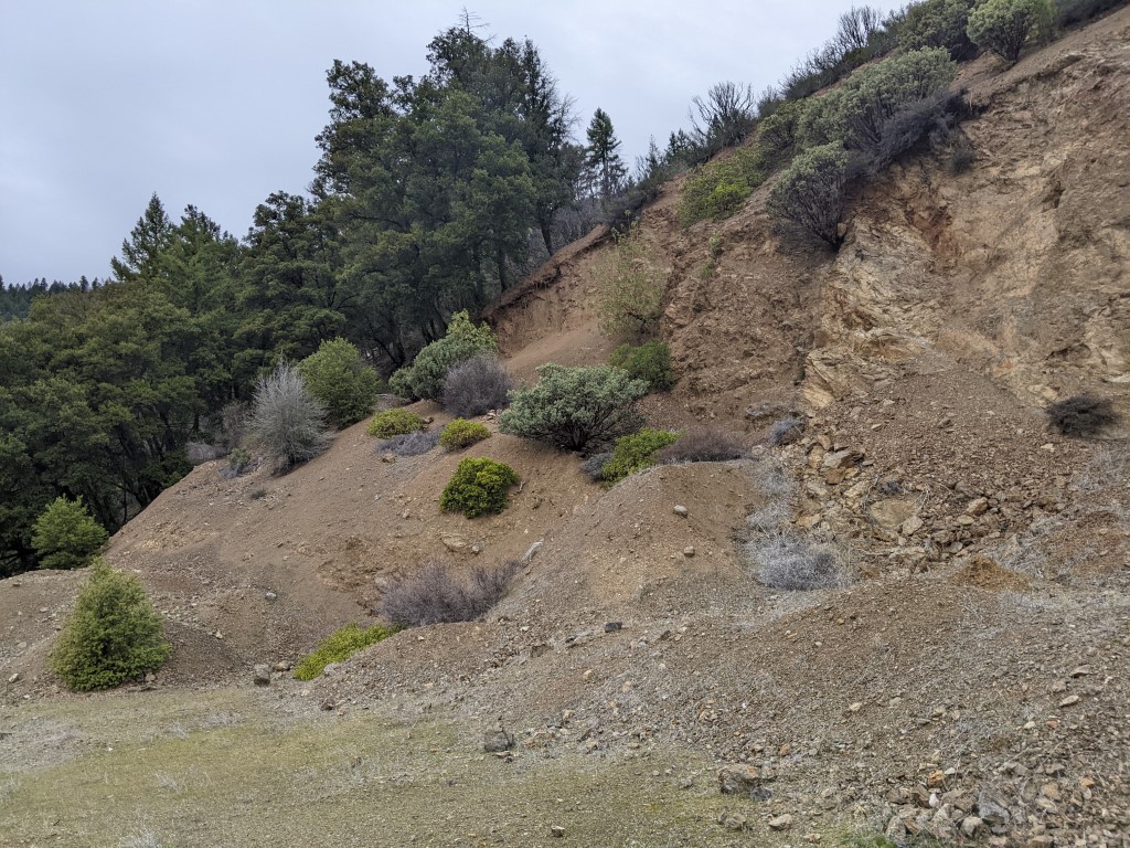
Driving back down from the 'mine'. The drive was more interesting than the 'mine' :)
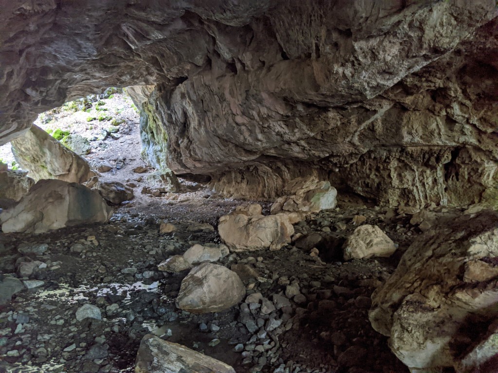
Then it was time to head to Natural
Bridges. It's only a few miles away. It's basically an opening with a
creek that runs through from one side of a large and tall rock
formation to the other. Plenty tall enough to easily walk through
upright.
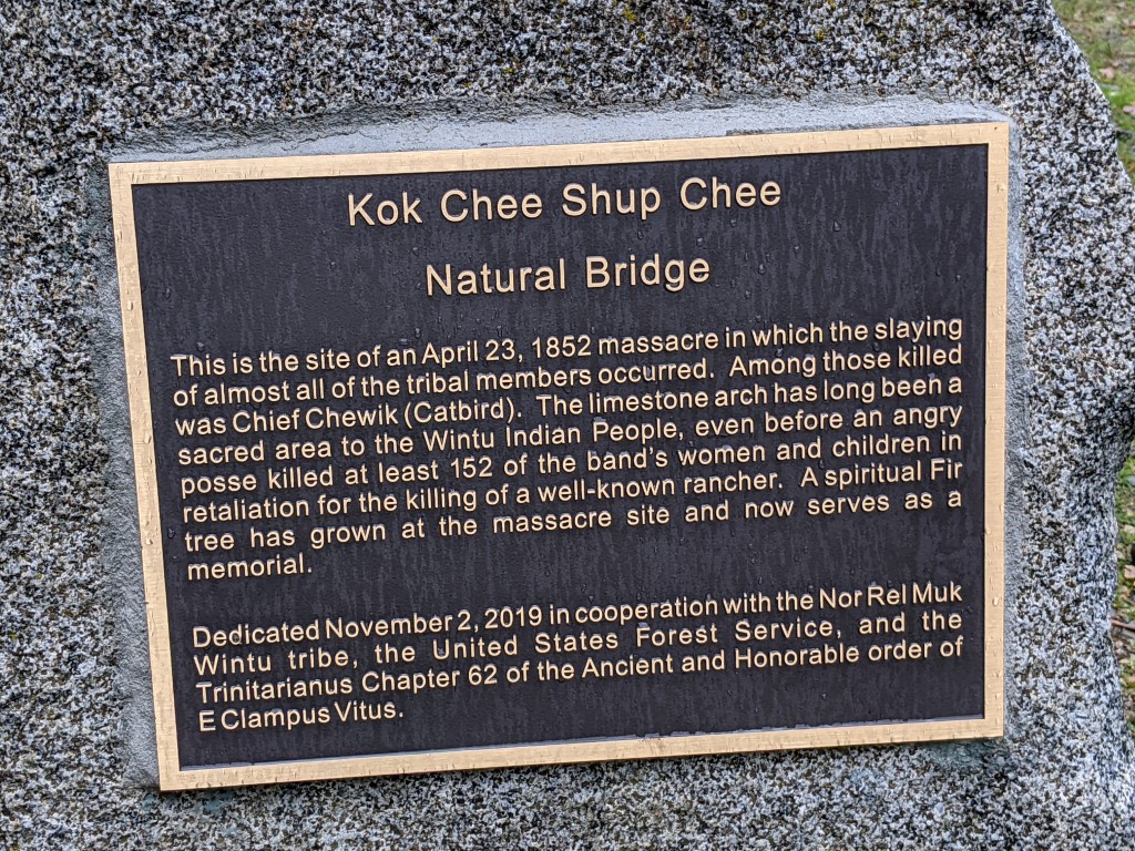
After checking out the area, I drove
further along the forestry road and saw a turnoff. At the end of the
road down to the creek (same one that runs through the Natural Bridge
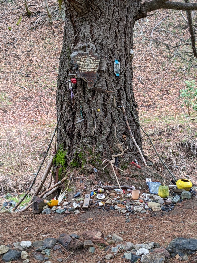
formation) there's a small picnic area and some signage telling of the
sad history. The plaque says it all, and I'll let you read it and think
about the sadness of the event.
This is a picture of the Fir Tree. People have made it a shrine.
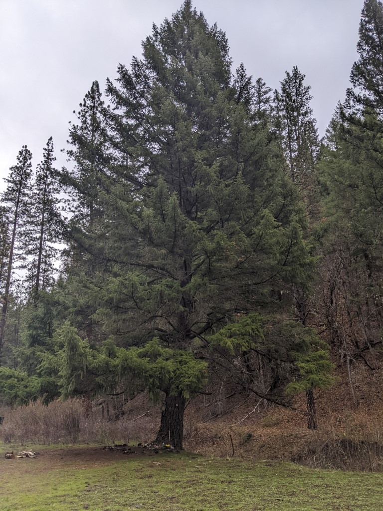
Some of what people have placed at the base and on the tree.
After Natural Bridges, I headed back
out to hwy3 and to 36 and Bramlet Rd via more forestry roads. Then
hooked back onto Red Mountain Motorway to get back to the White Rock
cabin since clouds were thickening up and rain was expected to hit in
the late afternoon. You get a pretty good idea of just how much has
burned away and how non-forest it all looks now. Interestingly there
will be areas that didn't burn right up to the edge of burned out
areas. Sometimes a foresty road becomes a fire break and sometimes the
top of a ridge where the fire comes up one side, but doesn't have the
heat and wood/undergrowth to carry back down to the other side (fire
& heat likes to go up).
Back at White Rock, in a little
'campground' near the abandoned cabin. Firering and plenty of wood for
the fire. Since rain was imminent it was time to quickly get a fire
going and then get dinner made and consumed. As long as that was
achieved before the rain, I could always duck into the back of the 80
and plan tomorrows departure back to Red Bluff and then home. I was
planning on finding an alternate way to Red Bluff versus hwy 36 that
I've taken too often.
Morning after the very wet night. It
was great to be in the back of the 80, no wet tent to have to pack away
etc. Just make breakfast and then spend 20 mins or so packing
everything away and then hit the road. The morning view before clouds
started lifting.
From White Rock, I continued in a
southerly/easterly direction on forestry 35. This winds its way through
the forest and eventually takes you out of the mountains and onto
country roads that eventually take you to Red Bluff. It's a well
maintained road and makes for a relatively quick and scenic exit.
At Stuart Gap I got off the 35 (signs warned of a slide further on) and
took Tedoc road to work myself 'around' the slide. I rejoined the 35 by
getting off Tedoc road (near the Tedoc Gap) and getting onto the 45.
The 45 is a well maintained major forestry road as is the 35.
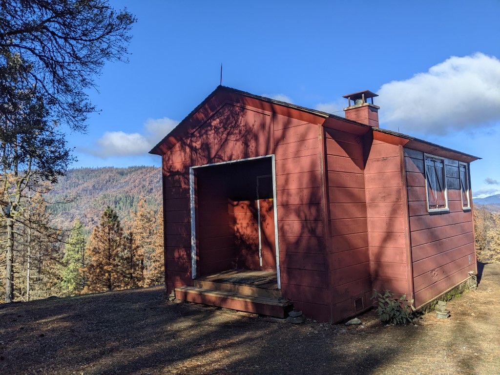
On the way I came across this forestry cabin (there's a second one near
it). It is called Post Creek guard station and is on the Tedoc
Road. It is for 'rent' and based on the signs runs $75 with a
proposed hike to $90 per night (for a small group). I guess if it is
raining and you want a place to hang out it would make some sense.
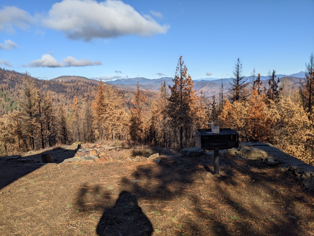
The view from the terrace. There is a
fire pit and a BBQ. Again you can see lots of burned forest in this
area, definitely detracts from the view.
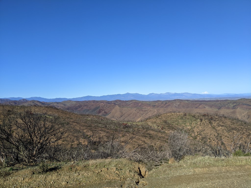
After descending out of the forest
area you reach the foothills with the central valley in the background.
Lot's of rolling hills and the road winds its way down and is quite
windy as it heads to Red Bluff in the distance. You can see snow capped
Mt Shasta (14,000' elevation) in the distance (about 80 miles as the
crow flies) on the right side of this picture.
That's
essentially the end of this trip with great driving weather to depart
the Trinity area. Hard to imagine that the the night just passed was so
wet and miserable.